 |
|
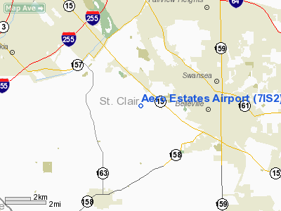
Location
& QuickFacts
|
FAA
Information Effective: |
2007-07-05 |
|
Airport
Identifier: |
7IS2 |
|
Airport
Status: |
Operational |
|
Longitude/Latitude: |
090-03-25.0000W/38-31-28.1820N
-90.056944/38.524495 (Estimated) |
|
Elevation: |
565 ft / 172.21 m (Estimated) |
|
Land: |
8 acres |
|
From
nearest city: |
3 nautical miles W of Belleville, IL |
|
Location: |
St Clair County, IL |
|
Magnetic Variation: |
02E (1985) |
Owner
& Manager
|
Ownership: |
Privately
owned |
|
Owner: |
Aero Estates Property Owners |
|
Address: |
2123 Cloverleaf School Rd
Belleville, IL 62223 |
|
Phone
number: |
618-277-5236 |
|
Manager: |
Kenneth E. Kellogg |
|
Address: |
2123 Cloverleaf School Rd
Belleville, IL 62223 |
|
Phone number: |
618-277-5236 |
Airport Operations and Facilities
|
Airport
Use: |
Private |
|
Wind
indicator: |
Yes |
|
Segmented Circle: |
No |
|
Control
Tower: |
No |
|
Sectional chart: |
St Louis |
|
Region: |
AGL - Great Lakes |
|
Boundary
ARTCC: |
ZKC - Kansas City |
|
Tie-in
FSS: |
STL - Saint Louis |
|
FSS
on Airport: |
No |
|
FSS
Phone: |
636-536-2980 |
|
FSS
Toll Free: |
1-800-WX-BRIEF |
|
Runway Information
Runway 16/34
|
Dimension: |
2500
x 100 ft / 762.0 x 30.5 m |
|
Surface: |
TURF, |
|
|
Runway 16 |
Runway 34 |
|
Traffic
Pattern: |
Right |
Left |
|
Displaced
threshold: |
300.00 ft |
0.00 ft |
|
Radio Navigation
Aids
|
ID |
Type |
Name |
Ch |
Freq |
Var |
Dist |
|
BL |
NDB |
Belleville |
|
362.00 |
02E |
14.6 nm |
|
CVM |
NDB |
Civic Memorial |
|
263.00 |
02E |
22.1 nm |
|
FES |
NDB |
Festus |
|
269.00 |
01E |
25.2 nm |
|
LM |
NDB |
Oblio |
|
338.00 |
00E |
25.7 nm |
|
SAR |
NDB |
Sparta |
|
239.00 |
01E |
28.3 nm |
|
LTD |
NDB |
Litchfield |
|
371.00 |
01E |
42.5 nm |
|
PJY |
NDB |
Pinckneyville |
|
215.00 |
00E |
46.5 nm |
|
PRI |
NDB |
Perrine |
|
367.00 |
02E |
48.9 nm |
|
SKE |
TACAN |
Scott |
059X |
|
02E |
9.7 nm |
|
CSX |
VOR/DME |
Cardinal |
111Y |
116.45 |
00E |
19.8 nm |
|
TOY |
VORTAC |
Troy |
107X |
116.00 |
04E |
14.4 nm |
|
STL |
VORTAC |
St Louis |
121X |
117.40 |
01E |
28.4 nm |
|
ENL |
VORTAC |
Centralia |
097X |
115.00 |
04E |
42.7 nm |
|
FTZ |
VORTAC |
Foristell |
045X |
110.80 |
05E |
44.1 nm |
|
STL |
VOT |
St Louis Lambert |
|
111.00 |
|
19.7 nm |
|
SUS |
VOT |
Spirit Of St Louis |
|
112.20 |
|
29.2 nm |
Remarks
- ALL
TFC RMN W OF RLA TO AVOID INTERFERENCE WITH FLYING DUTCHMAN ARPT TFC.
- TFC
PAT ALT: 1300'MSL.
- PRVDD
LTR OF AGRMNT WITH FLYING DUTCHMAN ARPT REMAINS IN EFF. OBSTNS IN APP
SFC ARE RMVD/LWRD OR THRS DSPLCDTO PRVD 20:1 CLRNC. 150'PRIM SFC CLRD
& MAINTD.
Based
Aircraft
|
Aircraft
based on field: |
19 |
|
Single
Engine Airplanes: |
19 |
Aero Estates Airport
Address:
St Clair County, IL
Tel:
618-277-5236
Images
and information placed above are from
http://www.airport-data.com/airport/7IS2/
We
thank them for the data!
| General
Info |
| Country |
United
States |
| State |
ILLINOIS
|
| FAA ID |
7IS2 |
| Latitude |
38-31-28.182N
|
| Longitude |
090-03-25.000W
|
| Elevation |
565 feet
|
| Near City |
BELLEVILLE
|
We don't guarantee the information is fresh and accurate. The data may
be wrong or outdated.
For more up-to-date information please refer to other sources.
|
|


