 |
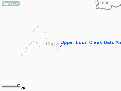
|
Upper Loon Creek U.S. Forest Service Airport |
|
|
Location
& QuickFacts
|
FAA
Information Effective: |
2007-07-05 |
|
Airport
Identifier: |
U72 |
|
Airport
Status: |
Operational |
|
Longitude/Latitude: |
114-49-23.3160W/44-35-29.6810N
-114.823143/44.591578 (Estimated) |
|
Elevation: |
5500 ft / 1676.40 m (Estimated) |
|
Land: |
17 acres |
|
From
nearest city: |
26 nautical miles NW of Challis, ID |
|
Location: |
Custer County, ID |
|
Magnetic
Variation: |
17E (1985) |
Owner
& Manager
|
Ownership: |
Publicly
owned |
|
Owner: |
U.s. Forest Service |
|
Address: |
324 25th St
Ogden, UT 84401 |
|
Phone
number: |
208-625-5511 |
|
Manager: |
Middle Fork Dist Ranger |
|
Address: |
P.o. Box 750 Highway 93
Challis, ID 83226 |
|
Phone
number: |
208-879-4101 |
Airport
Operations and Facilities
|
Airport
Use: |
Open
to public |
|
Wind
indicator: |
Yes |
|
Segmented Circle: |
Yes |
|
Control
Tower: |
No |
|
Landing
fee charge: |
No |
|
Sectional chart: |
Great Falls |
|
Region: |
ANM - Northwest Mountain |
|
Boundary
ARTCC: |
ZLC - Salt Lake City |
|
Tie-in
FSS: |
BOI - Boise |
|
FSS
on Airport: |
No |
|
FSS
Phone: |
208-332-0200 |
|
FSS
Toll Free: |
1-800-WX-BRIEF |
|
NOTAMs
Facility: |
BOI (NOTAM-d service avaliable) |
Airport
Communications
Airport
Services
|
Airframe
Repair: |
NONE |
|
Power
Plant Repair: |
NONE |
|
Bottled
Oxygen: |
NONE |
|
Bulk
Oxygen: |
NONE |
|
Runway Information
Runway 04/22
|
Dimension: |
2500
x 75 ft / 762.0 x 22.9 m |
|
Surface: |
TURF-DIRT, Fair Condition |
|
|
Runway 04 |
Runway 22 |
|
Traffic
Pattern: |
Left |
Left |
|
Obstruction: |
60 ft tree, 45.0 ft from runway, 105 ft left
of centerline |
60 ft trees, 0.0 ft from runway, 125 ft right
of centerline |
|
Radio Navigation
Aids
|
ID |
Type |
Name |
Ch |
Freq |
Var |
Dist |
|
LLJ |
NDB |
Challis |
|
397.00 |
17E |
26.4 nm |
|
LKT |
VOR/DME |
Salmon |
082X |
113.50 |
18E |
40.7 nm |
Remarks
- RECOMMENDED
FOR EXPERINCED MOUNTAIN PILOTS ONLY.
- TREES
AND HIGH TRRN ON BOTH ENDS OF RWY 04/22, REQUIRES A STEEP APCH.
- NO
WINTER MAINTENANCE.
- RY
04/22 NUMEROUS ADDITIONAL OBSTNS ON APCH TO BOTH RY ENDS.
- EXISTED
PRIOR TO 31 DEC 1958.
Operational
Statistics
Time Period: 2004-09-10
- 2005-09-09
|
Aircraft
Operations: |
16/Week |
|
Air
Taxi: |
37.5% |
|
General
Aviation Itinerant: |
62.5% |
Upper Loon Creek U S Forest Service Airport
Address:
Custer County, ID
Tel:
208-625-5511,
208-879-4101
Images
and information placed above are from
http://www.airport-data.com/airport/U72/
We
thank them for the data!
| General
Info |
| Country |
United
States |
| State |
IDAHO
|
| FAA ID |
U72 |
| Latitude |
44-35-29.681N
|
| Longitude |
114-49-23.316W
|
| Elevation |
5500 feet
|
| Near City |
CHALLIS
|
We don't guarantee the information is fresh and accurate. The data may
be wrong or outdated.
For more up-to-date information please refer to other sources.
|
|


