 |
|
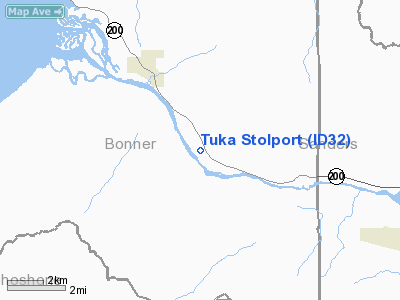
Location
& QuickFacts
|
FAA
Information Effective: |
2007-07-05 |
|
Airport
Identifier: |
ID32 |
|
Airport
Status: |
Operational |
|
Longitude/Latitude: |
116-08-12.6000W/48-06-19.8000N
-116.136833/48.105500 (Estimated) |
|
Elevation: |
2086 ft / 635.81 m (Surveyed) |
|
Land: |
10 acres |
|
From
nearest city: |
4 nautical miles SE of Clark Fork, ID |
|
Location: |
Bonner County, ID |
|
Magnetic
Variation: |
18E (1990) |
Owner
& Manager
|
Ownership: |
Privately
owned |
|
Owner: |
H T Sallmon |
|
Address: |
Po Box 1265
Sandpoint, ID 83864 |
|
Manager: |
H T Sallmon |
|
Address: |
Po Box 1265
Sandpoint, ID 83864 |
Airport
Operations and Facilities
|
Airport
Use: |
Private |
|
Wind
indicator: |
Yes |
|
Segmented Circle: |
No |
|
Control
Tower: |
No |
|
Sectional chart: |
Great Falls |
|
Region: |
ANM - Northwest Mountain |
|
Boundary
ARTCC: |
ZSE - Seattle |
|
Tie-in
FSS: |
BOI - Boise |
|
FSS
on Airport: |
No |
|
FSS
Phone: |
208-332-0200 |
|
FSS
Toll Free: |
1-800-WX-BRIEF |
|
Runway Information
Runway 13W/31W
|
Dimension: |
8000
x 100 ft / 2438.4 x 30.5 m |
|
Surface: |
WATER, |
|
|
Runway 13W |
Runway 31W |
|
Traffic
Pattern: |
Left |
Left |
|
Runway 16S/34S
|
Dimension: |
2700
x 40 ft / 823.0 x 12.2 m |
|
Surface: |
TURF, |
|
|
Runway 16S |
Runway 34S |
|
Traffic
Pattern: |
Left |
Right |
|
Obstruction: |
150 ft trees, 400.0 ft from runway |
100 ft trees, 600.0 ft from runway |
|
Radio Navigation
Aids
|
ID |
Type |
Name |
Ch |
Freq |
Var |
Dist |
|
SZT |
NDB |
Sandpoe |
|
264.00 |
20E |
20.4 nm |
|
LYI |
NDB |
Libby |
|
414.00 |
17E |
28.3 nm |
|
COE |
VOR/DME |
Coeur D'alene |
025X |
108.80 |
19E |
34.0 nm |
|
MLP |
VOR/DME |
Mullan Pass |
125X |
117.80 |
20E |
43.7 nm |
Remarks
- SEALANE
CURRENT 1-5 KTS; GRAVEL BARS NORTHWEST; SEASONAL BIRDS & FLOATING
DEBRIS.
- DEER
INVOF RY; OCNL CROSS WINDS; HIGH PERFORMANCE TAKEOFFS ONLY.
- PPR
- DEER
INVOF RY.
Based
Aircraft
|
Aircraft
based on field: |
2 |
|
Single
Engine Airplanes: |
2 |
Tuka Stolport
Address:
Bonner County, ID
Tel:
Images
and information placed above are from
http://www.airport-data.com/airport/ID32/
We
thank them for the data!
| General
Info |
| Country |
United
States |
| State |
IDAHO
|
| FAA ID |
ID32 |
| Latitude |
48-06-19.800N
|
| Longitude |
116-08-12.600W
|
| Elevation |
2086 feet
|
| Near City |
CLARK
FORK |
We don't guarantee the information is fresh and accurate. The data may
be wrong or outdated.
For more up-to-date information please refer to other sources.
|
|


