 |
|
Location
& QuickFacts
|
FAA
Information Effective: |
2007-07-05 |
|
Airport
Identifier: |
ID41 |
|
Airport
Status: |
Operational |
|
Longitude/Latitude: |
115-19-58.3930W/44-53-59.6670N
-115.332887/44.899907 (Estimated) |
|
Elevation: |
6539 ft / 1993.09 m (Estimated) |
|
Land: |
10 acres |
|
From
nearest city: |
8 nautical miles SE of Yellow Pine, ID |
|
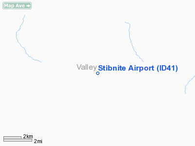
Location: |
Valley County, ID |
|
Magnetic
Variation: |
17E (1985) |
Owner
& Manager
|
Ownership: |
Privately
owned |
|
Owner: |
Stibnite Mine Inc. |
|
Address: |
921 S. Orchard, Ste 0
Boise, ID 83705 |
|
Phone
number: |
208-345-4102 |
|
Manager: |
Don Bork |
|
Address: |
921 S. Orchard, Ste 0
Boise, ID 83705 |
|
Phone
number: |
208-345-4102 |
Airport
Operations and Facilities
|
Airport
Use: |
Private |
|
Wind
indicator: |
Yes |
|
Segmented Circle: |
No |
|
Control
Tower: |
No |
|
Landing
fee charge: |
No |
|
Sectional chart: |
Great Falls |
|
Region: |
ANM - Northwest Mountain |
|
Boundary
ARTCC: |
ZLC - Salt Lake City |
|
Tie-in
FSS: |
BOI - Boise |
|
FSS
on Airport: |
No |
|
FSS
Phone: |
208-332-0200 |
|
FSS
Toll Free: |
1-800-WX-BRIEF |
|
Runway Information
Runway 06/24
|
Dimension: |
2450
x 175 ft / 746.8 x 53.3 m |
|
Surface: |
GRAVEL, Poor Condition |
|
|
Runway 06 |
Runway 24 |
|
Traffic
Pattern: |
Left |
Right |
|
Radio Navigation
Aids
|
ID |
Type |
Name |
Ch |
Freq |
Var |
Dist |
|
IOM |
NDB |
Mc Call |
|
363.00 |
17E |
33.3 nm |
|
DNJ |
VORTAC |
Donnelly |
109X |
116.20 |
19E |
38.1 nm |
Remarks
- RWY
CURVES, CONCAVE SIDE TO N.W.; NOT PLOWED AND/OR PACKED IN WINTER.
- (A1101)
RWY CONDITIONS VARIES, POOR IN THE SPRING AND FALL AND AFTER SUMMER
STORMS.
- FILED
FOR RECOR PURPOSES ONLY.
Stibnite Airport
Address:
Valley County, ID
Tel:
208-345-4102
Images
and information placed above are from
http://www.airport-data.com/airport/ID41/
We
thank them for the data!
| General
Info |
| Country |
United
States |
| State |
IDAHO
|
| FAA ID |
ID41 |
| Latitude |
44-53-59.667N
|
| Longitude |
115-19-58.393W
|
| Elevation |
6539 feet
|
| Near City |
YELLOW
PINE |
We don't guarantee the information is fresh and accurate. The data may
be wrong or outdated.
For more up-to-date information please refer to other sources.
|
|


