 |
|
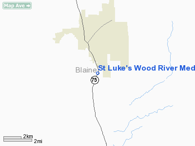
St Luke's Wood River Medical Center Heliport |
Location
& QuickFacts
|
FAA
Information Effective: |
2007-07-05 |
|
Airport
Identifier: |
1ID5 |
|
Airport
Status: |
Operational |
|
Longitude/Latitude: |
114-20-54.0000W/43-38-55.0000N
-114.348333/43.648611 (Estimated) |
|
Elevation: |
5737 ft / 1748.64 m (Estimated) |
|
Land: |
19 acres |
|
From
nearest city: |
1 nautical miles N of Ketchum, ID |
|
Location: |
Blaine County, ID |
|
Magnetic
Variation: |
15E (2000) |
Owner
& Manager
|
Ownership: |
Privately
owned |
|
Owner: |
St Luke's Corporation |
|
Address: |
190 E. Bannock
Boise, ID 83712 |
|
Phone
number: |
208-381-2023 |
|
Manager: |
Hospital Administrator |
|
Address: |
100 Hospital Drive
Ketchum, ID 83340 |
|
Phone
number: |
208-727-8800 |
Airport
Operations and Facilities
|
Airport
Use: |
Private
MEDICAL |
|
Wind
indicator: |
Yes |
|
Segmented Circle: |
No |
|
Control
Tower: |
No |
|
Sectional chart: |
Salt Lake City |
|
Region: |
ANM - Northwest Mountain |
|
Boundary
ARTCC: |
ZLC - Salt Lake City |
|
Tie-in
FSS: |
BOI - Boise |
|
FSS
Phone: |
208-332-0200 |
|
FSS
Toll Free: |
1-800-WX-BRIEF |
|
Runway Information
Helipad H1
|
Dimension: |
40
x 40 ft / 12.2 x 12.2 m |
|
Surface: |
CONC, |
|
|
Runway H1 |
Runway |
|
Traffic
Pattern: |
Left |
Left |
|
Radio Navigation
Aids
|
ID |
Type |
Name |
Ch |
Freq |
Var |
Dist |
|
AOC |
NDB |
Arco |
|
200.00 |
15E |
43.9 nm |
|
HDG |
NDB |
Steelhead |
|
211.00 |
16E |
46.3 nm |
|
HLE |
NDB/DME |
Hailey |
025X |
220.00 |
16E |
19.8 nm |
St Luke's Wood River Medical Center Heliport
Address:
Blaine County, ID
Tel:
208-381-2023,
208-727-8800
Images
and information placed above are from
http://www.airport-data.com/airport/1ID5/
We
thank them for the data!
| General
Info |
| Country |
United
States |
| State |
IDAHO
|
| FAA ID |
1ID5 |
| Latitude |
43-38-55.000N
|
| Longitude |
114-20-54.000W
|
| Elevation |
5737 feet
|
| Near City |
KETCHUM
|
We don't guarantee the information is fresh and accurate. The data may
be wrong or outdated.
For more up-to-date information please refer to other sources.
|
|


