 |
|
St Joseph's Regional Medical Center Heliport |
|
|
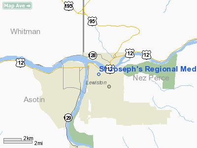
Location
& QuickFacts
|
FAA
Information Effective: |
2007-07-05 |
|
Airport
Identifier: |
ID37 |
|
Airport
Status: |
Operational |
|
Longitude/Latitude: |
117-01-01.5640W/46-24-47.5810N
-117.017101/46.413217 (Estimated) |
|
Elevation: |
740 ft / 225.55 m (Estimated) |
|
Land: |
0 acres |
|
From
nearest city: |
0 nautical miles NE of Lewiston, ID |
|
Location: |
Nez Perce County, ID |
|
Magnetic
Variation: |
19E (1985) |
Owner
& Manager
|
Ownership: |
Privately
owned |
|
Owner: |
St Joseph's Regional Med Ctr |
|
Address: |
P.o. Box 816
Lewiston, ID 83501 |
|
Phone
number: |
208-743-2511 |
|
Manager: |
Administrator |
|
Address: |
P.o. Box 816
Lewiston, ID 83501 |
|
Phone
number: |
208-743-2511 |
Airport
Operations and Facilities
|
Airport
Use: |
Private
MEDICAL USE. |
|
Wind
indicator: |
Yes |
|
Segmented Circle: |
No |
|
Control
Tower: |
No |
|
Lighting
Schedule: |
PHONE REQ
FOR PERIMETER LGTS CALL 208-743-2511 |
|
Landing
fee charge: |
No |
|
Sectional
chart: |
Seattle |
|
Region: |
ANM - Northwest Mountain |
|
Boundary
ARTCC: |
ZSE - Seattle |
|
Tie-in
FSS: |
BOI - Boise |
|
FSS
on Airport: |
No |
|
FSS
Phone: |
208-332-0200 |
|
FSS
Toll Free: |
1-800-WX-BRIEF |
Airport
Services
|
Airframe
Repair: |
NONE |
|
Power
Plant Repair: |
NONE |
|
Runway Information
Helipad H1
|
Dimension: |
50
x 50 ft / 15.2 x 15.2 m |
|
Surface: |
CONC, |
|
|
Runway H1 |
Runway |
|
Traffic
Pattern: |
Left |
Left |
|
Radio Navigation
Aids
|
ID |
Type |
Name |
Ch |
Freq |
Var |
Dist |
|
GVV |
NDB |
Grain |
|
280.00 |
18E |
43.7 nm |
|
MQG |
VOR/DME |
Nez Perce |
019X |
108.20 |
20E |
6.4 nm |
|
PUW |
VOR/DME |
Pullman |
027X |
109.00 |
20E |
17.9 nm |
Remarks
- HELIPORT
IS ON HOSPITAL OWNED PROPERTY.
St Joseph's Regional Medical Center Heliport
Address:
Nez Perce County, ID
Tel:
208-743-2511
Images
and information placed above are from
http://www.airport-data.com/airport/ID37/
We
thank them for the data!
| General
Info |
| Country |
United
States |
| State |
IDAHO
|
| FAA ID |
ID37 |
| Latitude |
46-24-47.581N
|
| Longitude |
117-01-01.564W
|
| Elevation |
740 feet
|
| Near City |
LEWISTON
|
We don't guarantee the information is fresh and accurate. The data may
be wrong or outdated.
For more up-to-date information please refer to other sources.
|
|


