 |
|
Soldier Bar U.S. Forest Service Airport |
|
|
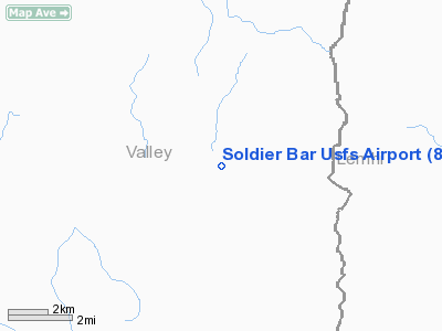
Location
& QuickFacts
|
FAA
Information Effective: |
2007-07-05 |
|
Airport
Identifier: |
85U |
|
Airport
Status: |
Operational |
|
Longitude/Latitude: |
114-48-03.3440W/45-05-59.6910N
-114.800929/45.099914 (Estimated) |
|
Elevation: |
4190 ft / 1277.11 m (Estimated) |
|
Land: |
6 acres |
|
From
nearest city: |
1 nautical miles SW of Soldier Bar, ID |
|
Location: |
Valley County, ID |
|
Magnetic
Variation: |
17E (1985) |
Owner
& Manager
|
Ownership: |
Publicly
owned |
|
Owner: |
U S Forest Service |
|
Address: |
324 25th St
Ogden, UT 84401 |
|
Phone
number: |
801-625-5511 |
|
Manager: |
Payette Forest Air Officer |
|
Address: |
P.o. Box 1026
Mc Call, ID 83638 |
|
Phone
number: |
208-634-0746 |
Airport
Operations and Facilities
|
Airport
Use: |
Open
to public |
|
Wind
indicator: |
Yes |
|
Segmented Circle: |
No |
|
Control
Tower: |
No |
|
Landing
fee charge: |
No |
|
Sectional chart: |
Great Falls |
|
Region: |
ANM - Northwest Mountain |
|
Boundary
ARTCC: |
ZLC - Salt Lake City |
|
Tie-in
FSS: |
BOI - Boise |
|
FSS
on Airport: |
No |
|
FSS
Phone: |
208-332-0200 |
|
FSS
Toll Free: |
1-800-WX-BRIEF |
|
NOTAMs
Facility: |
BOI (NOTAM-d service avaliable) |
Airport
Communications
Airport
Services
|
Airframe
Repair: |
NONE |
|
Power
Plant Repair: |
NONE |
|
Runway Information
Runway 07/25
|
Dimension: |
1650
x 15 ft / 502.9 x 4.6 m |
|
Surface: |
DIRT, Fair Condition |
|
|
Runway 07 |
Runway 25 |
|
Traffic
Pattern: |
Left |
Left |
|
Obstruction: |
60 ft trees, 35.0 ft from runway |
150 ft hill, 900.0 ft from runway, 6:1 slope
to clear |
|
Radio Navigation
Aids
|
ID |
Type |
Name |
Ch |
Freq |
Var |
Dist |
|
LLJ |
NDB |
Challis |
|
397.00 |
17E |
42.9 nm |
|
LKT |
VOR/DME |
Salmon |
082X |
113.50 |
18E |
30.8 nm |
Remarks
- STEEP
CANYON WALLS IN ALL DRCTNS.
- ARPT
ON BENCH 500 FT ABOVE BIG CREEK ON S SIDE.
- CABIN
CREEK ARPT APPROX 7 MILES WEST UP BIG CREEK CANYON.
- WEST
1/3 OF RY HAS 4 DEG SLOPE DOWN TO THE NORTH.
- GO-AROUNDS
NOT RECOMMENDED.
- NO
TELEPHONE AVBL AT ARPT.
Operational
Statistics
Time Period: 2003-05-16
- 2004-05-14
|
Aircraft
Operations: |
21/Month |
|
Air
Taxi: |
40.0% |
|
General
Aviation Itinerant: |
60.0% |
Soldier Bar U S Forest Service Airport
Address:
Valley County, ID
Tel:
801-625-5511,
208-634-0746
Images
and information placed above are from
http://www.airport-data.com/airport/85U/
We
thank them for the data!
| General
Info |
| Country |
United
States |
| State |
IDAHO
|
| FAA ID |
85U |
| Latitude |
45-05-59.691N
|
| Longitude |
114-48-03.344W
|
| Elevation |
4190 feet
|
| Near City |
SOLDIER
BAR |
We don't guarantee the information is fresh and accurate. The data may
be wrong or outdated.
For more up-to-date information please refer to other sources.
|
|


