 |
|
Snake River Seaplane Base |
|
|
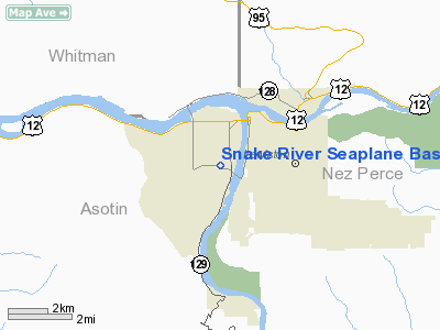
Location
& QuickFacts
|
FAA
Information Effective: |
2007-07-05 |
|
Airport
Identifier: |
78U |
|
Airport
Status: |
Operational |
|
Longitude/Latitude: |
117-03-03.5680W/46-23-59.5790N
-117.050991/46.399883 (Estimated) |
|
Elevation: |
735 ft / 224.03 m (Estimated) |
|
Land: |
0 acres |
|
From
nearest city: |
1 nautical miles SW of Lewiston, ID |
|
Location: |
Nez Perce County, ID |
|
Magnetic
Variation: |
19E (1985) |
Owner
& Manager
|
Ownership: |
Publicly
owned |
|
Owner: |
Us Army Corps Of Engineers |
|
Address: |
City-county Arpt/ocr Div
Walla Walla, WA 99362 |
|
Phone
number: |
509-522-6704 |
|
Manager: |
Hells Gate State Park |
|
Address: |
5100 Hells Gate Rd
Lewiston, ID 83501 |
|
Phone
number: |
208-799-5015 |
Airport
Operations and Facilities
|
Airport
Use: |
Open
to public |
|
Wind
indicator: |
No |
|
Segmented Circle: |
No |
|
Control
Tower: |
No |
|
Landing
fee charge: |
No |
|
Sectional chart: |
Seattle |
|
Region: |
ANM - Northwest Mountain |
|
Boundary
ARTCC: |
ZSE - Seattle |
|
Tie-in
FSS: |
BOI - Boise |
|
FSS
on Airport: |
No |
|
FSS
Phone: |
208-332-0200 |
|
FSS
Toll Free: |
1-800-WX-BRIEF |
|
NOTAMs
Facility: |
BOI (NOTAM-d service avaliable) |
Airport
Communications
Airport
Services
|
Airframe
Repair: |
NONE |
|
Power
Plant Repair: |
NONE |
|
Bottled
Oxygen: |
NONE |
|
Bulk
Oxygen: |
NONE |
|
Runway Information
Runway N/S
|
Dimension: |
3000
x 150 ft / 914.4 x 45.7 m |
|
Surface: |
WATER, |
|
|
Runway N |
Runway S |
|
Traffic
Pattern: |
Left |
Left |
|
Obstruction: |
, 50:1 slope to clear |
150 ft pline, 3780.0 ft from runway, 25:1 slope
to clear |
|
Radio Navigation
Aids
|
ID |
Type |
Name |
Ch |
Freq |
Var |
Dist |
|
GVV |
NDB |
Grain |
|
280.00 |
18E |
44.2 nm |
|
MQG |
VOR/DME |
Nez Perce |
019X |
108.20 |
20E |
7.6 nm |
|
PUW |
VOR/DME |
Pullman |
027X |
109.00 |
20E |
18.0 nm |
Remarks
- PLINES
CROSS SNAKE RIVER APPROXIMATELY 2 MILES N & 1 MILE S OF LNDG AREA;
IN ADDITION OTHER PLINES TELEPHONE LINES CROSS SNAKE RIVER ABOVE &
BELOW LNDG AREA. BRIDGE
ACROSS SNAKE RIVER N OF LNDG AREA.
- CAUTION:
LNDG AREA WITHIN LEWISTON-NEZ PERCE COUNTY ARPT TFC AREA; CTC LWS ATCT.
- NO
BEACHING GEAR OR MOORING BUOYS AVAILABLE.
- HEAVY
BOAT TFC INVOF SEAPLANE BASE.
Operational
Statistics
Time Period: 2005-09-27
- 2006-09-26
|
Aircraft
Operations: |
1/Month |
|
General
Aviation Itinerant: |
100.0% |
Snake River Seaplane Base
Address:
Nez Perce County, ID
Tel:
509-522-6704,
208-799-5015
Images
and information placed above are from
http://www.airport-data.com/airport/78U/
We
thank them for the data!
| General
Info |
| Country |
United
States |
| State |
IDAHO
|
| FAA ID |
78U |
| Latitude |
46-23-59.579N
|
| Longitude |
117-03-03.568W
|
| Elevation |
735 feet
|
| Near City |
LEWISTON
|
We don't guarantee the information is fresh and accurate. The data may
be wrong or outdated.
For more up-to-date information please refer to other sources.
|
|


