 |
|
|
|
|
|
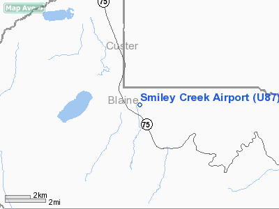
Location
& QuickFacts
|
FAA
Information Effective: |
2007-07-05 |
|
Airport
Identifier: |
U87 |
|
Airport
Status: |
Operational |
|
Longitude/Latitude: |
114-47-50.2510W/43-54-54.6610N
-114.797292/43.915184 (Estimated) |
|
Elevation: |
7160 ft / 2182.37 m (Estimated) |
|
Land: |
40 acres |
|
From
nearest city: |
6 nautical miles NW of Galena, ID |
|
Location: |
Blaine County, ID |
|
Magnetic
Variation: |
17E (1985) |
Owner
& Manager
|
Ownership: |
Publicly
owned
PRIVATE LAND LEASED TO THE IDAHO BUREAU OF AERONAUTICS. |
|
Owner: |
State Of Id, Itd Div Aero |
|
Address: |
P O Box 7129
Boise, ID 83707-1129 |
|
Phone
number: |
208-334-8775 |
|
Manager: |
Aero Div Admin |
|
Address: |
P O Box 7129
Boise, ID 83707-1129 |
|
Phone
number: |
208-334-8775 |
Airport
Operations and Facilities
|
Airport
Use: |
Open
to public |
|
Wind
indicator: |
Yes |
|
Segmented Circle: |
Yes |
|
Control
Tower: |
No |
|
Landing
fee charge: |
No |
|
Sectional chart: |
Salt Lake City |
|
Region: |
ANM - Northwest Mountain |
|
Boundary
ARTCC: |
ZLC - Salt Lake City |
|
Tie-in
FSS: |
BOI - Boise |
|
FSS
on Airport: |
No |
|
FSS
Phone: |
208-332-0200 |
|
FSS
Toll Free: |
1-800-WX-BRIEF |
|
NOTAMs
Facility: |
BOI (NOTAM-d service avaliable) |
Airport
Communications
Airport
Services
|
Airframe
Repair: |
NONE |
|
Power
Plant Repair: |
NONE |
|
Bottled
Oxygen: |
NONE |
|
Bulk
Oxygen: |
NONE |
|
Runway Information
Runway 14/32
|
Dimension: |
4900
x 150 ft / 1493.5 x 45.7 m |
|
Surface: |
TURF, Good Condition |
|
|
Runway 14 |
Runway 32 |
|
Traffic
Pattern: |
Left |
Left |
|
Obstruction: |
4 ft fence, 100 ft left of centerline |
5 ft fence, 0.0 ft from runway, 100 ft right
of centerline |
|
Radio Navigation
Aids
|
ID |
Type |
Name |
Ch |
Freq |
Var |
Dist |
|
LLJ |
NDB |
Challis |
|
397.00 |
17E |
44.1 nm |
|
HLE |
NDB/DME |
Hailey |
025X |
220.00 |
16E |
42.7 nm |
Remarks
- NO
WINTER MAINTENANCE.
- RECOMMEND
LNDG RY 14 TKOF RY 32 WHEN WIND CONDITIONS ALLOW.
- BE
ALERT FOR SPRINKLERS/STAND PIPES ON EDGE OF RY.
- ARPT
LCTD IN VALLEY SURROUNDED BY HIGH MOUNTAINOUS TERRAIN.
- EXTREMELY
HIGH DENSITY ALTITUDE CONDITIONS EXIST DURING SUMMER MONTHS.
Operational
Statistics
Time Period: 2005-06-07
- 2006-06-06
|
Aircraft
Operations: |
89/Week |
|
Air
Taxi: |
8.7% |
|
General
Aviation Itinerant: |
91.3% |
Smiley Creek Airport
Address:
Blaine County, ID
Tel:
208-334-8775
Images
and information placed above are from
http://www.airport-data.com/airport/U87/
We
thank them for the data!
| General
Info |
| Country |
United
States |
| State |
IDAHO
|
| FAA ID |
U87 |
| Latitude |
43-54-54.661N
|
| Longitude |
114-47-50.251W
|
| Elevation |
7160 feet
|
| Near City |
GALENA
|
We don't guarantee the information is fresh and accurate. The data may
be wrong or outdated.
For more up-to-date information please refer to other sources.
|
|


