 |
|
Location
& QuickFacts
|
FAA
Information Effective: |
2007-07-05 |
|
Airport
Identifier: |
ID13 |
|
Airport
Status: |
Operational |
|
Longitude/Latitude: |
116-38-23.6100W/47-19-19.6670N
-116.639892/47.322130 (Estimated) |
|
Elevation: |
2880 ft / 877.82 m (Estimated) |
|
Land: |
0 acres |
|
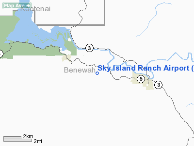
From
nearest city: |
3 nautical miles W of St Maries, ID |
|
Location: |
Benewah County, ID |
|
Magnetic
Variation: |
19E (1985) |
Owner
& Manager
|
Ownership: |
Privately
owned |
|
Owner: |
Frederick C. Welch |
|
Address: |
Hc 01, Box 198-d
St Maries, ID 83861 |
|
Phone
number: |
208-245-3080 |
|
Manager: |
Frederick C. Welch |
|
Address: |
Hc 01, Box 198-d
St Maries, ID 83861 |
|
Phone
number: |
208-245-3080 |
Airport
Operations and Facilities
|
Airport Use: |
Private |
|
Wind
indicator: |
No |
|
Segmented
Circle: |
No |
|
Control
Tower: |
No |
|
Landing
fee charge: |
No |
|
Sectional
chart: |
Great Falls |
|
Region: |
ANM - Northwest Mountain |
|
Boundary
ARTCC: |
ZSE - Seattle |
|
Tie-in
FSS: |
BOI - Boise |
|
FSS
on Airport: |
No |
|
FSS
Phone: |
208-332-0200 |
|
FSS
Toll Free: |
1-800-WX-BRIEF |
Airport
Communications
|
Runway Information
Runway 07/25
|
Dimension: |
1000 x 200 ft / 304.8 x 61.0 m
200 FEET WIDE CLEARED & GRADED BUT ONLY 40 FEET WIDE IN CENTER
IS GROOMED & MAINTAINED. |
|
Surface: |
TURF, |
|
|
Runway 07 |
Runway 25 |
|
Traffic
Pattern: |
Left |
Right |
|
Radio Navigation
Aids
|
ID |
Type |
Name |
Ch |
Freq |
Var |
Dist |
|
SFF |
NDB |
Felts |
|
365.00 |
19E |
35.0 nm |
|
SKA |
TACAN |
Fairchild |
051X |
|
19E |
45.0 nm |
|
COE |
VOR/DME |
Coeur D'alene |
025X |
108.80 |
19E |
28.1 nm |
|
MLP |
VOR/DME |
Mullan Pass |
125X |
117.80 |
20E |
41.2 nm |
|
PUW |
VOR/DME |
Pullman |
027X |
109.00 |
20E |
45.7 nm |
|
GEG |
VORTAC |
Spokane |
102X |
115.50 |
21E |
42.7 nm |
|
SFF |
VOT |
Spokane/felts Field |
|
114.00 |
|
35.0 nm |
|
GEG |
VOT |
Spokane Intl |
|
109.60 |
|
40.8 nm |
Remarks
- FIELD
SOFT WHEN WET OR THAWING.
- PETS,
LIVESTOCK, AND GAME ANIMALS MAY BE ON FIELD.
- UNAUTHORIZED
TFC NOT ALLOWED.
Based
Aircraft
|
Aircraft
based on field: |
2 |
|
Single
Engine Airplanes: |
2 |
Sky Island Ranch Airport
Address:
Benewah County, ID
Tel:
208-245-3080
Images
and information placed above are from
http://www.airport-data.com/airport/ID13/
We
thank them for the data!
| General
Info |
| Country |
United
States |
| State |
IDAHO
|
| FAA ID |
ID13 |
| Latitude |
47-19-19.667N
|
| Longitude |
116-38-23.610W
|
| Elevation |
2880 feet
|
| Near City |
ST MARIES
|
We don't guarantee the information is fresh and accurate. The data may
be wrong or outdated.
For more up-to-date information please refer to other sources.
|
|


