 |
|
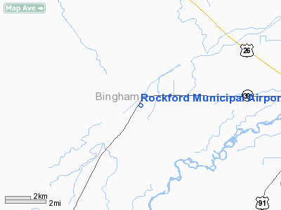
Rockford Municipal Airport |
|
|
Location
& QuickFacts
|
FAA
Information Effective: |
2007-07-05 |
|
Airport
Identifier: |
2U4 |
|
Airport
Status: |
Operational |
|
Longitude/Latitude: |
112-31-54.9380W/43-11-24.6900N
-112.531927/43.190192 (Estimated) |
|
Elevation: |
4465 ft / 1360.93 m (Estimated) |
|
Land: |
18 acres |
|
From
nearest city: |
0 nautical miles E of Rockford, ID |
|
Location: |
Bingham County, ID |
|
Magnetic
Variation: |
16E (1985) |
Owner
& Manager
|
Ownership: |
Publicly
owned |
|
Owner: |
Bingham County |
|
Address: |
P O Box 1028
Blackfoot, ID 83221 |
|
Phone
number: |
208-785-5005 |
|
Manager: |
Dave Babbitt |
|
Address: |
501 N Maple #209
Blackfoot, ID 83221 |
|
Phone
number: |
208-782-3170
EXT 278 |
Airport
Operations and Facilities
|
Airport
Use: |
Open
to public |
|
Wind
indicator: |
Yes |
|
Segmented Circle: |
No |
|
Control
Tower: |
No |
|
Landing
fee charge: |
No |
|
Sectional chart: |
Salt Lake City |
|
Region: |
ANM - Northwest Mountain |
|
Boundary
ARTCC: |
ZLC - Salt Lake City |
|
Tie-in
FSS: |
BOI - Boise |
|
FSS
on Airport: |
No |
|
FSS
Phone: |
208-332-0200 |
|
FSS
Toll Free: |
1-800-WX-BRIEF |
|
NOTAMs
Facility: |
BOI (NOTAM-d service avaliable) |
Airport
Communications
Airport
Services
|
Airframe
Repair: |
NONE |
|
Power
Plant Repair: |
NONE |
|
Bottled
Oxygen: |
NONE |
|
Bulk
Oxygen: |
NONE |
|
Runway Information
Runway 16/34
|
Dimension: |
2800
x 50 ft / 853.4 x 15.2 m |
|
Surface: |
ASPH, Good Condition |
|
|
Runway 16 |
Runway 34 |
|
Traffic
Pattern: |
Left |
Left |
|
Markings: |
None, |
None, |
|
Runway
End Identifier: |
No |
No |
|
Centerline
Lights: |
No |
No |
|
Touchdown
Lights: |
No |
No |
|
Obstruction: |
26 ft rr, 200.0 ft from runway, 125 ft right
of centerline
+4 FT FENCE AT 100 FT; 15 FT ROAD AT 140 FT; +4 FT FENCE AT
0 FT 85 FT R; 15 FT ROAD AT 30 FT 125 FT R. |
4 ft fence, 200.0 ft from runway
+4 FENCE AT 0 FT ON CNTRLN; +25 FT TREE AT 50 FT 100 FT L. |
|
Radio Navigation
Aids
|
ID |
Type |
Name |
Ch |
Freq |
Var |
Dist |
|
SWU |
NDB |
Sweden |
|
350.00 |
15E |
21.7 nm |
|
AOC |
NDB |
Arco |
|
200.00 |
15E |
43.1 nm |
|
IDA |
VOR/DME |
Idaho Falls |
85Y |
113.85 |
15E |
28.4 nm |
|
PIH |
VORTAC |
Pocatello |
073X |
112.60 |
17E |
19.9 nm |
Remarks
- RY
16 USE EXTREME CTN RR BOX CARS ARE OFTEN PARKED ON CNTRLN.
- CONSIDERABLE
AGRICULTURE OPS DURING GROWING SEASON.
- NO
WINTER MAINTENANCE.
- ESTABD
PRIOR TO 15 MAY 1959.
Operational
Statistics
Time Period: 2002-10-24
- 2003-10-23
|
Aircraft
Operations: |
39/Week |
|
General
Aviation Itinerant: |
100.0% |
Rockford Municipal Airport
Address:
Bingham County, ID
Tel:
208-785-5005
Images
and information placed above are from
http://www.airport-data.com/airport/2U4/
We
thank them for the data!
| General
Info |
| Country |
United
States |
| State |
IDAHO
|
| FAA ID |
2U4 |
| Latitude |
43-11-24.690N
|
| Longitude |
112-31-54.938W
|
| Elevation |
4465 feet
|
| Near City |
ROCKFORD
|
We don't guarantee the information is fresh and accurate. The data may
be wrong or outdated.
For more up-to-date information please refer to other sources.
|
|


