 |
|
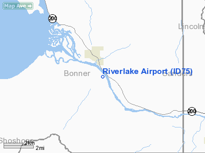
Location
& QuickFacts
|
FAA
Information Effective: |
2007-07-05 |
|
Airport
Identifier: |
ID75 |
|
Airport
Status: |
Operational |
|
Longitude/Latitude: |
116-09-55.6320W/48-07-33.7350N
-116.165453/48.126037 (Estimated) |
|
Elevation: |
2076 ft / 632.76 m (Estimated) |
|
Land: |
10 acres |
|
From
nearest city: |
1 nautical miles S of Clark Fork, ID |
|
Location: |
Bonner County, ID |
|
Magnetic
Variation: |
18E (1995) |
Owner
& Manager
|
Ownership: |
Privately
owned |
|
Owner: |
Riverlake Estates |
|
Address: |
17 N River Lake Drive
Clark Fork, ID 83811 |
|
Phone
number: |
208-266-1722 |
|
Manager: |
Delbert Mc Daniel |
|
Address: |
17 N River Lake Drive
Clark Fork, ID 83811 |
|
Phone
number: |
208-266-1622
OR 208-266-0195. |
Airport
Operations and Facilities
|
Airport
Use: |
Private |
|
Wind
indicator: |
Yes |
|
Segmented Circle: |
No |
|
Control
Tower: |
No |
|
Landing
fee charge: |
No |
|
Sectional chart: |
Great Falls |
|
Region: |
ANM - Northwest Mountain |
|
Boundary
ARTCC: |
ZSE - Seattle |
|
Tie-in
FSS: |
BOI - Boise |
|
FSS
on Airport: |
No |
|
FSS
Phone: |
208-332-0200 |
|
FSS
Toll Free: |
1-800-WX-BRIEF |
|
Runway Information
Runway 14/32
|
Dimension: |
2600
x 75 ft / 792.5 x 22.9 m |
|
Surface: |
TURF, Good Condition |
|
|
Runway 14 |
Runway 32 |
|
Traffic
Pattern: |
Left |
Left |
|
Radio Navigation
Aids
|
ID |
Type |
Name |
Ch |
Freq |
Var |
Dist |
|
SZT |
NDB |
Sandpoe |
|
264.00 |
20E |
18.8 nm |
|
LYI |
NDB |
Libby |
|
414.00 |
17E |
28.9 nm |
|
COE |
VOR/DME |
Coeur D'alene |
025X |
108.80 |
19E |
33.8 nm |
|
MLP |
VOR/DME |
Mullan Pass |
125X |
117.80 |
20E |
45.4 nm |
Remarks
- SEE
AIRSPACE LETTER DATED 29 DEC 94.
Based
Aircraft
|
Aircraft
based on field: |
2 |
|
Single
Engine Airplanes: |
2 |
Riverlake Airport
Address:
Bonner County, ID
Tel:
208-266-1722,
208-266-1622,
208-266-0195
Images
and information placed above are from
http://www.airport-data.com/airport/ID75/
We
thank them for the data!
| General
Info |
| Country |
United
States |
| State |
IDAHO
|
| FAA ID |
ID75 |
| Latitude |
48-07-33.735N
|
| Longitude |
116-09-55.632W
|
| Elevation |
2076 feet
|
| Near City |
CLARK
FORK |
We don't guarantee the information is fresh and accurate. The data may
be wrong or outdated.
For more up-to-date information please refer to other sources.
|
|


