 |
|
|
|
|
|
Location
& QuickFacts
|
FAA
Information Effective: |
2007-07-05 |
|
Airport
Identifier: |
1U9 |
|
Airport
Status: |
Operational |
|
Longitude/Latitude: |
115-18-33.2910W/43-27-44.6240N
-115.309248/43.462396 (Estimated) |
|
Elevation: |
4232 ft / 1289.91 m (Estimated) |
|
Land: |
16 acres |
|
From
nearest city: |
1 nautical miles S of Pine, ID |
|
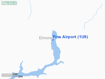
Location: |
Elmore County, ID |
|
Magnetic
Variation: |
17E (1985) |
Owner
& Manager
|
Ownership: |
Publicly
owned |
|
Owner: |
State Of Id, Itd Div Of Aero |
|
Address: |
P.o. Box 7129
Boise, ID 83707-1129 |
|
Phone
number: |
208-334-8775 |
|
Manager: |
Div Admin |
|
Address: |
P.o. Box 7129
Boise, ID 83707-1129 |
|
Phone
number: |
208-334-8775 |
Airport
Operations and Facilities
|
Airport
Use: |
Open
to public |
|
Wind
indicator: |
Yes |
|
Segmented Circle: |
Yes |
|
Control
Tower: |
No |
|
Landing
fee charge: |
No |
|
Sectional chart: |
Salt Lake City |
|
Region: |
ANM - Northwest Mountain |
|
Boundary
ARTCC: |
ZLC - Salt Lake City |
|
Tie-in
FSS: |
BOI - Boise |
|
FSS
on Airport: |
No |
|
FSS
Phone: |
208-332-0200 |
|
FSS
Toll Free: |
1-800-WX-BRIEF |
|
NOTAMs
Facility: |
BOI (NOTAM-d service avaliable) |
Airport
Communications
Airport
Services
|
Airframe
Repair: |
NONE |
|
Power
Plant Repair: |
NONE |
|
Bottled
Oxygen: |
NONE |
|
Bulk
Oxygen: |
NONE |
|
Runway Information
Runway 16/34
|
Dimension: |
2300
x 125 ft / 701.0 x 38.1 m |
|
Surface: |
TURF, Fair Condition |
|
|
Runway 16 |
Runway 34 |
|
Traffic
Pattern: |
Left |
Right |
|
Obstruction: |
17 ft road, 115 ft right of centerline |
10 ft brush, 250.0 ft from runway, 25:1 slope
to clear |
|
Radio Navigation
Aids
|
ID |
Type |
Name |
Ch |
Freq |
Var |
Dist |
|
STI |
NDB |
Sturgeon |
|
333.00 |
17E |
26.0 nm |
|
HDG |
NDB |
Steelhead |
|
211.00 |
16E |
43.0 nm |
|
BO |
NDB |
Ustik |
|
359.00 |
17E |
44.6 nm |
|
HLE |
NDB/DME |
Hailey |
025X |
220.00 |
16E |
47.3 nm |
|
MUO |
TACAN |
Mountain Home |
087X |
|
18E |
35.4 nm |
|
LIA |
VOR |
Liberator |
|
114.90 |
18E |
35.3 nm |
|
BOI |
VORTAC |
Boise |
080X |
113.30 |
17E |
38.9 nm |
|
BOI |
VOT |
Boise |
|
116.70 |
|
40.7 nm |
Remarks
- NO
WINTER MAINTENANCE.
- DOG-LEG
NORTH END OF STRIP.
- NO
LINE OF SIGHT BETWEEN RWY ENDS.
- RECOMMEND
LAND RWY 34 & TAKEOFF RWY 16 WHEN WIND CONDITIONS PERMIT.
- RY
HAS SIDESLOPE, DOWNHILL FM WEST TO EAST.
- ESTABD
PRIOR TO 1959.
Operational
Statistics
Time Period: 2003-09-01
- 2004-08-30
|
Aircraft
Operations: |
30/Week |
|
General
Aviation Itinerant: |
98.4% |
|
Military: |
1.6% |
Pine Airport
Address:
Elmore County, ID
Tel:
208-334-8775
Images
and information placed above are from
http://www.airport-data.com/airport/1U9/
We
thank them for the data!
| General
Info |
| Country |
United
States |
| State |
IDAHO
|
| FAA ID |
1U9 |
| Latitude |
43-27-44.624N
|
| Longitude |
115-18-33.291W
|
| Elevation |
4232 feet
|
| Near City |
PINE |
We don't guarantee the information is fresh and accurate. The data may
be wrong or outdated.
For more up-to-date information please refer to other sources.
|
|


