 |
|
Payette Municipal Airport |
|
|
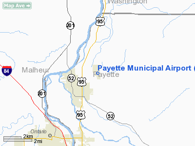
Location
& QuickFacts
|
FAA
Information Effective: |
2007-07-05 |
|
Airport
Identifier: |
S75 |
|
Airport
Status: |
Operational |
|
Longitude/Latitude: |
116-54-03.5710W/44-05-29.5910N
-116.900992/44.091553 (Estimated) |
|
Elevation: |
2228 ft / 679.09 m (Estimated) |
|
Land: |
260 acres |
|
From
nearest city: |
2 nautical miles NE of Payette, ID |
|
Location: |
Payette County, ID |
|
Magnetic
Variation: |
17E (1985) |
Owner
& Manager
|
Ownership: |
Publicly
owned |
|
Owner: |
City Of Payette |
|
Address: |
700 Center Avenue
Payette, ID 83661 |
|
Phone
number: |
208-642-6024 |
|
Manager: |
City Engineer |
|
Address: |
700 Center Ave
Payette, ID 83661 |
|
Phone
number: |
208-642-6024 |
Airport
Operations and Facilities
|
Airport
Use: |
Open
to public |
|
Wind
indicator: |
Yes |
|
Segmented Circle: |
No |
|
Control
Tower: |
No |
|
Lighting
Schedule: |
DUSK-DAWN
ACTVT LIRL RY 13/31-CTAF |
|
Beacon
Color: |
Clear-Green (lighted land airport) |
|
Landing
fee charge: |
No |
|
Sectional chart: |
Salt Lake City |
|
Region: |
ANM - Northwest Mountain |
|
Boundary
ARTCC: |
ZLC - Salt Lake City |
|
Tie-in
FSS: |
BOI - Boise |
|
FSS
on Airport: |
No |
|
FSS
Phone: |
208-332-0200 |
|
FSS
Toll Free: |
1-800-WX-BRIEF |
|
NOTAMs
Facility: |
BOI (NOTAM-d service avaliable) |
Airport
Communications
Airport
Services
|
Airframe
Repair: |
MINOR |
|
Power
Plant Repair: |
MAJOR |
|
Bottled
Oxygen: |
NONE |
|
Bulk
Oxygen: |
NONE |
|
Runway Information
Runway 13/31
|
Dimension: |
3000
x 50 ft / 914.4 x 15.2 m |
|
Surface: |
ASPH, Fair Condition |
|
Weight
Limit: |
Single wheel: 8000 lbs. |
|
Edge
Lights: |
Low |
|
|
Runway 13 |
Runway 31 |
|
Traffic
Pattern: |
Left |
Left |
|
Markings: |
Basic, Fair Condition
/31 THLDS MKD WITH WHITE CONCRETE MKRS & WHITE CONCRETE
BOUNDARY MKRS. |
Basic, Fair Condition |
|
Displaced
threshold: |
250.00 ft |
0.00 ft |
|
Obstruction: |
25 ft trees, 378.0 ft from runway, 50 ft right
of centerline, 7:1 slope to clear
RWY 13 APCH SLOPE 25:1 TO DSPLCD THLD.
+35' TREES 190' FM EOR, 65' L; +6' BLDG, 75' EOR, 50'L. |
, 50:1 slope to clear |
|
Radio Navigation
Aids
|
ID |
Type |
Name |
Ch |
Freq |
Var |
Dist |
|
ONO |
NDB |
Ontario |
|
305.00 |
17E |
6.3 nm |
|
MPA |
NDB |
Meridian |
|
238.00 |
16E |
33.3 nm |
|
BO |
NDB |
Ustik |
|
359.00 |
17E |
39.1 nm |
|
BOI |
VORTAC |
Boise |
080X |
113.30 |
17E |
44.7 nm |
|
BOI |
VOT |
Boise |
|
116.70 |
|
42.7 nm |
Remarks
- ARPT
CLSD TO ACFT OVER 10000 LBS GWT.
- 2885'
MSL (405' AGL) MKD & LGTD STEEL TWR LCTD 2.2 MILES S OF ARPT.
- GOLFERS
ADJACENT TO TWY EDGES & RY 13 THR.
- ESTABD
PRIOR TO 15 MAY 1959.
Based
Aircraft
|
Aircraft
based on field: |
8 |
|
Single
Engine Airplanes: |
8 |
Operational Statistics
Time Period: 2005-11-30
- 2006-11-29
|
Aircraft
Operations: |
125/Week |
|
General
Aviation Local: |
23.1% |
|
General
Aviation Itinerant: |
76.9% |
Payette Municipal Airport
Address:
Payette County, ID
Tel:
208-642-6024
Images
and information placed above are from
http://www.airport-data.com/airport/S75/
We
thank them for the data!
| General
Info |
| Country |
United
States |
| State |
IDAHO
|
| FAA ID |
S75 |
| Latitude |
44-05-29.591N
|
| Longitude |
116-54-03.571W
|
| Elevation |
2228 feet
|
| Near City |
PAYETTE
|
We don't guarantee the information is fresh and accurate. The data may
be wrong or outdated.
For more up-to-date information please refer to other sources.
|
|


