 |
|
|
|
|
|
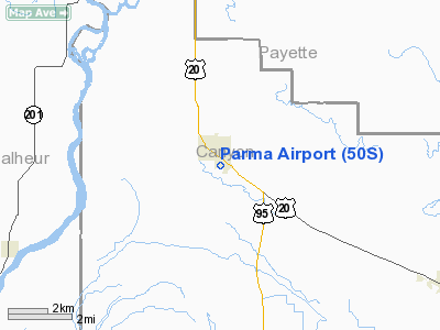
Location
& QuickFacts
|
FAA
Information Effective: |
2007-07-05 |
|
Airport
Identifier: |
50S |
|
Airport
Status: |
Operational |
|
Longitude/Latitude: |
116-56-18.5500W/43-46-43.5810N
-116.938486/43.778773 (Estimated) |
|
Elevation: |
2228 ft / 679.09 m (Estimated) |
|
Land: |
44 acres |
|
From
nearest city: |
1 nautical miles S of Parma, ID |
|
Location: |
Canyon County, ID |
|
Magnetic
Variation: |
17E (1985) |
Owner
& Manager
|
Ownership: |
Publicly
owned |
|
Owner: |
City Of Parma |
|
Address: |
Po Box 608
Parma, ID 83660 |
|
Phone
number: |
208-722-5138 |
|
Manager: |
Bob Flowers |
|
Address: |
P O Box 608
Parma, ID 83660 |
|
Phone
number: |
208-722-5138 |
Airport
Operations and Facilities
|
Airport
Use: |
Open
to public |
|
Wind
indicator: |
Yes |
|
Segmented Circle: |
Yes |
|
Control
Tower: |
No |
|
Landing
fee charge: |
No |
|
Sectional chart: |
Salt Lake City |
|
Region: |
ANM - Northwest Mountain |
|
Boundary
ARTCC: |
ZLC - Salt Lake City |
|
Tie-in
FSS: |
BOI - Boise |
|
FSS
on Airport: |
No |
|
FSS
Phone: |
208-332-0200 |
|
FSS
Toll Free: |
1-800-WX-BRIEF |
|
NOTAMs
Facility: |
BOI (NOTAM-d service avaliable) |
Airport
Communications
Airport
Services
|
Bottled
Oxygen: |
NONE |
|
Bulk
Oxygen: |
NONE |
|
Runway Information
Runway 12/30
|
Dimension: |
2700
x 50 ft / 823.0 x 15.2 m |
|
Surface: |
ASPH, Good Condition |
|
|
Runway 12 |
Runway 30 |
|
Longitude: |
116-56-24.9600W |
116-55-58.8000W |
|
Latitude: |
43-46-49.0200N |
43-46-30.3000N |
|
Traffic
Pattern: |
Right |
Left |
|
Markings: |
Basic, Good Condition
/30 +3 FT WOODEN RY THLD MARKERS ON RY 12; +1.5 FT THLD MARKERS
ON RY 30; REFLECTORS ON RY EDGES. |
Basic, Good Condition |
|
Obstruction: |
56 ft tree, 500.0 ft from runway, 125 ft right
of centerline, 5:1 slope to clear |
4 ft fence, 200.0 ft from runway, 107 ft left
of centerline
4' FENCE AT 185' ON CL |
|
Radio Navigation
Aids
|
ID |
Type |
Name |
Ch |
Freq |
Var |
Dist |
|
ONO |
NDB |
Ontario |
|
305.00 |
17E |
14.8 nm |
|
MPA |
NDB |
Meridian |
|
238.00 |
16E |
20.3 nm |
|
BO |
NDB |
Ustik |
|
359.00 |
17E |
29.2 nm |
|
BOI |
VORTAC |
Boise |
080X |
113.30 |
17E |
35.2 nm |
|
BOI |
VOT |
Boise |
|
116.70 |
|
33.2 nm |
Remarks
- RWY
12 NUMEROUS ADDITIONAL OBSTRUCTIONS ON APPROACH TO RWY 12.
- RY
30 HAS +4 FT FENCE 185 FT FM END OF RY ON CNTRLN.
- ESTABD
PRIOR TO 15 MAY 1959.
Based
Aircraft
|
Aircraft
based on field: |
4 |
|
Single
Engine Airplanes: |
4 |
Operational Statistics
Time Period: 2003-03-26
- 2004-03-24
|
Aircraft
Operations: |
67/Week |
|
General
Aviation Local: |
11.6% |
|
General
Aviation Itinerant: |
87.0% |
|
Military: |
1.4% |
Parma Airport
Address:
Canyon County, ID
Tel:
208-722-5138
Images
and information placed above are from
http://www.airport-data.com/airport/50S/
We
thank them for the data!
| General
Info |
| Country |
United
States |
| State |
IDAHO
|
| FAA ID |
50S |
| Latitude |
43-46-43.581N
|
| Longitude |
116-56-18.550W
|
| Elevation |
2228 feet
|
| Near City |
PARMA
|
We don't guarantee the information is fresh and accurate. The data may
be wrong or outdated.
For more up-to-date information please refer to other sources.
|
|


