 |
|
Nez Perce Municipal Airport |
|
|
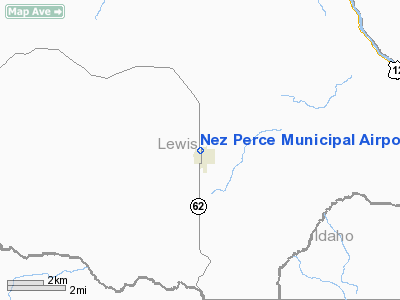
Location
& QuickFacts
|
FAA
Information Effective: |
2007-07-05 |
|
Airport
Identifier: |
0S5 |
|
Airport
Status: |
Operational |
|
Longitude/Latitude: |
116-14-33.5110W/46-14-14.6090N
-116.242642/46.237391 (Estimated) |
|
Elevation: |
3201 ft / 975.66 m (Estimated) |
|
Land: |
11 acres |
|
From
nearest city: |
0
nautical miles NE of Nez Perce, ID |
|
Location: |
Lewis
County, ID |
|
Magnetic
Variation: |
18E
(1985) |
Owner
& Manager
|
Ownership: |
Publicly
owned |
|
Owner: |
City Of Nez Perce |
|
Address: |
Po Box 36
Nez Perce, ID 83543 |
|
Phone
number: |
208-937-2454
OR 208-937-2652. |
|
Manager: |
Gary Doggett |
|
Address: |
Po Box 396
Nez Perce, ID 83543 |
|
Phone
number: |
208-937-2474 |
Airport
Operations and Facilities
|
Airport
Use: |
Open
to public |
|
Wind
indicator: |
Yes |
|
Segmented Circle: |
No |
|
Control
Tower: |
No |
|
Landing
fee charge: |
No |
|
Sectional chart: |
Great Falls |
|
Region: |
ANM - Northwest Mountain |
|
Boundary
ARTCC: |
ZSE - Seattle |
|
Tie-in
FSS: |
BOI - Boise |
|
FSS
on Airport: |
No |
|
FSS
Phone: |
208-332-0200 |
|
FSS
Toll Free: |
1-800-WX-BRIEF |
|
NOTAMs
Facility: |
BOI (NOTAM-d service avaliable) |
Airport
Communications
Airport
Services
|
Airframe
Repair: |
NONE |
|
Power
Plant Repair: |
NONE |
|
Bottled
Oxygen: |
NONE |
|
Bulk
Oxygen: |
NONE |
|
Runway Information
Runway 15/33
|
Dimension: |
2400
x 30 ft / 731.5 x 9.1 m |
|
Surface: |
ASPH, Good Condition |
|
|
Runway 15 |
Runway 33 |
|
Traffic
Pattern: |
Left |
Left |
|
Markings: |
Nonstandard, Good Condition
SOLID 10" LINE |
Nonstandard, Good Condition
SOLID 10" LINE |
|
Obstruction: |
80 ft hill, 1000.0 ft from runway, 10:1 slope
to clear
+3 FT SIGN AT 50 FT 20 FT L&R; +2 FT BRIDGE ABUTMENTS
AT 60 FT 20 FT L&R. |
40 ft pline, 475.0 ft from runway, 6:1 slope
to clear
RWY 33 RY 33 +18 FT ROAD AT 35 FT ON CNTRLN; +10 FT SIGN AT
55',63L; +6'FENCE AT 15'ON CNTRLN. |
|
Radio Navigation
Aids
|
ID |
Type |
Name |
Ch |
Freq |
Var |
Dist |
|
GVV |
NDB |
Grain |
|
280.00 |
18E |
17.9 nm |
|
MQG |
VOR/DME |
Nez Perce |
019X |
108.20 |
20E |
27.4 nm |
|
PUW |
VOR/DME |
Pullman |
027X |
109.00 |
20E |
48.4 nm |
Remarks
- CONSIDERABLE
AGRICULTURAL OPNS DURING GROWING SEASON.
- 55
FT AGL UNMKD/UNLGTD STEEL GRAIN TWR 1350 FT S OF RY 33 116 FT L OF EXTDD
CNTRLN.
- ESTABD
PRIOR TO 5/15/59.
Based
Aircraft
|
Aircraft
based on field: |
2 |
|
Single
Engine Airplanes: |
2 |
Operational Statistics
Time Period: 2005-05-13
- 2006-05-12
|
Aircraft
Operations: |
49/Week |
|
General
Aviation Local: |
80.0% |
|
General
Aviation Itinerant: |
20.0% |
Nez Perce Municipal Airport
Address:
Lewis County, ID
Tel:
208-937-2454,
208-937-2652,
208-937-2474
Images
and information placed above are from
http://www.airport-data.com/airport/0S5/
We
thank them for the data!
| General
Info |
| Country |
United
States |
| State |
IDAHO
|
| FAA ID |
0S5 |
| Latitude |
46-14-14.609N
|
| Longitude |
116-14-33.511W
|
| Elevation |
3201 feet
|
| Near City |
NEZ PERCE
|
We don't guarantee the information is fresh and accurate. The data may
be wrong or outdated.
For more up-to-date information please refer to other sources.
|
|


