 |
|
|
|
|
|
Location
& QuickFacts
|
FAA
Information Effective: |
2007-07-05 |
|
Airport
Identifier: |
ID83 |
|
Airport
Status: |
Operational |
|
Longitude/Latitude: |
116-34-00.4640W/43-33-07.5810N
-116.566796/43.552106 (Estimated) |
|
Elevation: |
2535 ft / 772.67 m (Estimated) |
|
Land: |
0 acres |
|
From
nearest city: |
2 nautical miles S of Nampa, ID |
|
Location: |
Canyon County, ID |
|
Magnetic
Variation: |
17E (1985) |
Owner
& Manager
|
Ownership: |
Privately
owned |
|
Owner: |
Mercy Medical Center |
|
Address: |
1512 12th Ave Rd
Nampa, ID 83686 |
|
Phone
number: |
208-467-1171 |
|
Manager: |
Joe Messmer |
|
Address: |
1512 12th Ave Rd
Nampa, ID 83686-6000 |
|
Phone
number: |
208-467-1171 |
Airport
Operations and Facilities
|
Airport Use: |
Private
MEDICAL USE. |
|
Wind
indicator: |
Yes |
|
Segmented
Circle: |
No |
|
Control
Tower: |
No |
|
Landing
fee charge: |
No |
|
Sectional
chart: |
Salt Lake City |
|
Region: |
ANM - Northwest Mountain |
|
Boundary
ARTCC: |
ZLC - Salt Lake City |
|
Tie-in
FSS: |
BOI - Boise |
|
FSS
on Airport: |
No |
|
FSS
Phone: |
208-332-0200 |
|
FSS
Toll Free: |
1-800-WX-BRIEF |
Airport
Services
|
Fuel
available: |
80 |
|
Airframe
Repair: |
NONE |
|
Power
Plant Repair: |
NONE |
|
Runway Information
Helipad H1
|
Dimension: |
40
x 40 ft / 12.2 x 12.2 m |
|
Surface: |
CONC, |
|
|
Runway H1 |
Runway |
|
Traffic
Pattern: |
Left |
Left |
|
Radio Navigation
Aids
|
ID |
Type |
Name |
Ch |
Freq |
Var |
Dist |
|
MPA |
NDB |
Meridian |
|
238.00 |
16E |
3.3 nm |
|
BO |
NDB |
Ustik |
|
359.00 |
17E |
11.3 nm |
|
ONO |
NDB |
Ontario |
|
305.00 |
17E |
34.0 nm |
|
STI |
NDB |
Sturgeon |
|
333.00 |
17E |
47.7 nm |
|
MUO |
TACAN |
Mountain Home |
087X |
|
18E |
43.2 nm |
|
LIA |
VOR |
Liberator |
|
114.90 |
18E |
48.7 nm |
|
BOI |
VORTAC |
Boise |
080X |
113.30 |
17E |
16.3 nm |
|
BOI |
VOT |
Boise |
|
116.70 |
|
14.7 nm |
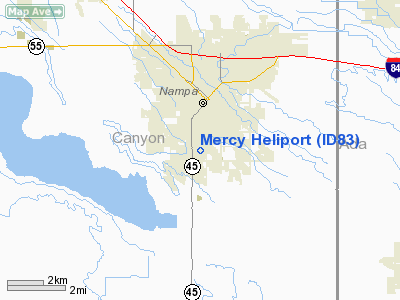
Mercy Heliport
Address:
Canyon County, ID
Tel:
208-467-1171
Images
and information placed above are from
http://www.airport-data.com/airport/ID83/
We
thank them for the data!
| General
Info |
| Country |
United
States |
| State |
IDAHO
|
| FAA ID |
ID83 |
| Latitude |
43-33-07.581N
|
| Longitude |
116-34-00.464W
|
| Elevation |
2535 feet
|
| Near City |
NAMPA
|
We don't guarantee the information is fresh and accurate. The data may
be wrong or outdated.
For more up-to-date information please refer to other sources.
|
|


