 |
|
|
|
|
|
Location
& QuickFacts
|
FAA
Information Effective: |
2007-07-05 |
|
Airport
Identifier: |
U02 |
|
Airport
Status: |
Operational |
|
Longitude/Latitude: |
112-20-58.5100W/43-12-33.3000N
-112.349586/43.209250 (Estimated) |
|
Elevation: |
4488 ft / 1367.94 m (Surveyed) |
|
Land: |
80 acres |
|
From
nearest city: |
1 nautical miles N of Blackfoot, ID |
|
Location: |
Bingham County, ID |
|
Magnetic
Variation: |
15E (2000) |
Owner
& Manager
|
Ownership: |
Publicly
owned |
|
Owner: |
City Of Blackfoot |
|
Address: |
157 North Broadway
Blackfoot, ID 83221 |
|
Phone
number: |
208-785-8600 |
|
Manager: |
Max Gibson |
|
Address: |
Box 858
Blackfoot, ID 83221 |
|
Phone
number: |
208-785-2727 |
Airport
Operations and Facilities
|
Airport
Use: |
Open
to public |
|
Wind
indicator: |
Yes |
|
Segmented Circle: |
Yes |
|
Control
Tower: |
No |
|
Lighting
Schedule: |
DUSK-DAWN |
|
Beacon
Color: |
Clear-Green (lighted land airport) |
|
Landing
fee charge: |
No |
|
Sectional chart: |
Salt Lake City |
|
Region: |
ANM - Northwest Mountain |
|
Boundary
ARTCC: |
ZLC - Salt Lake City |
|
Tie-in
FSS: |
BOI - Boise |
|
FSS
on Airport: |
No |
|
FSS
Phone: |
208-332-0200 |
|
FSS
Toll Free: |
1-800-WX-BRIEF |
|
NOTAMs
Facility: |
BOI (NOTAM-d service avaliable) |
|
Federal
Agreements: |
NGSY |
Airport
Communications
|
CTAF: |
122.800 |
|
Unicom: |
122.800
|
Airport
Services
|
Fuel
available: |
100LLA |
|
Airframe
Repair: |
MAJOR |
|
Power
Plant Repair: |
MAJOR |
|
Bottled
Oxygen: |
NONE |
|
Bulk
Oxygen: |
NONE |
|
Runway Information
Runway 01/19
|
Dimension: |
4314
x 75 ft / 1314.9 x 22.9 m |
|
Surface: |
ASPH, Good Condition |
|
Weight
Limit: |
Single wheel: 12500 lbs. |
|
Edge
Lights: |
Medium |
|
|
Runway 01 |
Runway 19 |
|
Longitude: |
112-21-10.3180W |
112-20-46.7010W |
|
Latitude: |
43-12-13.8270N |
43-12-52.7780N |
|
Elevation: |
4481.00 ft |
4488.00 ft |
|
Alignment: |
24 |
127 |
|
Traffic
Pattern: |
Left |
Left |
|
Markings: |
Basic, Fair Condition |
Basic, Fair Condition |
|
Crossing
Height: |
40.00 ft |
37.00 ft |
|
VASI: |
2-light PAPI on left side |
2-light PAPI on left side |
|
Visual
Glide Angle: |
3.00° |
3.00° |
|
Obstruction: |
4 ft fence, 200.0 ft from runway, 85 ft left
of centerline
RWY 01 HAS +4 FT FENCE AT 0 FT 85 FT L |
30 ft tree, 700.0 ft from runway, 16:1 slope
to clear |
|
Radio Navigation
Aids
|
ID |
Type |
Name |
Ch |
Freq |
Var |
Dist |
|
SWU |
NDB |
Sweden |
|
350.00 |
15E |
15.7 nm |
|
AOC |
NDB |
Arco |
|
200.00 |
15E |
49.3 nm |
|
IDA |
VOR/DME |
Idaho Falls |
85Y |
113.85 |
15E |
22.4 nm |
|
PIH |
VORTAC |
Pocatello |
073X |
112.60 |
17E |
24.3 nm |
Remarks
- CONSIDERABLE
AG OPERATIONS DURING GROWING SEASON.
- RY
01 ADDITIONAL OBSTN +35 FT POLE 550 FT 150 FT L.
- ESTABD
PRIOR TO 15 MAY 1959.
Based
Aircraft
|
Aircraft
based on field: |
64 |
|
Single
Engine Airplanes: |
57 |
|
Multi
Engine Airplanes: |
4 |
|
Jet
Engine Airplanes: |
1 |
|
Ultralights: |
2 |
Operational Statistics
Time Period: 2005-09-23
- 2006-09-22
|
Aircraft
Operations: |
60/Day |
|
Air
Taxi: |
5.1% |
|
General
Aviation Local: |
57.9% |
|
General
Aviation Itinerant: |
37.0% |
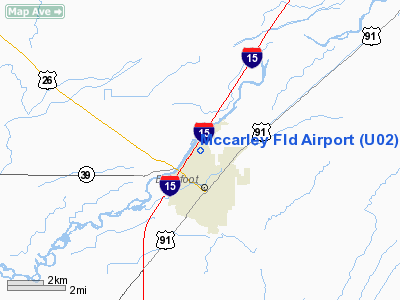
Mccarley Field Airport
Address:
Bingham County, ID
Tel:
208-785-8600,
208-785-2727
Images
and information placed above are from
http://www.airport-data.com/airport/U02/
We
thank them for the data!
| General
Info |
| Country |
United
States |
| State |
IDAHO
|
| FAA ID |
U02 |
| Latitude |
43-12-33.300N
|
| Longitude |
112-20-58.510W
|
| Elevation |
4488 feet
|
| Near City |
BLACKFOOT
|
We don't guarantee the information is fresh and accurate. The data may
be wrong or outdated.
For more up-to-date information please refer to other sources.
|
|


