 |
|
|
|
|
|
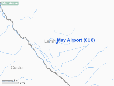
Location
& QuickFacts
|
FAA
Information Effective: |
2007-07-05 |
|
Airport
Identifier: |
0U8 |
|
Airport
Status: |
Operational |
|
Longitude/Latitude: |
113-53-45.1880W/44-36-36.7300N
-113.895886/44.610203 (Estimated) |
|
Elevation: |
5324 ft / 1622.76 m (Estimated) |
|
Land: |
25 acres |
|
From
nearest city: |
1 nautical miles NE of May, ID |
|
Location: |
Lemhi County, ID |
|
Magnetic Variation: |
17E (1985) |
Owner
& Manager
|
Ownership: |
Publicly
owned |
|
Owner: |
State Of Id, Itd Div Aero |
|
Address: |
P.o. Box 7129
Boise, ID 83707-1129 |
|
Phone
number: |
208-334-8775 |
|
Manager: |
Div Admin |
|
Address: |
P.o. Box 7129
Boise, ID 83707-1129 |
|
Phone number: |
208-334-8775 |
Airport Operations and Facilities
|
Airport
Use: |
Open
to public |
|
Wind
indicator: |
Yes |
|
Segmented Circle: |
Yes |
|
Control
Tower: |
No |
|
Landing
fee charge: |
No |
|
Sectional chart: |
Great Falls |
|
Region: |
ANM - Northwest Mountain |
|
Boundary
ARTCC: |
ZLC - Salt Lake City |
|
Tie-in
FSS: |
BOI - Boise |
|
FSS
on Airport: |
No |
|
FSS
Phone: |
208-332-0200 |
|
FSS
Toll Free: |
1-800-WX-BRIEF |
|
NOTAMs
Facility: |
BOI (NOTAM-d service avaliable) |
Airport Communications
Airport Services
|
Airframe
Repair: |
NONE |
|
Power
Plant Repair: |
NONE |
|
Bottled
Oxygen: |
NONE |
|
Bulk
Oxygen: |
NONE |
|
Runway Information
Runway 09/27
|
Dimension: |
4950
x 200 ft / 1508.8 x 61.0 m |
|
Surface: |
TURF, Good Condition |
|
|
Runway 09 |
Runway 27 |
|
Traffic
Pattern: |
Left |
Left |
|
Obstruction: |
40 ft pole, 500.0 ft from runway, 125 ft left
of centerline, 12:1 slope to clear |
4 ft fence, 0.0 ft from runway, 110 ft left
of centerline |
|
Radio Navigation
Aids
|
ID |
Type |
Name |
Ch |
Freq |
Var |
Dist |
|
LLJ |
NDB |
Challis |
|
397.00 |
17E |
14.7 nm |
|
LKT |
VOR/DME |
Salmon |
082X |
113.50 |
18E |
26.0 nm |
Remarks
- NO
WINTER MAINT.
- -2
FT DITCH ADJACENT TO BOTH EDGES OF RY & THRS.
- ARPT
LCTD IN HIGH MTN VALLEY SURROUNDED BY HIGH TERRAIN.
- RECOMMEND
LANDING RY 09; TKOFF RY 27 WHEN WIND CONDITIONS PERMIT.
- ARPT
SUBJECT TO CONTINUOUS DAMAGE BY GROUND VEHICLES; LIVESTOCK & RODENTS.
- FENCE
MARKERS LOCATED ON APPROACH END OF RY 27.
- ESTABD
PRIOR TO 15 MAY 1959.
Operational
Statistics
Time Period: 2005-05-23
- 2006-05-22
|
Aircraft
Operations: |
20/Week |
|
Air
Taxi: |
10.0% |
|
General
Aviation Itinerant: |
90.0% |
May Airport
Address:
Lemhi County, ID
Tel:
208-334-8775
Images
and information placed above are from
http://www.airport-data.com/airport/0U8/
We
thank them for the data!
| General
Info |
| Country |
United
States |
| State |
IDAHO
|
| FAA ID |
0U8 |
| Latitude |
44-36-36.730N
|
| Longitude |
113-53-45.188W
|
| Elevation |
5324 feet
|
| Near City |
MAY |
We don't guarantee the information is fresh and accurate. The data may
be wrong or outdated.
For more up-to-date information please refer to other sources.
|
|


