 |
|
|
|
|
|
Location
& QuickFacts
|
FAA
Information Effective: |
2007-07-05 |
|
Airport
Identifier: |
MLD |
|
Airport
Status: |
Operational |
|
Longitude/Latitude: |
112-17-47.8780W/42-09-59.7140N
-112.296633/42.166587 (Estimated) |
|
Elevation: |
4503 ft / 1372.51 m (Estimated) |
|
Land: |
188 acres |
|
From
nearest city: |
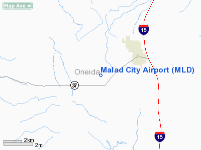
3 nautical miles SW of Malad City, ID |
|
Location: |
Oneida County, ID |
|
Magnetic Variation: |
15E (1985) |
Owner
& Manager
|
Ownership: |
Publicly
owned |
|
Owner: |
Oneida County |
|
Address: |
10 Court Street
Malad City, ID 83252 |
|
Phone
number: |
208-766-4116 |
|
Manager: |
Brent Romerell |
|
Address: |
771 N 500 W
Malad City, ID 83252 |
|
Phone number: |
208-766-4988 |
Airport Operations and Facilities
|
Airport
Use: |
Open
to public |
|
Wind
indicator: |
Yes |
|
Segmented Circle: |
Yes |
|
Control
Tower: |
No |
|
Lighting
Schedule: |
DUSK-DAWN
ACTVT MIRL RY 16/34 - CTAF. |
|
Beacon
Color: |
Clear-Green (lighted land airport) |
|
Landing
fee charge: |
No |
|
Sectional chart: |
Salt Lake City |
|
Region: |
ANM - Northwest Mountain |
|
Boundary
ARTCC: |
ZLC - Salt Lake City |
|
Tie-in
FSS: |
BOI - Boise |
|
FSS
on Airport: |
No |
|
FSS
Phone: |
208-332-0200 |
|
FSS
Toll Free: |
1-800-WX-BRIEF |
|
NOTAMs
Facility: |
MLD (NOTAM-d service avaliable) |
Airport Communications
Airport Services
|
Airframe
Repair: |
NONE |
|
Power
Plant Repair: |
NONE |
|
Bottled
Oxygen: |
NONE |
|
Bulk
Oxygen: |
NONE |
|
Runway Information
Runway 16/34
|
Dimension: |
4950 x 60 ft / 1508.8 x 18.3 m
ASPH PAVEMENT IS 60' WIDE, 45' WIDE ASPHALT-TREATED SHOULDERS ON
EACH SIDE OF PAVEMENT. |
|
Surface: |
ASPH, Fair Condition |
|
Edge
Lights: |
Medium |
|
|
Runway 16 |
Runway 34 |
|
Traffic
Pattern: |
Left |
Left |
|
Markings: |
Nonstandard, Poor Condition
RWY 16 MARKINGS BADLY FADED. |
Nonstandard, Poor Condition
RWY 34 MARKINGS BADLY FADED. |
|
Displaced
threshold: |
150.00 ft |
210.00 ft |
|
Obstruction: |
20 ft sprinkler, 900.0 ft from runway, 35:1
slope to clear
ROAD IS 19;1 FM DSPLCD THR.
+3' FENCE AT 100' AND 180' ON CNTRLN; 15' ROAD AT 140' ON
CNTRLN. |
45 ft pline, 2000.0 ft from runway, 40:1 slope
to clear
ROAD IS 19:1 FM DSPLCD THR.
+4' FENCE AT 60' ON CNTRLN; 15' ROAD AT 80' ON CNTRLN. |
|
Radio Navigation
Aids
|
ID |
Type |
Name |
Ch |
Freq |
Var |
Dist |
|
BMC |
NDB |
Brigham City |
|
294.00 |
16E |
40.3 nm |
|
MLD |
VOR/DME |
Malad City |
121X |
117.40 |
17E |
7.2 nm |
|
LHO |
VOR/DME |
Brigham City |
076X |
112.90 |
14E |
25.9 nm |
|
LGU |
VOR/DME |
Logan |
035X |
109.80 |
16E |
27.3 nm |
|
PIH |
VORTAC |
Pocatello |
073X |
112.60 |
17E |
45.1 nm |
Remarks
- AREAS
OFF PRIMARY RWY SURFACES NOT MAINTAINED.
- REFLECTORS
ON TWY AND RAMP.
- ESTABD
PRIOR TO 15 MAY 1959.
Based
Aircraft
|
Aircraft
based on field: |
5 |
|
Single
Engine Airplanes: |
5 |
Operational Statistics
Time Period: 2005-04-29
- 2006-04-28
|
Aircraft
Operations: |
86/Week |
|
General
Aviation Local: |
4.5% |
|
General
Aviation Itinerant: |
94.4% |
|
Military: |
1.1% |
Malad City Airport
Address:
Oneida County, ID
Tel:
208-766-4116,
208-766-4988
Images
and information placed above are from
http://www.airport-data.com/airport/MLD/
We
thank them for the data!
| General
Info |
| Country |
United
States |
| State |
IDAHO
|
| FAA ID |
MLD |
| Latitude |
42-09-59.714N
|
| Longitude |
112-17-47.878W
|
| Elevation |
4503 feet
|
| Near City |
MALAD
CITY |
We don't guarantee the information is fresh and accurate. The data may
be wrong or outdated.
For more up-to-date information please refer to other sources.
|
|


