 |
|
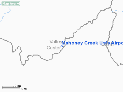
Mahoney Creek U.S. Forest Service Airport |
|
|
Location
& QuickFacts
|
FAA
Information Effective: |
2007-07-05 |
|
Airport
Identifier: |
0U3 |
|
Airport
Status: |
Operational |
|
Longitude/Latitude: |
114-55-17.3410W/44-44-40.6780N
-114.921484/44.744633 (Estimated) |
|
Elevation: |
4618 ft / 1407.57 m (Surveyed) |
|
Land: |
10 acres |
|
From
nearest city: |
2 nautical miles SE of Mahoney Creek, ID |
|
Location: |
Valley County, ID |
|
Magnetic Variation: |
17E (1985) |
Owner
& Manager
|
Ownership: |
Publicly
owned |
|
Owner: |
U S Forest Service |
|
Address: |
324 25th St
Ogden, UT 84401 |
|
Phone
number: |
801-625-5511 |
|
Manager: |
Middle Fork Dist Ranger |
|
Address: |
Po Box 750, Hwy 93
Challis, ID 83226 |
|
Phone number: |
208-879-4101 |
Airport Operations and Facilities
|
Airport
Use: |
Open
to public |
|
Wind
indicator: |
Yes |
|
Segmented Circle: |
Yes |
|
Control
Tower: |
No |
|
Landing
fee charge: |
No |
|
Sectional chart: |
Great Falls |
|
Region: |
ANM - Northwest Mountain |
|
Boundary
ARTCC: |
ZLC - Salt Lake City |
|
Tie-in
FSS: |
BOI - Boise |
|
FSS
on Airport: |
No |
|
FSS
Phone: |
208-332-0200 |
|
FSS
Toll Free: |
1-800-WX-BRIEF |
|
NOTAMs
Facility: |
BOI (NOTAM-d service avaliable) |
Airport Communications
Airport Services
|
Airframe
Repair: |
NONE |
|
Power
Plant Repair: |
NONE |
|
Bottled
Oxygen: |
NONE |
|
Bulk
Oxygen: |
NONE |
|
Runway Information
Runway 03/21
|
Dimension: |
2150
x 15 ft / 655.3 x 4.6 m |
|
Surface: |
DIRT, Fair Condition |
|
|
Runway 03 |
Runway 21 |
|
Traffic
Pattern: |
Left |
Left |
|
Obstruction: |
6 ft berm, 70 ft left of centerline |
285 ft hill, 1900.0 ft from runway, 200 ft
left of centerline, 6:1 slope to clear |
|
Radio Navigation
Aids
|
ID |
Type |
Name |
Ch |
Freq |
Var |
Dist |
|
LLJ |
NDB |
Challis |
|
397.00 |
17E |
33.1 nm |
|
LKT |
VOR/DME |
Salmon |
082X |
113.50 |
18E |
39.3 nm |
Remarks
- NO
WINTER MAINTENANCE.
- RECOMMEND
LNDG RWY 21; TKOF RWY 03 WHEN WIND CONDITIONS ALLOW.
- -1'
DITCH LCTD 20' FM CNTRLN BOTH SIDES OF RY.
- FIRST
500 FT OF RY 21 HAS -1.5 FT TO -2 FT DEEP HOLES.
- ESTABD
PRIOR TO 12/31/58.
Operational Statistics
Time Period: 2004-03-12
- 2005-03-11
|
Aircraft
Operations: |
25/Week |
|
Air
Taxi: |
60.0% |
|
General
Aviation Itinerant: |
40.0% |
Mahoney Creek U S Forest Service Airport
Address:
Valley County, ID
Tel:
801-625-5511,
208-879-4101
Images
and information placed above are from
http://www.airport-data.com/airport/0U3/
We
thank them for the data!
| General
Info |
| Country |
United
States |
| State |
IDAHO
|
| FAA ID |
0U3 |
| Latitude |
44-44-40.678N
|
| Longitude |
114-55-17.341W
|
| Elevation |
4618 feet
|
| Near City |
MAHONEY
CREEK |
We don't guarantee the information is fresh and accurate. The data may
be wrong or outdated.
For more up-to-date information please refer to other sources.
|
|


