 |
|
|
|
|
|
Location
& QuickFacts
|
FAA
Information Effective: |
2007-07-05 |
|
Airport
Identifier: |
U93 |
|
Airport
Status: |
Operational |
|
Longitude/Latitude: |
114-23-43.1670W/43-16-56.6530N
-114.395324/43.282404 (Estimated) |
|
Elevation: |
4844 ft / 1476.45 m (Surveyed) |
|
Land: |
20 acres |
|
From
nearest city: |
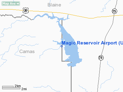
15 nautical miles SW of Hailey, ID |
|
Location: |
Camas County, ID |
|
Magnetic Variation: |
16E (1985) |
Owner
& Manager
|
Ownership: |
Publicly
owned |
|
Owner: |
State Of Id,itd Div Aero |
|
Address: |
P O Box 7129
Boise, ID 83707-1129 |
|
Phone
number: |
208-334-8775 |
|
Manager: |
Div Admin |
|
Address: |
P O Box 7129
Boise, ID 83707-1129 |
|
Phone number: |
208-334-8775 |
Airport Operations and Facilities
|
Airport
Use: |
Open
to public |
|
Wind
indicator: |
Yes |
|
Segmented Circle: |
Yes |
|
Control
Tower: |
No |
|
Landing
fee charge: |
No |
|
Sectional chart: |
Salt Lake City |
|
Region: |
ANM - Northwest Mountain |
|
Boundary
ARTCC: |
ZLC - Salt Lake City |
|
Tie-in
FSS: |
BOI - Boise |
|
FSS
on Airport: |
No |
|
FSS
Phone: |
208-332-0200 |
|
FSS
Toll Free: |
1-800-WX-BRIEF |
|
NOTAMs
Facility: |
BOI (NOTAM-d service avaliable) |
Airport Communications
Airport Services
|
Airframe
Repair: |
NONE |
|
Power
Plant Repair: |
NONE |
|
Bottled
Oxygen: |
NONE |
|
Bulk
Oxygen: |
NONE |
|
Runway Information
Runway 03/21
|
Dimension: |
4000
x 100 ft / 1219.2 x 30.5 m |
|
Surface: |
TURFRVL, Good Condition |
|
|
Runway 03 |
Runway 21 |
|
Traffic
Pattern: |
Left |
Left |
|
Obstruction: |
4 ft fence, 60 ft right of centerline |
4 ft fence, 0.0 ft from runway, 110 ft right
of centerline |
|
Runway 09/27
|
Dimension: |
1750
x 100 ft / 533.4 x 30.5 m |
|
Surface: |
TURF, Fair Condition |
|
|
Runway 09 |
Runway 27 |
|
Traffic
Pattern: |
Left |
Left |
|
Obstruction: |
4 ft fence |
45 ft trees, 360.0 ft from runway, 8:1 slope
to clear |
|
Radio Navigation
Aids
|
ID |
Type |
Name |
Ch |
Freq |
Var |
Dist |
|
HDG |
NDB |
Steelhead |
|
211.00 |
16E |
25.2 nm |
|
AOC |
NDB |
Arco |
|
200.00 |
15E |
49.7 nm |
|
HLE |
NDB/DME |
Hailey |
025X |
220.00 |
16E |
7.2 nm |
|
BYI |
VOR/DME |
Burley |
088X |
114.10 |
18E |
48.2 nm |
|
TWF |
VORTAC |
Twin Falls |
105X |
115.80 |
18E |
48.4 nm |
Remarks
- NO
WINTER MAINTENANCE.
- WHEN
WIND CONDS ALLOW; LAND RY 03 OR RY 09; TKOF RY 21 OR RY 27 TO AVOID
FLYING OVER RESORT AREA.
- RWY
09/27 NO LINE OF SIGHT BTN RWY ENDS.
- NO
TELEPHONE AVBL AT ARPT.
- ESTABD
PRIOR TO 1959.
Operational
Statistics
Time Period: 2004-11-17
- 2005-11-16
|
Aircraft
Operations: |
29/Week |
|
General
Aviation Itinerant: |
100.0% |
Magic Reservoir Airport
Address:
Camas County, ID
Tel:
208-334-8775
Images
and information placed above are from
http://www.airport-data.com/airport/U93/
We
thank them for the data!
| General
Info |
| Country |
United
States |
| State |
IDAHO
|
| FAA ID |
U93 |
| Latitude |
43-16-56.653N
|
| Longitude |
114-23-43.167W
|
| Elevation |
4844 feet
|
| Near City |
HAILEY
|
We don't guarantee the information is fresh and accurate. The data may
be wrong or outdated.
For more up-to-date information please refer to other sources.
|
|


