 |
|
|
|
|
|
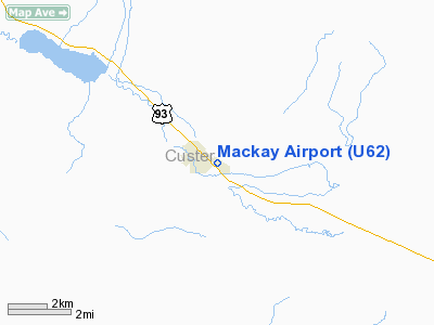
Location
& QuickFacts
|
FAA
Information Effective: |
2007-07-05 |
|
Airport
Identifier: |
U62 |
|
Airport
Status: |
Operational |
|
Longitude/Latitude: |
113-36-08.5200W/43-54-36.0300N
-113.602367/43.910008 (Estimated) |
|
Elevation: |
5892 ft / 1795.88 m (Estimated) |
|
Land: |
51 acres |
|
From
nearest city: |
1 nautical miles SE of Mackay, ID |
|
Location: |
Custer County, ID |
|
Magnetic Variation: |
16E (1985) |
Owner & Manager
|
Ownership: |
Publicly owned |
|
Owner: |
City Of Mackay |
|
Address: |
Po Box 509
Mackay, ID 83251 |
|
Phone number: |
208-588-2274 |
|
Manager: |
Ken Day |
|
Address: |
Po Box 509
Mackay, ID 83251 |
|
Phone number: |
208-588-2274 |
Airport
Operations and Facilities
|
Airport
Use: |
Open
to public |
|
Wind
indicator: |
Yes |
|
Segmented Circle: |
Yes |
|
Control
Tower: |
No |
|
Landing
fee charge: |
No |
|
Sectional chart: |
Salt Lake City |
|
Region: |
ANM - Northwest Mountain |
|
Boundary
ARTCC: |
ZLC - Salt Lake City |
|
Tie-in
FSS: |
BOI - Boise |
|
FSS
on Airport: |
No |
|
FSS
Phone: |
208-332-0200 |
|
FSS
Toll Free: |
1-800-WX-BRIEF |
|
NOTAMs
Facility: |
BOI (NOTAM-d service avaliable) |
|
Federal Agreements: |
1 |
Airport Communications
Airport Services
|
Airframe
Repair: |
NONE |
|
Power
Plant Repair: |
NONE |
|
Bottled
Oxygen: |
NONE |
|
Bulk
Oxygen: |
NONE |
|
Runway Information
Runway 12/30
|
Dimension: |
4389
x 60 ft / 1337.8 x 18.3 m |
|
Surface: |
ASPH, Good Condition |
|
|
Runway 12 |
Runway 30 |
|
Longitude: |
113-36-30.1200W |
113-35-46.9200W |
|
Latitude: |
43-54-51.0600N |
43-54-21.0000N |
|
Elevation: |
5892.00 ft |
5863.00 ft |
|
Traffic
Pattern: |
Left |
Left |
|
Markings: |
Basic, Good Condition |
Basic, Good Condition |
|
Obstruction: |
35 ft pline, 200.0 ft from runway, 115 ft left
of centerline
+35 FT PLINE AT 0 FT 115 FT L. |
35 ft tree, 375.0 ft from runway, 5:1 slope
to clear |
|
Helipad H1
|
Dimension: |
50
x 50 ft / 15.2 x 15.2 m |
|
Surface: |
ASPH, Good Condition |
|
|
Runway H1 |
Runway |
|
Traffic
Pattern: |
Left |
Left |
|
Markings: |
None, |
, |
|
Radio Navigation
Aids
|
ID |
Type |
Name |
Ch |
Freq |
Var |
Dist |
|
AOC |
NDB |
Arco |
|
200.00 |
15E |
21.8 nm |
|
LLJ |
NDB |
Challis |
|
397.00 |
17E |
45.2 nm |
|
HLE |
NDB/DME |
Hailey |
025X |
220.00 |
16E |
44.7 nm |
Remarks
- RY
12 HAS +35 FT PLINE MKD AT 1350 FT ON CNTRLN.
- RECOMMEND
LAND RY 30; DEPART RY 12, WHEN WINDS PERMIT.
Based
Aircraft
|
Aircraft
based on field: |
2 |
|
Single
Engine Airplanes: |
2 |
Operational Statistics
Time Period: 2004-04-15
- 2005-04-14
|
Aircraft
Operations: |
33/Week |
|
General
Aviation Local: |
11.8% |
|
General
Aviation Itinerant: |
88.2% |
Mackay Airport
Address:
Custer County, ID
Tel:
208-588-2274
Images
and information placed above are from
http://www.airport-data.com/airport/U62/
We
thank them for the data!
| General
Info |
| Country |
United
States |
| State |
IDAHO
|
| FAA ID |
U62 |
| Latitude |
43-54-14.666N
|
| Longitude |
113-36-03.076W
|
| Elevation |
5891 feet
|
| Near City |
MACKAY
|
We don't guarantee the information is fresh and accurate. The data may
be wrong or outdated.
For more up-to-date information please refer to other sources.
|
|


