|
|
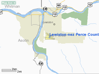
Lewiston - Nez Perce County Airport |
| Lewiston-Nez Perce County Airport |
 |
| IATA: LWS â ICAO: KLWS |
| Summary |
| Airport type |
Public |
| Operator |
City of Lewiston &
Nez Perce County]] |
| Location |
Lewiston, Idaho |
| Elevation AMSL |
1,438 ft / 438.3 m |
| Coordinates |
46°22â²28.19â³N 117°00â²55.42â³W / 46.3744972°N 117.0153944°W / 46.3744972; -117.0153944Coordinates: 46°22â²28.19â³N 117°00â²55.42â³W / 46.3744972°N 117.0153944°W / 46.3744972; -117.0153944 |
| Runways |
| Direction |
Length |
Surface |
| ft |
m |
| 8/26 |
6,511 |
1,985 |
Asphalt |
| 11/29 |
5,002 |
1,525 |
Asphalt |
Lewiston-Nez Perce County Airport (IATA: LWS, ICAO: KLWS) is a public airport located in the southern part of the city of Lewiston, in Nez Perce County, Idaho, USA. The airport has two runways.
See also
Airlines and destinations
| Airlines |
Destinations |
| Horizon Air |
Boise, Pullman, Seattle/Tacoma |
| Delta Connection operated by SkyWest Airlines |
Salt Lake City |
The above content comes from Wikipedia and is published under free licenses – click here to read more.
Location
& QuickFacts
|
FAA
Information Effective: |
2007-07-05 |
|
Airport
Identifier: |
LWS |
|
Airport
Status: |
Operational |
|
Longitude/Latitude: |
117-00-55.4000W/46-22-28.2000N
-117.015389/46.374500 (Estimated) |
|
Elevation: |
1442 ft / 439.52 m (Estimated) |
|
Land: |
865 acres |
|
From
nearest city: |
2 nautical miles S of Lewiston, ID |
|
Location: |
Nez Perce County, ID |
|
Magnetic Variation: |
20E (1975) |
Owner
& Manager
|
Ownership: |
Publicly
owned |
|
Owner: |
City Of Lewiston/nez Perce County |
|
Address: |
Lewiston-nez Perce County Arpt, 406 Burrell
Suite 301
Lewiston, ID 83501 |
|
Phone
number: |
208-746-7962 |
|
Manager: |
Robin Turner |
|
Address: |
Lewiston-nez Perce County Arpt, 406 Burrell
Suite 301
Lewiston, ID 83501 |
|
Phone number: |
208-746-7962 |
Airport Operations and Facilities
|
Airport
Use: |
Open
to public |
|
Wind
indicator: |
Yes |
|
Segmented Circle: |
Yes |
|
Control
Tower: |
Yes |
|
Lighting
Schedule: |
DUSK-DAWN
WHEN ATCT CLSD ACTVT MALSR RY 26; REIL RYS 08 & 11 -
CTAF. |
|
Beacon
Color: |
Clear-Green (lighted land airport) |
|
Landing
fee charge: |
No |
|
Sectional chart: |
Seattle |
|
Region: |
ANM - Northwest Mountain |
|
Boundary
ARTCC: |
ZSE - Seattle |
|
Tie-in
FSS: |
BOI - Boise |
|
FSS
on Airport: |
No |
|
FSS
Phone: |
208-332-0200 |
|
FSS
Toll Free: |
1-800-WX-BRIEF |
|
NOTAMs
Facility: |
LWS (NOTAM-d service avaliable) |
|
Certification type/date: |
I A S 05/1973
CLSD TO UNSKED ACR OPNS WITH MORE THAN 30 PSGR SEATS 0700-1700
EXCP PPR CALL AMGR 208-746-7962 OTHER TIMES CALL STATION
NO 4 208-743-0172. |
|
Federal Agreements: |
NGY3 |
Airport Communications
|
CTAF: |
119.400 |
|
Unicom: |
122.950
|
Airport
Services
|
Fuel
available: |
100
100LLA |
|
Airframe
Repair: |
MAJOR |
|
Power
Plant Repair: |
MAJOR |
|
Bottled
Oxygen: |
NONE |
|
Bulk
Oxygen: |
NONE |
|
Runway Information
Runway 08/26
|
Dimension: |
6511
x 150 ft / 1984.6 x 45.7 m |
|
Surface: |
ASPH, Good Condition |
|
Surface
Treatment: |
Porous Friction Course |
|
Weight
Limit: |
Single wheel: 150000 lbs.
Dual wheel: 180000 lbs.
Dual tandem wheel: 400000 lbs. |
|
Edge
Lights: |
High |
|
|
Runway 08 |
Runway 26 |
|
Longitude: |
117-01-39.2819W |
117-00-07.5207W |
|
Latitude: |
46-22-25.5405N |
46-22-15.7061N |
|
Elevation: |
1427.00 ft |
1434.00 ft |
|
Alignment: |
98 |
127 |
|
ILS
Type: |
|
ILS |
|
Traffic
Pattern: |
Right |
Left |
|
Markings: |
Non-precision instrument, Good Condition |
Precision instrument, Good Condition |
|
Crossing
Height: |
45.00 ft |
50.00 ft |
|
VASI: |
4-box on left side |
4-light PAPI on left side |
|
Visual
Glide Angle: |
3.00° |
3.00° |
|
Approach
lights: |
|
MALSR |
|
Runway
End Identifier: |
Yes |
|
|
Obstruction: |
, 50:1 slope to clear |
185 ft tree, 6500.0 ft from runway, 250 ft
right of centerline, 35:1 slope to clear |
|
Runway 11/29
|
Dimension: |
5002
x 100 ft / 1524.6 x 30.5 m |
|
Surface: |
ASPH, Good Condition |
|
Surface
Treatment: |
Saw-cut or plastic Grooved |
|
Weight
Limit: |
Single wheel: 70000 lbs.
Dual wheel: 94000 lbs.
Dual tandem wheel: 150000 lbs. |
|
Edge
Lights: |
Medium |
|
|
Runway 11 |
Runway 29 |
|
Longitude: |
117-01-24.7298W |
117-00-31.4097W |
|
Latitude: |
46-22-54.4430N |
46-22-21.6490N |
|
Elevation: |
1370.00 ft |
1442.00 ft |
|
Alignment: |
127 |
127 |
|
Traffic
Pattern: |
Right |
Left |
|
Markings: |
Basic, Good Condition |
Basic, Good Condition |
|
Crossing
Height: |
40.00 ft |
47.00 ft |
|
VASI: |
4-light PAPI on left side |
4-box on right side |
|
Visual
Glide Angle: |
3.00° |
3.00° |
|
Runway
End Identifier: |
Yes |
|
|
Obstruction: |
, 50:1 slope to clear |
33 ft ant, 500.0 ft from runway, 18:1 slope
to clear |
|
Radio Navigation
Aids
|
ID |
Type |
Name |
Ch |
Freq |
Var |
Dist |
|
GVV |
NDB |
Grain |
|
280.00 |
18E |
42.1 nm |
|
MQG |
VOR/DME |
Nez Perce |
019X |
108.20 |
20E |
6.1 nm |
|
PUW |
VOR/DME |
Pullman |
027X |
109.00 |
20E |
20.0 nm |
Remarks
- FREQUENT
NO RADIO AGRICULTURAL ACFT ACTIVITY IN VICINITY OF ARPT.
Based
Aircraft
|
Aircraft
based on field: |
144 |
|
Single
Engine Airplanes: |
117 |
|
Multi
Engine Airplanes: |
12 |
|
Jet
Engine Airplanes: |
1 |
|
Helicopters: |
14 |
Major Carriers
Serving This Airport
|
Skywest Airlines Inc. |
100.0% |
Most Popular Destinations
|
Salt Lake City Intl (SLC) |
100.0% |
Most Popular Aircraft
|
N710BR |
5.0% |
|
N446SW |
4.4% |
|
N433SW |
3.9% |
|
N863AS |
3.9% |
|
N441SW |
3.9% |
|
N464SW |
3.9% |
|
N865AS |
3.3% |
|
N407SW |
3.3% |
|
N418SW |
3.3% |
|
N461SW |
3.3% |
Operational Statistics
Time Period: 2005-07-01
- 2006-06-30
|
Aircraft
Operations: |
103/Day |
|
Commerical: |
0.1% |
|
Air
Taxi: |
29.4% |
|
General
Aviation Local: |
25.1% |
|
General
Aviation Itinerant: |
43.2% |
|
Military: |
2.3% |
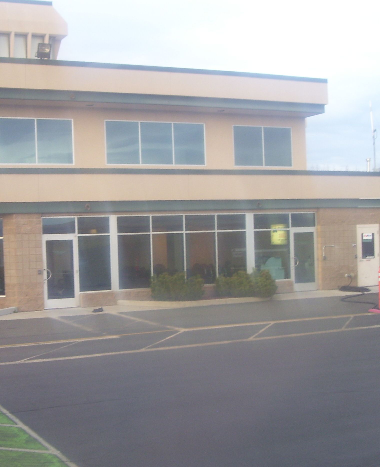
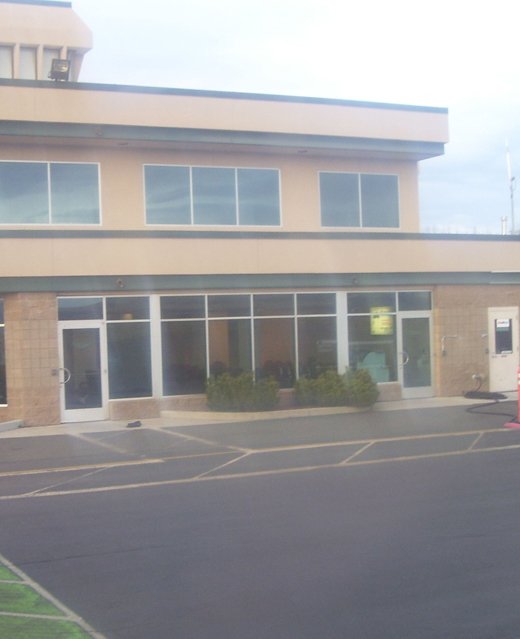
Lewiston-nez Perce County Airport
Address:
Nez Perce County, ID
Tel:
208-746-7962
Images
and information placed above are from
http://www.airport-data.com/airport/LWS/
We
thank them for the data!
| General
Info |
| Country |
United
States |
| State |
IDAHO
|
| FAA ID |
LWS |
| Latitude |
46-22-28.193N
|
| Longitude |
117-00-55.420W
|
| Elevation |
1438 feet
|
| Near City |
LEWISTON
|
We don't guarantee the information is fresh and accurate. The data may
be wrong or outdated.
For more up-to-date information please refer to other sources.
|
|