 |
|
|
|
|
|
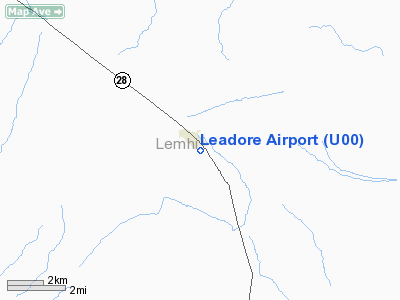
Location
& QuickFacts
|
FAA
Information Effective: |
2007-07-05 |
|
Airport
Identifier: |
U00 |
|
Airport
Status: |
Operational |
|
Longitude/Latitude: |
113-21-11.1250W/44-40-25.7210N
-113.353090/44.673811 (Estimated) |
|
Elevation: |
6018 ft / 1834.29 m (Surveyed) |
|
Land: |
35 acres |
|
From
nearest city: |
0 nautical miles S of Leadore, ID |
|
Location: |
Lemhi County, ID |
|
Magnetic Variation: |
17E (1985) |
Owner & Manager
|
Ownership: |
Publicly owned |
|
Owner: |
Lemhi County |
|
Address: |
206 Courthouse Dr.
Salmon, ID 83467 |
|
Phone number: |
208-756-2815 |
|
Manager: |
Dale Peterson |
|
Address: |
206 Courthouse Dr
Salmon, ID 83467 |
|
Phone number: |
208-768-2742 |
Airport
Operations and Facilities
|
Airport
Use: |
Open
to public |
|
Wind
indicator: |
Yes |
|
Segmented Circle: |
Yes |
|
Control
Tower: |
No |
|
Lighting
Schedule: |
DUSK-DAWN |
|
Landing
fee charge: |
No |
|
Sectional chart: |
Great Falls |
|
Region: |
ANM - Northwest Mountain |
|
Boundary
ARTCC: |
ZLC - Salt Lake City |
|
Tie-in
FSS: |
BOI - Boise |
|
FSS
on Airport: |
No |
|
FSS
Phone: |
208-332-0200 |
|
FSS
Toll Free: |
1-800-WX-BRIEF |
|
NOTAMs
Facility: |
BOI (NOTAM-d service avaliable) |
Airport Communications
Airport Services
|
Airframe
Repair: |
NONE |
|
Power
Plant Repair: |
NONE |
|
Bottled
Oxygen: |
NONE |
|
Bulk
Oxygen: |
NONE |
|
Runway Information
Runway 11/29
|
Dimension: |
3500
x 140 ft / 1066.8 x 42.7 m |
|
Surface: |
ASPH-TURF, Poor Condition
2300 FT BY 50 FT ASPH SECTION; STARTING AT RY 11 END. |
|
Edge
Lights: |
Non-standard lighting system
RWY 11 LAST 1200 FT NOT LIGHTED. |
|
|
Runway 11 |
Runway 29 |
|
Traffic
Pattern: |
Left |
Left |
|
Obstruction: |
35 ft poles, 450.0 ft from runway, 100L/ ft
right of centerline, 7:1 slope to clear |
4 ft fence, 0.0 ft from runway, 75 ft right
of centerline |
|
Runway 16/34
|
Dimension: |
2900
x 90 ft / 883.9 x 27.4 m |
|
Surface: |
TURF, Fair Condition
2300 FT BY 50 FT ASPH SECTION; STARTING AT RY 11 END. |
|
|
Runway 16 |
Runway 34 |
|
Traffic
Pattern: |
Left |
Left |
|
Obstruction: |
14 ft bldg, 75.0 ft from runway, 100 ft left
of centerline, 5:1 slope to clear |
5 ft fence, 20.0 ft from runway, 4:1 slope
to clear |
|
Radio Navigation
Aids
|
ID |
Type |
Name |
Ch |
Freq |
Var |
Dist |
|
LLJ |
NDB |
Challis |
|
397.00 |
17E |
38.1 nm |
|
LKT |
VOR/DME |
Salmon |
082X |
113.50 |
18E |
37.5 nm |
|
DLN |
VOR/DME |
Dillon |
077X |
113.00 |
18E |
48.7 nm |
Remarks
- RWY
11/29; 16/34; +3' SAGEBRUSH ADJACENT TO ALL RWY EDGES.
- ESTABD
PRIOR TO 15 MAY 1959.
Based
Aircraft
|
Aircraft
based on field: |
1 |
|
Single
Engine Airplanes: |
1 |
Operational Statistics
Time Period: 2005-06-21
- 2006-06-20
|
Aircraft
Operations: |
10/Week |
|
General
Aviation Itinerant: |
100.0% |
Leadore Airport
Address:
Lemhi County, ID
Tel:
208-756-2815, 208-768-2742
Images
and information placed above are from
http://www.airport-data.com/airport/U00/
We
thank them for the data!
| General
Info |
| Country |
United
States |
| State |
IDAHO
|
| FAA ID |
U00 |
| Latitude |
44-40-25.721N
|
| Longitude |
113-21-11.125W
|
| Elevation |
6018 feet
|
| Near City |
LEADORE
|
We don't guarantee the information is fresh and accurate. The data may
be wrong or outdated.
For more up-to-date information please refer to other sources.
|
|


