 |
|
Coordinates: 44°54′44″N 115°29′08″W / 44.91222°N 115.48556°W / 44.91222; -115.48556
| Johnson Creek Airport |
| IATA: none – ICAO: none – FAA LID: 3U2 |
| Summary |
| Airport type |
Public |
| Owner |
Idaho Transportation Department, Division of Aeronautics |
| Serves |
Yellow Pine, Idaho |
| Elevation AMSL |
4,933 ft / 1,504 m |
| Runways |
| Direction |
Length |
Surface |
| ft |
m |
| 17/35 |
3,400 |
1,036 |
Turf |
| Statistics (2003) |
| Aircraft operations |
5,750 |
| Source: Federal Aviation Administration |
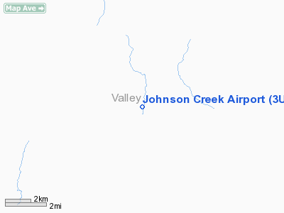
Johnson Creek Airport (FAA LID: 3U2) is a grass airstrip located in Central Idaho three miles (5 km) south of Yellow Pine, a village in Valley County, Idaho, United States. It is managed by the Idaho Division of Aeronautics of the Idaho Transportation Department. A caretaker resides at the field, and as a result, the turf runway is well cared for. Johnson Creek is in the category of backcountry airstrips, and is popular with pilots who enjoy airplane camping.
Facilities
Johnson Creek Airport covers an area of 40 acres (16 ha) which contains one grass runway (17/35) which is 3,400 feet (1,000 m) long and 150 feet (46 m) wide (1,036 x 46 m). The field elevation is 4,933 feet (1,504 m) above sea level. For the 12-month period ending October 24, 2003, the airport had 5,750 aircraft operations, an average of 15 per day: 87% general aviation and 13% air taxi.
The above content comes from Wikipedia and is published under free licenses – click here to read more.
Location
& QuickFacts
|
FAA
Information Effective: |
2007-07-05 |
|
Airport
Identifier: |
3U2 |
|
Airport
Status: |
Operational |
|
Longitude/Latitude: |
115-29-08.4050W/44-54-43.6600N
-115.485668/44.912128 (Estimated) |
|
Elevation: |
4933 ft / 1503.58 m (Surveyed) |
|
Land: |
40 acres |
|
From
nearest city: |
3 nautical miles S of Yellow Pine, ID |
|
Location: |
Valley County, ID |
|
Magnetic Variation: |
17E (1985) |
Owner
& Manager
|
Ownership: |
Publicly
owned |
|
Owner: |
State Of Idaho Itd, Div Aero |
|
Address: |
Box 7129
Boise, ID 83707-1129 |
|
Phone number: |
208-334-8775 |
|
Manager: |
Division Admin |
|
Address: |
Box 7129
Boise, ID 83707-1129 |
|
Phone number: |
208-334-8775 |
Airport
Operations and Facilities
|
Airport
Use: |
Open
to public |
|
Wind
indicator: |
Yes |
|
Segmented Circle: |
Yes
1/2 SEGMENTED CIRCLE. |
|
Control
Tower: |
No |
|
Landing
fee charge: |
No |
|
Sectional chart: |
Great Falls |
|
Region: |
ANM - Northwest Mountain |
|
Boundary
ARTCC: |
ZLC - Salt Lake City |
|
Tie-in
FSS: |
BOI - Boise |
|
FSS
on Airport: |
No |
|
FSS
Phone: |
208-332-0200 |
|
FSS
Toll Free: |
1-800-WX-BRIEF |
|
NOTAMs
Facility: |
BOI (NOTAM-d service avaliable) |
Airport Communications
Airport Services
|
Airframe
Repair: |
NONE |
|
Power
Plant Repair: |
NONE |
|
Bottled
Oxygen: |
NONE |
|
Bulk
Oxygen: |
NONE |
|
Runway Information
Runway 17/35
|
Dimension: |
3400
x 150 ft / 1036.3 x 45.7 m |
|
Surface: |
TURF, Good Condition |
|
|
Runway 17 |
Runway 35 |
|
Traffic
Pattern: |
Left |
Left |
|
Obstruction: |
1500 ft ridge, 4000.0 ft from runway, 400 ft
right of centerline, 2:1 slope to clear |
4 ft fence, 0.0 ft from runway, 100 ft right
of centerline |
|
Radio Navigation
Aids
|
ID |
Type |
Name |
Ch |
Freq |
Var |
Dist |
|
IOM |
NDB |
Mc Call |
|
363.00 |
17E |
27.0 nm |
|
DNJ |
VORTAC |
Donnelly |
109X |
116.20 |
19E |
31.9 nm |
Remarks
- ADDNL
250 FT OF LENGTH AVBL FOR TKOF ON RY 35 END.
- NO
WINTER MAINTENANCE.
- NUMEROUS
+60' TREES ADJACENT TO EACH SIDE OF RY.
- BE
ALERT FOR SPRINKLERS ON RY.
- RECOMMEND
LAND RWY 17; TKOF RWY 35 WHEN WIND CONDITIONS ALLOW.
- BIG
GAME ANIMALS ON & INVOF AIRPORT.
- SPECIAL
CONSIDERATIONS SHOULD BE GIVEN TO DENSITY ALTITUDE, TURBULENCE, AND
MOUNTAIN FLYING PROFICIENCY.
- ESTAB
PRIOR TO OCT 1959.
Operational
Statistics
Time Period: 2002-10-25
- 2003-10-24
|
Aircraft
Operations: |
111/Week |
|
Air
Taxi: |
13.0% |
|
General
Aviation Itinerant: |
87.0% |
Johnson Creek Airport
Address:
Valley County, ID
Tel:
208-334-8775
Images
and information placed above are from
http://www.airport-data.com/airport/3U2/
We
thank them for the data!
| General
Info |
| Country |
United
States |
| State |
IDAHO
|
| FAA ID |
3U2 |
| Latitude |
44-54-43.660N
|
| Longitude |
115-29-08.405W
|
| Elevation |
4933 feet
|
| Near City |
YELLOW
PINE |
We don't guarantee the information is fresh and accurate. The data may
be wrong or outdated.
For more up-to-date information please refer to other sources.
|
|


