 |
|
|
|
|
|
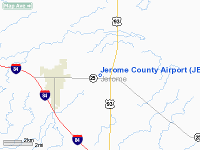
Location
& QuickFacts
|
FAA
Information Effective: |
2007-07-05 |
|
Airport
Identifier: |
JER |
|
Airport
Status: |
Operational |
|
Longitude/Latitude: |
114-27-23.9210W/42-43-36.0540N
-114.456645/42.726682 (Estimated) |
|
Elevation: |
4053 ft / 1235.35 m (Estimated) |
|
Land: |
410 acres |
|
From
nearest city: |
3 nautical miles E of Jerome, ID |
|
Location: |
Jerome County, ID |
|
Magnetic Variation: |
18E (1965) |
Owner
& Manager
|
Ownership: |
Publicly
owned |
|
Owner: |
Jerome County |
|
Address: |
300 N Lincoln Rm 300
Jerome, ID 83338 |
|
Phone number: |
208-644-2704 |
|
Manager: |
Bonnie Dietrick |
|
Address: |
Jerome, ID 83338 |
|
Phone number: |
208-324-9980 |
Airport
Operations and Facilities
|
Airport
Use: |
Open
to public |
|
Wind
indicator: |
Yes |
|
Segmented Circle: |
Yes |
|
Control
Tower: |
No |
|
Lighting
Schedule: |
RDO-CTL
ACTVT ROTG BCN - CTAF. |
|
Beacon
Color: |
Clear-Green (lighted land airport) |
|
Landing
fee charge: |
No |
|
Sectional chart: |
Salt Lake City |
|
Region: |
ANM - Northwest Mountain |
|
Boundary
ARTCC: |
ZLC - Salt Lake City |
|
Tie-in
FSS: |
BOI - Boise |
|
FSS
on Airport: |
No |
|
FSS
Phone: |
208-332-0200 |
|
FSS
Toll Free: |
1-800-WX-BRIEF |
|
NOTAMs
Facility: |
JER (NOTAM-d service avaliable) |
|
Federal Agreements: |
NGY |
Airport Communications
|
CTAF: |
122.800 |
|
Unicom: |
122.800
|
Airport
Services
|
Fuel
available: |
100LLA |
|
Airframe
Repair: |
MAJOR |
|
Power
Plant Repair: |
MAJOR |
|
Bottled
Oxygen: |
NONE |
|
Bulk
Oxygen: |
NONE |
|
Runway Information
Runway 08/26
|
Dimension: |
5000
x 75 ft / 1524.0 x 22.9 m |
|
Surface: |
ASPH, Good Condition |
|
Weight
Limit: |
Single wheel: 12500 lbs. |
|
Edge
Lights: |
Medium |
|
|
Runway 08 |
Runway 26 |
|
Longitude: |
114-27-56.8921W |
114-26-50.9514W |
|
Latitude: |
42-43-40.3776N |
42-43-31.7305N |
|
Elevation: |
3961.00 ft |
4053.00 ft |
|
Alignment: |
100 |
127 |
|
Traffic
Pattern: |
Right |
Left |
|
Markings: |
Non-precision instrument, Good Condition |
Non-precision instrument, Good Condition |
|
Crossing
Height: |
40.00 ft |
0.00 ft |
|
VASI: |
4-light PAPI on left side |
|
|
Visual
Glide Angle: |
3.00° |
0.00° |
|
Obstruction: |
3 ft fence, 200.0 ft from runway, 70 ft left
of centerline
+2 FT FENCE AT 0 FT; 115 FT L. |
10 ft fence, 370.0 ft from runway, 138 ft left
of centerline, 17:1 slope to clear |
|
Radio Navigation
Aids
|
ID |
Type |
Name |
Ch |
Freq |
Var |
Dist |
|
HDG |
NDB |
Steelhead |
|
211.00 |
16E |
14.9 nm |
|
HLE |
NDB/DME |
Hailey |
025X |
220.00 |
16E |
37.4 nm |
|
BYI |
VOR/DME |
Burley |
088X |
114.10 |
18E |
27.6 nm |
|
TWF |
VORTAC |
Twin Falls |
105X |
115.80 |
18E |
14.9 nm |
Remarks
- REFLECTORS
ON PARALLEL TXY.
- CTN:
TOWER 688' AGL (4971' MSL) LCTD 1.5 E OF ARPT.
- DEER
& WILDLIFE ON ARPT.
- ESTABD
PRIOR TO 1959.
Based
Aircraft
|
Aircraft
based on field: |
44 |
|
Single
Engine Airplanes: |
39 |
|
Multi
Engine Airplanes: |
2 |
|
Jet
Engine Airplanes: |
2 |
|
Helicopters: |
1 |
Operational Statistics
Time Period: 2005-08-04
- 2006-08-03
|
Aircraft
Operations: |
68/Day |
|
General
Aviation Local: |
12.2% |
|
General
Aviation Itinerant: |
87.7% |
|
Military: |
0.0% |
Jerome County Airport
Address:
Jerome County, ID
Tel:
208-644-2704, 208-324-9980
Images
and information placed above are from
http://www.airport-data.com/airport/JER/
We
thank them for the data!
| General
Info |
| Country |
United
States |
| State |
IDAHO
|
| FAA ID |
JER |
| Latitude |
42-43-35.891N
|
| Longitude |
114-27-25.742W
|
| Elevation |
4048 feet
|
| Near City |
JEROME
|
We don't guarantee the information is fresh and accurate. The data may
be wrong or outdated.
For more up-to-date information please refer to other sources.
|
|


