 |
|
Indian Creek U.S. Forest Service Airport |
|
|
Location
& QuickFacts
|
FAA
Information Effective: |
2007-07-05 |
|
Airport
Identifier: |
S81 |
|
Airport
Status: |
Operational |
|
Longitude/Latitude: |
115-06-26.3640W/44-45-40.6700N
-115.107323/44.761297 (Estimated) |
|
Elevation: |
4701 ft / 1432.86 m (Surveyed) |
|
Land: |
37 acres |
|
From
nearest city: |
0 nautical miles NE of Indian Creek, ID |
|
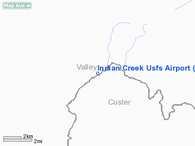
Location: |
Valley County, ID |
|
Magnetic Variation: |
17E (1985) |
Owner
& Manager
|
Ownership: |
Publicly
owned |
|
Owner: |
U S Forest Service |
|
Address: |
324 25th St
Ogden, UT 84401 |
|
Phone
number: |
801-625-5511 |
|
Manager: |
Middle Fork Dist Ranger |
|
Address: |
Po Box 750, Hwy 93
Challis, ID 83226 |
|
Phone number: |
208-879-4101 |
Airport Operations and Facilities
|
Airport
Use: |
Open
to public |
|
Wind
indicator: |
Yes |
|
Segmented Circle: |
Yes |
|
Control
Tower: |
No |
|
Landing
fee charge: |
No |
|
Sectional chart: |
Great Falls |
|
Region: |
ANM - Northwest Mountain |
|
Boundary
ARTCC: |
ZLC - Salt Lake City |
|
Tie-in
FSS: |
BOI - Boise |
|
FSS
on Airport: |
No |
|
FSS
Phone: |
208-332-0200 |
|
FSS
Toll Free: |
1-800-WX-BRIEF |
|
NOTAMs
Facility: |
BOI (NOTAM-d service avaliable) |
Airport Communications
Airport Services
|
Airframe
Repair: |
NONE |
|
Power
Plant Repair: |
NONE |
|
Bottled
Oxygen: |
NONE |
|
Bulk
Oxygen: |
NONE |
|
Runway Information
Runway 04/22
|
Dimension: |
4650 x 40 ft / 1417.3 x 12.2 m
40 FT USEABLE WIDTH, RY EDGE MARKERS ARE 100 FT APART. |
|
Surface: |
DIRT, Fair Condition |
|
|
Runway 04 |
Runway 22 |
|
Traffic
Pattern: |
Left |
Left |
|
Obstruction: |
80 ft tree, 105 ft left of centerline |
40 ft tree, 0.0 ft from runway, 60 ft right
of centerline |
|
Radio Navigation
Aids
|
ID |
Type |
Name |
Ch |
Freq |
Var |
Dist |
|
LLJ |
NDB |
Challis |
|
397.00 |
17E |
40.8 nm |
|
IOM |
NDB |
Mc Call |
|
363.00 |
17E |
42.5 nm |
|
LKT |
VOR/DME |
Salmon |
082X |
113.50 |
18E |
46.3 nm |
|
DNJ |
VORTAC |
Donnelly |
109X |
116.20 |
19E |
46.9 nm |
Remarks
- NO
WINTER MAINTENANCE.
- BE
ADVISED USFS RECOMMENDS: WHEN DEPARTING UP OR DOWN STREAM REMAIN IN
MAIN CANYON. DO
NOT ATTEMPT TO CLIMB OUT SIDE CANYONS.
- TFC
OBSERVANCE VCNTY OF PISTOL CREEK AIRPORT LCTD 2.5 MILES UPSTREAM.
- RY
04, 350 FT STOPWAY.
- RY
04 HAS +12 FT FENCE & TERRAIN 0 FT 60 FT L; NUMEROUS TREES TO 70
FT ON L HALF OF APCH; +55 FT TREES 600 FT ON CNTRLN.
- RY
22 RIGHT HALF OF APCH BLOCKED BY 200 FT TIMBERED RIDGE 400 FT ON CNTRLN;
+300 FT RIDGE 1800 FT 400 FT L.
- ESTABD
PRIOR TO 1959.
Operational Statistics
Time Period: 2006-04-06
- 2007-04-05
|
Aircraft
Operations: |
59/Week |
|
Air
Taxi: |
33.9% |
|
General
Aviation Itinerant: |
66.1% |
Indian Creek U S Forest Service Airport
Address:
Valley County, ID
Tel:
801-625-5511,
208-879-4101
Images
and information placed above are from
http://www.airport-data.com/airport/S81/
We
thank them for the data!
| General
Info |
| Country |
United
States |
| State |
IDAHO
|
| FAA ID |
S81 |
| Latitude |
44-45-40.670N
|
| Longitude |
115-06-26.364W
|
| Elevation |
4701 feet
|
| Near City |
INDIAN
CREEK |
We don't guarantee the information is fresh and accurate. The data may
be wrong or outdated.
For more up-to-date information please refer to other sources.
|
|


