|
|
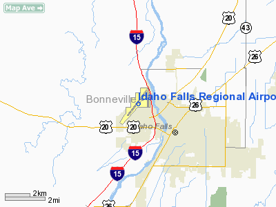
Idaho Falls Regional Airport |
Idaho Falls Regional Airport
(Fanning Field) |
 |
| IATA: IDA â ICAO: KIDA |
| Summary |
| Airport type |
Public |
| Operator |
City of Idaho Falls |
| Location |
Idaho Falls, Idaho |
| Elevation AMSL |
4,740 ft / 1444.8 m |
| Coordinates |
43°30â²49.4â³N 112°04â²14.7â³W / 43.513722°N 112.07075°W / 43.513722; -112.07075Coordinates: 43°30â²49.4â³N 112°04â²14.7â³W / 43.513722°N 112.07075°W / 43.513722; -112.07075 |
| Runways |
| Direction |
Length |
Surface |
| ft |
m |
| 2/20 |
9,002 |
2,744 |
Asphalt |
| 17/35 |
4,051 |
1,235 |
Asphalt |
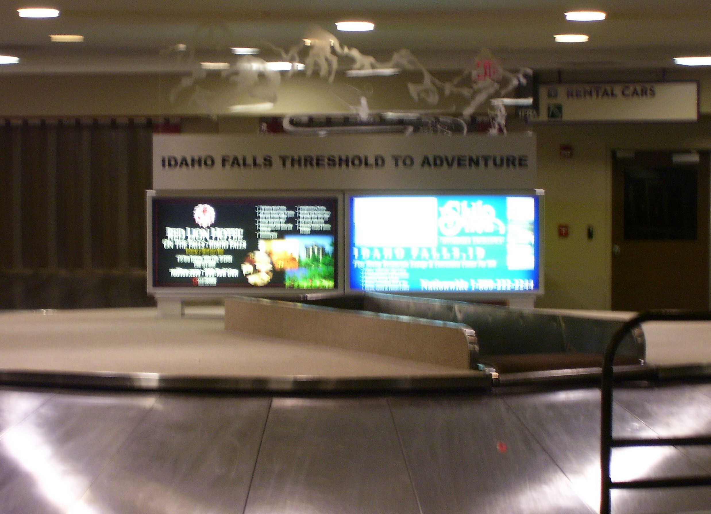
Idaho Falls Regional Airport (IATA: IDA, ICAO: KIDA), formerly known as Fanning Field, is a public airport located in the northwest part of Idaho Falls, in Bonneville County, Idaho, USA. The airport has two runways. The airport terminal has been expanded twice and partially re-built once. The current terminal was built in 1959, expanded in 1982 and the boarding area torn down and retrofitted to accommodate smaller aircraft with jet ways in the mid-2000s (the previous layout was designed for 737s, which stopped arriving in Idaho Falls after Delta discontinued service in 2002). Airlines
| Airlines |
Destinations |
| Allegiant Air |
Las Vegas, Long Beach [begins October 8], Los Angeles [ends October 8], Phoenix-Mesa [begins November 18] |
| Delta Connection operated by SkyWest Airlines |
Salt Lake City |
| United Express operated by SkyWest Airlines |
Denver |
Service history
- Horizon Air tried running non-stop service between Idaho Falls, Idaho and Seattle starting in 2003 with their larger Q400 planes that hold 76 passengers, but discontinued the service in 2004.. However, it reinstated non-stop flights to Seattle beginning October 25, 2008. This service was discontinued as of August 23, 2009.
On June 16, 2010, Horizon Air announced its intention to once again discontinue service to Idaho Falls effective August 22, 2010.
- Delta Air Lines discontinued mainline 737 service to Salt Lake City in 2002.
Food and Beverage Service
The airport has a restaurant and lounge, named Kathryn's. The restaurant serves basic American fare and is traditionally open for breakfasts and lunches Monday through Saturday. At other times, sundries and basic food are available at Kathryn's Snack Shack, however there are no food or beverage services beyond the security checkpoint.
The airport has struggled to maintain a restaurant operator in the past. The restaurant has previously been "Das Kinder Haus" which served German food, "Dolores' Place" operated by local restaurant critic Dolores Casella, and "Runway 21" which tried to be an upscale steak house and coffee shop. The restaurant has been remodeled once in the 1980s.
The above content comes from Wikipedia and is published under free licenses – click here to read more.
Location
& QuickFacts
|
FAA
Information Effective: |
2007-07-05 |
|
Airport
Identifier: |
IDA |
|
Airport
Status: |
Operational |
|
Longitude/Latitude: |
112-04-14.7000W/43-30-49.4000N
-112.070750/43.513722 (Estimated) |
|
Elevation: |
4744 ft / 1445.97 m (Surveyed) |
|
Land: |
866 acres |
|
From
nearest city: |
2 nautical miles NW of Idaho Falls, ID |
|
Location: |
Bonneville County, ID |
|
Magnetic Variation: |
16E (1985) |
Owner
& Manager
|
Ownership: |
Publicly
owned |
|
Owner: |
City Of Idaho Falls |
|
Address: |
Po Box 50220
Idaho Falls, ID 83405 |
|
Phone
number: |
208-612-8224 |
|
Manager: |
Len Nelson
DIRECTOR OF AVIATION |
|
Address: |
2140 N Skyline
Idaho Falls, ID 83402 |
|
Phone number: |
208-612-8224 |
Airport Operations and Facilities
|
Airport
Use: |
Open
to public |
|
Wind
indicator: |
Yes |
|
Segmented Circle: |
Yes |
|
Control
Tower: |
Yes |
|
Lighting
Schedule: |
DUSK-DAWN
WHEN ATCT CLOSED, ACTVT HIRL RY 02/20, REIL RY 02 &
MALSR RY 20 - CTAF. |
|
Beacon
Color: |
Clear-Green (lighted land airport) |
|
Landing
fee charge: |
No |
|
Sectional chart: |
Salt Lake City |
|
Region: |
ANM - Northwest Mountain |
|
Boundary
ARTCC: |
ZLC - Salt Lake City |
|
Tie-in
FSS: |
BOI - Boise |
|
FSS
on Airport: |
No |
|
FSS
Phone: |
208-332-0200 |
|
FSS
Toll Free: |
1-800-WX-BRIEF |
|
NOTAMs
Facility: |
IDA (NOTAM-d service avaliable) |
|
Certification type/date: |
I B S 05/1993
24 HR PPR FOR UNSKED ACR OPNS WITH MORE THAN 30 PSGR SEATS
CALL AMGR 208-529-1221. |
|
Federal Agreements: |
NGY3 |
Airport Communications
|
CTAF: |
118.500 |
|
Unicom: |
122.950
|
Airport
Services
|
Fuel
available: |
100LLA1 |
|
Airframe
Repair: |
MAJOR |
|
Power
Plant Repair: |
MAJOR |
|
Bottled
Oxygen: |
HIGH/LOW |
|
Bulk
Oxygen: |
HIGH/LOW |
|
Runway Information
Runway 02/20
|
Dimension: |
9002
x 150 ft / 2743.8 x 45.7 m |
|
Surface: |
ASPH, Fair Condition |
|
Surface
Treatment: |
Saw-cut or plastic Grooved |
|
Weight
Limit: |
Single wheel: 140000 lbs.
Dual wheel: 175000 lbs.
Dual tandem wheel: 270000 lbs. |
|
Edge
Lights: |
High |
|
|
Runway 02 |
Runway 20 |
|
Longitude: |
112-05-06.7704W |
112-03-51.5582W |
|
Latitude: |
43-30-09.0552N |
43-31-19.0806N |
|
Elevation: |
4742.00 ft |
4731.00 ft |
|
Alignment: |
38 |
127 |
|
ILS
Type: |
|
ILS/DME |
|
Traffic
Pattern: |
Left |
Left |
|
Markings: |
Precision instrument, Good Condition |
Precision instrument, Good Condition |
|
Crossing
Height: |
50.00 ft |
49.00 ft |
|
VASI: |
4-box on left side |
4-light PAPI on left side |
|
Visual
Glide Angle: |
3.00° |
3.00° |
|
RVR
Equipment: |
|
touchdown |
|
Approach
lights: |
|
MALSR |
|
Runway
End Identifier: |
Yes |
|
|
Runway 17/35
|
Dimension: |
4051
x 75 ft / 1234.7 x 22.9 m |
|
Surface: |
ASPH, Good Condition |
|
Weight
Limit: |
Single wheel: 43000 lbs.
Dual wheel: 58000 lbs. |
|
Edge
Lights: |
Medium |
|
|
Runway 17 |
Runway 35 |
|
Longitude: |
112-03-41.7364W |
112-03-43.5731W |
|
Latitude: |
43-31-21.3332N |
43-30-41.3606N |
|
Elevation: |
4731.00 ft |
4731.00 ft |
|
Alignment: |
127 |
2 |
|
Traffic
Pattern: |
Left |
Left |
|
Markings: |
Basic, Good Condition |
Basic, Good Condition |
|
Crossing
Height: |
40.00 ft |
45.00 ft |
|
VASI: |
4-light PAPI on left side |
4-light PAPI on left side |
|
Visual
Glide Angle: |
3.00° |
3.50° |
|
Obstruction: |
|
23 ft ant, 700.0 ft from runway, 80 ft left
of centerline, 21:1 slope to clear |
|
Radio Navigation
Aids
|
ID |
Type |
Name |
Ch |
Freq |
Var |
Dist |
|
SWU |
NDB |
Sweden |
|
350.00 |
15E |
6.3 nm |
|
IDA |
VOR/DME |
Idaho Falls |
85Y |
113.85 |
15E |
0.4 nm |
|
DBS |
VORTAC |
Dubois |
116X |
116.90 |
15E |
35.1 nm |
|
PIH |
VORTAC |
Pocatello |
073X |
112.60 |
17E |
46.3 nm |
Remarks
- WHEN
ATCT CLOSED, TWY A BETWEEN A1 AND HOLD SHORT LINE FOR RY 17 IS CLSD
TO PROTECT RY 20 PRECISION APPROACHES.
- FLOCKS
OF BIRDS & WATERFOWL ON & INVOF ARPT ALL YEAR.
- EXTENSIVE
AGRICULTURAL OPNS.
- ACFT
OPS BE ALERT FOR POSSIBLE INCURSIONS; NO LINE OF SIGHT BTN RYS.
Based Aircraft
|
Aircraft
based on field: |
95 |
|
Single
Engine Airplanes: |
75 |
|
Multi
Engine Airplanes: |
11 |
|
Jet
Engine Airplanes: |
6 |
|
Helicopters: |
2 |
|
Gliders: |
1 |
Major Carriers
Serving This Airport
|
Skywest Airlines Inc. |
100.0% |
Most Popular Destinations
|
Salt Lake City Intl (SLC) |
73.8% |
|
Denver
Intl (DEN) |
26.2% |
Most Popular Aircraft
|
N459SW |
2.2% |
|
N606SK |
2.2% |
|
N608SK |
2.2% |
|
N603SK |
1.9% |
|
N447SW |
1.9% |
|
N412SW |
1.9% |
|
N910EV |
1.7% |
|
N604SK |
1.7% |
|
N445SW |
1.6% |
|
N448SW |
1.6% |
Operational Statistics
Time Period: 2006-02-01
- 2007-01-31
|
Aircraft
Operations: |
117/Day |
|
Commerical: |
0.9% |
|
Air
Taxi: |
30.9% |
|
General
Aviation Local: |
25.7% |
|
General
Aviation Itinerant: |
42.2% |
|
Military: |
0.4% |
Idaho Falls Regional Airport
Address:
Bonneville County, ID
Tel:
208-612-8224
Images
and information placed above are from
http://www.airport-data.com/airport/IDA/
We
thank them for the data!
| General
Info |
| Country |
United
States |
| State |
IDAHO
|
| FAA ID |
IDA |
| Latitude |
43-30-52.400N
|
| Longitude |
112-04-12.600W
|
| Elevation |
4740 feet
|
| Near City |
IDAHO
FALLS |
We don't guarantee the information is fresh and accurate. The data may
be wrong or outdated.
For more up-to-date information please refer to other sources.
|
|