 |
|
|
|
|
|
Location
& QuickFacts
|
FAA
Information Effective: |
2007-07-05 |
|
Airport
Identifier: |
U97 |
|
Airport
Status: |
Operational |
|
Longitude/Latitude: |
113-02-48.0100W/43-50-20.6520N
-113.046669/43.839070 (Estimated) |
|
Elevation: |
4930 ft / 1502.66 m (Estimated) |
|
Land: |
60 acres |
|
From
nearest city: |
4 nautical miles NW of Howe, ID |
|
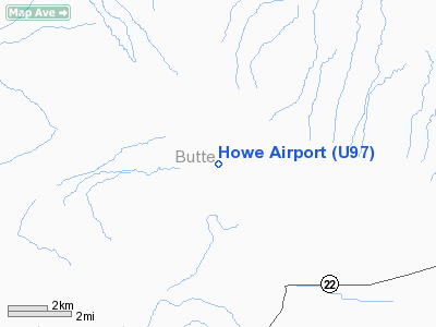
Location: |
Butte County, ID |
|
Magnetic Variation: |
16E (1985) |
Owner
& Manager
|
Ownership: |
Publicly
owned |
|
Owner: |
Butte County |
|
Address: |
P O Box 737
Arco, ID 83213 |
|
Phone number: |
208-527-3021 |
|
Manager: |
Wayne Bare |
|
Address: |
1790 W 3720 N
Howe, ID 83244 |
|
Phone number: |
208-767-3455 |
Airport
Operations and Facilities
|
Airport
Use: |
Open
to public |
|
Wind
indicator: |
Yes |
|
Segmented Circle: |
No |
|
Control
Tower: |
No |
|
Landing
fee charge: |
No |
|
Sectional chart: |
Salt Lake City |
|
Region: |
ANM - Northwest Mountain |
|
Boundary
ARTCC: |
ZLC - Salt Lake City |
|
Tie-in
FSS: |
BOI - Boise |
|
FSS
on Airport: |
No |
|
FSS
Phone: |
208-332-0200 |
|
FSS
Toll Free: |
1-800-WX-BRIEF |
|
NOTAMs
Facility: |
BOI (NOTAM-d service avaliable) |
Airport Communications
Airport Services
|
Airframe
Repair: |
NONE |
|
Power
Plant Repair: |
NONE |
|
Bottled
Oxygen: |
NONE |
|
Bulk
Oxygen: |
NONE |
|
Runway Information
Runway 13/31
|
Dimension: |
3800
x 25 ft / 1158.2 x 7.6 m |
|
Surface: |
GRVL, Good Condition |
|
|
Runway 13 |
Runway 31 |
|
Traffic
Pattern: |
Left |
Left |
|
Obstruction: |
10 ft road |
15 ft road, 0.0 ft from runway, 75 ft right
of centerline |
|
Radio Navigation
Aids
|
ID |
Type |
Name |
Ch |
Freq |
Var |
Dist |
|
AOC |
NDB |
Arco |
|
200.00 |
15E |
19.3 nm |
|
SWU |
NDB |
Sweden |
|
350.00 |
15E |
45.6 nm |
|
IDA |
VOR/DME |
Idaho Falls |
85Y |
113.85 |
15E |
46.9 nm |
|
DBS |
VORTAC |
Dubois |
116X |
116.90 |
15E |
39.2 nm |
Remarks
- ARPT
USED HEAVILY BY SPRAY PLANES DURING SUMMER.
- RY
31 THLD NOT DEFINED.
- +15'
TO +20' FARM MACHINERY MAY BE PARKED ON APROACH TO RY 13; 230' FM END
OF RY.
Based
Aircraft
|
Aircraft
based on field: |
3 |
|
Single
Engine Airplanes: |
3 |
Operational Statistics
Time Period: 2004-06-24
- 2005-06-23
|
Aircraft
Operations: |
92/Week |
|
General
Aviation Local: |
15.8% |
|
General
Aviation Itinerant: |
84.2% |
Howe Airport
Address:
Butte County, ID
Tel:
208-527-3021, 208-767-3455
Images
and information placed above are from
http://www.airport-data.com/airport/U97/
We
thank them for the data!
| General
Info |
| Country |
United
States |
| State |
IDAHO
|
| FAA ID |
U97 |
| Latitude |
43-50-20.652N
|
| Longitude |
113-02-48.010W
|
| Elevation |
4930 feet
|
| Near City |
HOWE |
We don't guarantee the information is fresh and accurate. The data may
be wrong or outdated.
For more up-to-date information please refer to other sources.
|
|


