 |
|
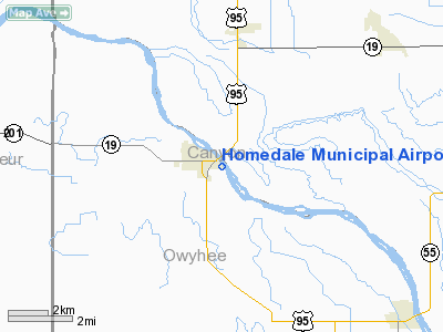
Homedale Municipal Airport |
|
|
Location
& QuickFacts
|
FAA
Information Effective: |
2007-07-05 |
|
Airport
Identifier: |
S66 |
|
Airport
Status: |
Operational |
|
Longitude/Latitude: |
116-55-17.5340W/43-36-53.5700N
-116.921537/43.614881 (Estimated) |
|
Elevation: |
2210 ft / 673.61 m (Estimated) |
|
Land: |
22 acres |
|
From
nearest city: |
0 nautical miles SE of Homedale, ID |
|
Location: |
Owyhee County, ID |
|
Magnetic Variation: |
17E (1985) |
Owner
& Manager
|
Ownership: |
Publicly
owned |
|
Owner: |
City Of Homedale |
|
Address: |
Po Box 757
Homedale, ID 83628 |
|
Phone
number: |
208-337-4641 |
|
Manager: |
John Rodgers |
|
Address: |
P.o. Box 431
Homedale, ID 83628 |
|
Phone number: |
208-337-5506 |
Airport Operations and Facilities
|
Airport
Use: |
Open
to public |
|
Wind
indicator: |
Yes |
|
Segmented Circle: |
No |
|
Control
Tower: |
No |
|
Lighting
Schedule: |
DUSK-DAWN |
|
Landing
fee charge: |
No |
|
Sectional chart: |
Salt Lake City |
|
Region: |
ANM - Northwest Mountain |
|
Boundary
ARTCC: |
ZLC - Salt Lake City |
|
Tie-in
FSS: |
BOI - Boise |
|
FSS
on Airport: |
No |
|
FSS
Phone: |
208-332-0200 |
|
FSS
Toll Free: |
1-800-WX-BRIEF |
|
NOTAMs
Facility: |
BOI (NOTAM-d service avaliable) |
|
Federal Agreements: |
N |
Airport Communications
Airport
Services
|
Airframe
Repair: |
MINOR |
|
Bottled
Oxygen: |
NONE |
|
Bulk
Oxygen: |
NONE |
|
Runway Information
Runway 13/31
|
Dimension: |
2900
x 50 ft / 883.9 x 15.2 m |
|
Surface: |
ASPH, Good Condition |
|
Weight
Limit: |
Single wheel: 6000 lbs. |
|
Edge
Lights: |
Non-standard lighting system
RWY 13/31 FIRST 600 FT RY 31 - LIRL; RY 31 HAS LOW INTST THLD LGTS. |
|
|
Runway 13 |
Runway 31 |
|
Traffic
Pattern: |
Left |
Left |
|
Markings: |
Basic, Good Condition |
Basic, Good Condition |
|
Displaced
threshold: |
335.00 ft |
0.00 ft |
|
Obstruction: |
41 ft tree, 243.0 ft from runway, 90 ft right
of centerline, 1:1 slope to clear
RWY 13 APCH SLOPE 14:1 TO DSPLCD THR.
RWY 13 +3 FT FENCE 20 FT FM RWY END; +21 HWY 175 FT FM END
OF RY ON CNTRLN; +15 ROAD AT 25 FT ON CNTRLN. |
20 ft brush, 400.0 ft from runway, 100 ft left
of centerline, 10:1 slope to clear
RWY 31 +5 FT FENCE AT 65 FT ON CNTRLN; +8 FT BRUSH AT 0 FT
25 FT R. |
|
Radio Navigation
Aids
|
ID |
Type |
Name |
Ch |
Freq |
Var |
Dist |
|
MPA |
NDB |
Meridian |
|
238.00 |
16E |
16.7 nm |
|
ONO |
NDB |
Ontario |
|
305.00 |
17E |
24.6 nm |
|
BO |
NDB |
Ustik |
|
359.00 |
17E |
26.4 nm |
|
BOI |
VORTAC |
Boise |
080X |
113.30 |
17E |
32.0 nm |
|
BOI |
VOT |
Boise |
|
116.70 |
|
30.2 nm |
Remarks
- EXTV
AGRICULTURAL OPNS DURG GROWING SEASON.
- NO
TELEPHONE AVBL AT ARPT.
- ESTABD
PRIOR TO 15 MAY 1959.
Based
Aircraft
|
Aircraft
based on field: |
15 |
|
Single
Engine Airplanes: |
13 |
|
Ultralights: |
2 |
Operational Statistics
Time Period: 2006-02-23
- 2007-02-22
|
Aircraft
Operations: |
136/Week |
|
General
Aviation Local: |
14.2% |
|
General
Aviation Itinerant: |
85.1% |
|
Military: |
0.7% |
Homedale Municipal Airport
Address:
Owyhee County, ID
Tel:
208-337-4641,
208-337-5506
Images
and information placed above are from
http://www.airport-data.com/airport/S66/
We
thank them for the data!
| General
Info |
| Country |
United
States |
| State |
IDAHO
|
| FAA ID |
S66 |
| Latitude |
43-36-53.570N
|
| Longitude |
116-55-17.534W
|
| Elevation |
2210 feet
|
| Near City |
HOMEDALE
|
We don't guarantee the information is fresh and accurate. The data may
be wrong or outdated.
For more up-to-date information please refer to other sources.
|
|


