 |
|
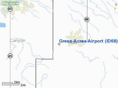
Location
& QuickFacts
|
FAA
Information Effective: |
2007-07-05 |
|
Airport
Identifier: |
ID68 |
|
Airport
Status: |
Operational |
|
Longitude/Latitude: |
116-27-31.4440W/43-29-04.5880N
-116.458734/43.484608 (Estimated) |
|
Elevation: |
2865 ft / 873.25 m (Estimated) |
|
Land: |
10 acres |
|
From
nearest city: |
2 nautical miles SW of Kuna, ID |
|
Location: |
Ada County, ID |
|
Magnetic Variation: |
17E (1990) |
Owner
& Manager
|
Ownership: |
Privately
owned |
|
Owner: |
Karst Home Owners Association |
|
Address: |
3333 W Ambrosia Lane
Kuna, ID 83634 |
|
Phone
number: |
208-922-1300 |
|
Manager: |
Russ Whale |
|
Address: |
3333 W Ambrosia Lane
Kuna, ID 83634 |
|
Phone number: |
208-922-1300 |
Airport Operations and Facilities
|
Airport
Use: |
Private |
|
Wind
indicator: |
Yes |
|
Segmented Circle: |
No |
|
Control
Tower: |
No |
|
Sectional chart: |
Salt Lake City |
|
Region: |
ANM - Northwest Mountain |
|
Boundary
ARTCC: |
ZLC - Salt Lake City |
|
Tie-in
FSS: |
BOI - Boise |
|
FSS
on Airport: |
No |
|
FSS
Phone: |
208-332-0200 |
|
FSS
Toll Free: |
1-800-WX-BRIEF |
|
Runway Information
Runway 07/25
|
Dimension: |
2500
x 100 ft / 762.0 x 30.5 m |
|
Surface: |
DIRT, |
|
|
Runway 07 |
Runway 25 |
|
Traffic
Pattern: |
Left |
Left |
|
Obstruction: |
6 ft fence, 10.0 ft from runway |
30 ft road, 50.0 ft from runway |
|
Radio Navigation
Aids
|
ID |
Type |
Name |
Ch |
Freq |
Var |
Dist |
|
MPA |
NDB |
Meridian |
|
238.00 |
16E |
8.0 nm |
|
BO |
NDB |
Ustik |
|
359.00 |
17E |
9.2 nm |
|
ONO |
NDB |
Ontario |
|
305.00 |
17E |
40.1 nm |
|
STI |
NDB |
Sturgeon |
|
333.00 |
17E |
41.5 nm |
|
MUO |
TACAN |
Mountain Home |
087X |
|
18E |
37.0 nm |
|
LIA |
VOR |
Liberator |
|
114.90 |
18E |
42.5 nm |
|
BOI |
VORTAC |
Boise |
080X |
113.30 |
17E |
12.3 nm |
|
BOI |
VOT |
Boise |
|
116.70 |
|
11.2 nm |
Remarks
- PRVDD
POWER LINE IS OBSTRUCTION LIGHTED AND/OR MARKED; SIGNS WARNING MOTORIST
OF LOW FLYING ACFT.
Based
Aircraft
|
Aircraft
based on field: |
4 |
|
Single
Engine Airplanes: |
4 |
Green Acres Airport
Address:
Ada County, ID
Tel:
208-922-1300
Images
and information placed above are from
http://www.airport-data.com/airport/ID68/
We
thank them for the data!
| General
Info |
| Country |
United
States |
| State |
IDAHO
|
| FAA ID |
ID68 |
| Latitude |
43-29-04.588N
|
| Longitude |
116-27-31.444W
|
| Elevation |
2865 feet
|
| Near City |
KUNA |
We don't guarantee the information is fresh and accurate. The data may
be wrong or outdated.
For more up-to-date information please refer to other sources.
|
|


