 |
|
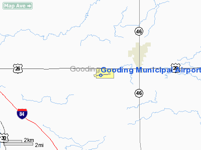
Gooding Municipal Airport |
|
|
Location
& QuickFacts
|
FAA
Information Effective: |
2007-07-05 |
|
Airport
Identifier: |
GNG |
|
Airport
Status: |
Operational |
|
Longitude/Latitude: |
114-45-54.5670W/42-55-01.7990N
-114.765158/42.917166 (Estimated) |
|
Elevation: |
3728 ft / 1136.29 m (Surveyed) |
|
Land: |
740 acres |
|
From
nearest city: |
3 nautical miles SW of Gooding, ID |
|
Location: |
Gooding County, ID |
|
Magnetic Variation: |
16E (1990) |
Owner
& Manager
|
Ownership: |
Publicly
owned |
|
Owner: |
City Of Gooding |
|
Address: |
308 5th Ave West
Gooding, ID 83330 |
|
Phone number: |
208-934-5669 |
|
Manager: |
Dale Thomas |
|
Address: |
1920 Airport Road
Gooding, ID 83330 |
|
Phone number: |
208-934-5934 |
Airport
Operations and Facilities
|
Airport
Use: |
Open
to public |
|
Wind
indicator: |
Yes |
|
Segmented Circle: |
Yes |
|
Control
Tower: |
No |
|
Lighting
Schedule: |
DUSK-DAWN
ACTVT MIRL RY 07/25 - CTAF; 3 CLICKS MED INTST - 5 CLICKS
HIGH INTST. |
|
Beacon
Color: |
Clear-Green (lighted land airport) |
|
Landing
fee charge: |
No |
|
Sectional chart: |
Salt Lake City |
|
Region: |
ANM - Northwest Mountain |
|
Boundary
ARTCC: |
ZLC - Salt Lake City |
|
Tie-in
FSS: |
BOI - Boise |
|
FSS
on Airport: |
No |
|
FSS
Phone: |
208-332-0200 |
|
FSS
Toll Free: |
1-800-WX-BRIEF |
|
NOTAMs
Facility: |
BOI (NOTAM-d service avaliable) |
|
Federal Agreements: |
NGY3 |
Airport Communications
|
CTAF: |
122.800 |
|
Unicom: |
122.800
|
Airport
Services
|
Fuel
available: |
100LLA |
|
Airframe
Repair: |
MAJOR |
|
Power
Plant Repair: |
MAJOR |
|
Bottled
Oxygen: |
NONE |
|
Bulk
Oxygen: |
NONE |
|
Runway Information
Runway 07/25
|
Dimension: |
4736
x 75 ft / 1443.5 x 22.9 m |
|
Surface: |
ASPH, Fair Condition |
|
Weight
Limit: |
Single wheel: 12500 lbs. |
|
Edge
Lights: |
Medium |
|
|
Runway 07 |
Runway 25 |
|
Longitude: |
114-46-26.2252W |
114-45-22.9079W |
|
Latitude: |
42-54-59.4518N |
42-55-04.1460N |
|
Elevation: |
3661.00 ft |
3728.00 ft |
|
Alignment: |
84 |
127 |
|
Traffic
Pattern: |
Left |
Left |
|
Markings: |
Non-precision instrument, Fair Condition |
Non-precision instrument, Fair Condition |
|
Obstruction: |
8 ft road, 260.0 ft from runway, 7:1 slope
to clear |
, 50:1 slope to clear
RY 25 +9 BFT FENCE AND BERM, 0 FT FM RY END, 250 FT L. |
|
Radio Navigation
Aids
|
ID |
Type |
Name |
Ch |
Freq |
Var |
Dist |
|
HDG |
NDB |
Steelhead |
|
211.00 |
16E |
4.0 nm |
|
STI |
NDB |
Sturgeon |
|
333.00 |
17E |
41.0 nm |
|
HLE |
NDB/DME |
Hailey |
025X |
220.00 |
16E |
33.7 nm |
|
MUO |
TACAN |
Mountain Home |
087X |
|
18E |
49.3 nm |
|
LIA |
VOR |
Liberator |
|
114.90 |
18E |
44.6 nm |
|
BYI |
VOR/DME |
Burley |
088X |
114.10 |
18E |
44.6 nm |
|
TWF |
VORTAC |
Twin Falls |
105X |
115.80 |
18E |
29.0 nm |
Remarks
- DO
NOT USE OLD DIAGONAL RYS; FENCE, TALL WEEDS AND MISC OBSTNS PRESENT.
- CONSIDERABLE
HELICOPTER OPNS.
- ESTABD
PRIOR TO 1959.
Based
Aircraft
|
Aircraft
based on field: |
82 |
|
Single
Engine Airplanes: |
70 |
|
Multi
Engine Airplanes: |
2 |
|
Jet
Engine Airplanes: |
4 |
|
Helicopters: |
4 |
|
Ultralights: |
2 |
Operational Statistics
Time Period: 2005-04-08
- 2006-04-07
|
Aircraft
Operations: |
74/Day |
|
Air
Taxi: |
1.1% |
|
General
Aviation Local: |
46.9% |
|
General
Aviation Itinerant: |
51.9% |
|
Military: |
0.2% |
Gooding Municipal Airport
Address:
Gooding County, ID
Tel:
208-934-5669, 208-934-5934
Images
and information placed above are from
http://www.airport-data.com/airport/GNG/
We
thank them for the data!
| General
Info |
| Country |
United
States |
| State |
IDAHO
|
| FAA ID |
GNG |
| Latitude |
42-55-01.799N
|
| Longitude |
114-45-54.567W
|
| Elevation |
3728 feet
|
| Near City |
GOODING
|
We don't guarantee the information is fresh and accurate. The data may
be wrong or outdated.
For more up-to-date information please refer to other sources.
|
|


