 |
|
|
|
|
|
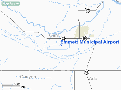
Location
& QuickFacts
|
FAA
Information Effective: |
2007-07-05 |
|
Airport
Identifier: |
S78 |
|
Airport
Status: |
Operational |
|
Longitude/Latitude: |
116-32-33.4900W/43-50-59.5900N
-116.542636/43.849886 (Estimated) |
|
Elevation: |
2350 ft / 716.28 m (Estimated) |
|
Land: |
80 acres |
|
From
nearest city: |
3 nautical miles SW of Emmett, ID |
|
Location: |
Gem County, ID |
|
Magnetic Variation: |
17E (1985) |
Owner
& Manager
|
Ownership: |
Publicly
owned |
|
Owner: |
City Of Emmett |
|
Address: |
501 East Main
Emmett, ID 83617 |
|
Phone
number: |
208-365-6050 |
|
Manager: |
Don Taylor
AIRPORT MANAGER ON CALL AFTER HOURS & WEEKENDS(208-365-4598). |
|
Address: |
P. O. Box 694
Emmett, ID 83617 |
|
Phone number: |
208-365-4598 |
Airport Operations and Facilities
|
Airport
Use: |
Open
to public |
|
Wind
indicator: |
Yes |
|
Segmented Circle: |
Yes |
|
Control
Tower: |
No |
|
Lighting
Schedule: |
DUSK-DAWN |
|
Beacon
Color: |
Clear-Green (lighted land airport) |
|
Landing
fee charge: |
No |
|
Sectional chart: |
Salt Lake City |
|
Region: |
ANM - Northwest Mountain |
|
Boundary
ARTCC: |
ZLC - Salt Lake City |
|
Tie-in
FSS: |
BOI - Boise |
|
FSS
on Airport: |
No |
|
FSS
Phone: |
208-332-0200 |
|
FSS
Toll Free: |
1-800-WX-BRIEF |
|
NOTAMs
Facility: |
BOI (NOTAM-d service avaliable) |
|
Federal Agreements: |
GY |
Airport Communications
Airport
Services
|
Airframe
Repair: |
MAJOR |
|
Power
Plant Repair: |
MAJOR |
|
Bulk
Oxygen: |
NONE |
|
Runway Information
Runway 10/28
|
Dimension: |
3250
x 50 ft / 990.6 x 15.2 m |
|
Surface: |
ASPH, Fair Condition |
|
Weight
Limit: |
Single wheel: 8000 lbs. |
|
Edge
Lights: |
Medium |
|
|
Runway 10 |
Runway 28 |
|
Traffic
Pattern: |
Left |
Left |
|
Markings: |
Basic, Fair Condition |
Basic, Fair Condition |
|
Displaced
threshold: |
385.00 ft |
260.00 ft
RWY 28 DISPLACED THLD MARKED WITH WHITE BAR AND WHITE CHEVRONS
ONLY. |
|
Obstruction: |
, 50:1 slope to clear
APCH SLOPE 50:1 AT DSPLCD THLD. |
3 ft fence, 200.0 ft from runway, 25 ft left
of centerline
RWY 28 +10' PRIVATE ROAD @ 0', 100L, 26:1 BASED ON DISPLACED
THRESHOLD
RWY 28 10 FT PVT ROAD AT 0', 100'L |
|
Radio Navigation
Aids
|
ID |
Type |
Name |
Ch |
Freq |
Var |
Dist |
|
MPA |
NDB |
Meridian |
|
238.00 |
16E |
14.8 nm |
|
BO |
NDB |
Ustik |
|
359.00 |
17E |
18.1 nm |
|
ONO |
NDB |
Ontario |
|
305.00 |
17E |
22.6 nm |
|
BOI |
VORTAC |
Boise |
080X |
113.30 |
17E |
23.5 nm |
|
BOI |
VOT |
Boise |
|
116.70 |
|
21.6 nm |
Remarks
- GOLF
COURSE ON BOTH SIDES OF RY.
- CONSIDERABLE
AGRI OPNS DAY & NGT IN SEASON.
- 1800'
X 20' PVT GRVL AGG RY LCTD ADJCNT NW OF ARPT.
- ESTABD
PRIOR TO 15 MAY 1959.
Based
Aircraft
|
Aircraft
based on field: |
21 |
|
Single
Engine Airplanes: |
21 |
Operational Statistics
Time Period: 2005-02-25
- 2006-02-24
|
Aircraft
Operations: |
218/Week |
|
Air
Taxi: |
2.7% |
|
General
Aviation Local: |
44.2% |
|
General
Aviation Itinerant: |
53.1% |
Emmett Municipal Airport
Address:
Gem County, ID
Tel:
208-365-6050,
208-365-4598
Images
and information placed above are from
http://www.airport-data.com/airport/S78/
We
thank them for the data!
| General
Info |
| Country |
United
States |
| State |
IDAHO
|
| FAA ID |
S78 |
| Latitude |
43-50-59.590N
|
| Longitude |
116-32-33.490W
|
| Elevation |
2350 feet
|
| Near City |
EMMETT
|
We don't guarantee the information is fresh and accurate. The data may
be wrong or outdated.
For more up-to-date information please refer to other sources.
|
|


