 |
|
|
|
Location
& QuickFacts
|
FAA
Information Effective: |
2007-07-05 |
|
Airport
Identifier: |
ID18 |
|
Airport
Status: |
Operational |
|
Longitude/Latitude: |
111-59-29.8900W/43-28-15.6910N
-111.991636/43.471025 (Estimated) |
|
Elevation: |
4713 ft / 1436.52 m (Estimated) |
|
Land: |
2 acres |
|
From
nearest city: |
2 nautical miles NW of Idaho Falls, ID |
|
Location: |
Bonneville County, ID |
|
Magnetic Variation: |
15E (1995) |
Owner
& Manager
|
Ownership: |
Privately
owned |
|
Owner: |
Healthtrust Inc |
|
Address: |
3100 Channing Way
Idaho Falls, ID 83404 |
|
Phone
number: |
208-529-6022 |
|
Manager: |
Erik C Gullikson |
|
Address: |
3100 Channing Way
Idaho Falls, ID 83404 |
|
Phone number: |
208-529-6022 |
Airport Operations and Facilities
|
Airport
Use: |
Private
MEDICAL. |
|
Wind
indicator: |
Yes |
|
Segmented Circle: |
No |
|
Control
Tower: |
No |
|
Lighting
Schedule: |
DUSK-DAWN
FOR PERIMETER LGTS CALL 208-529-6022. |
|
Sectional chart: |
Salt Lake City |
|
Region: |
ANM - Northwest Mountain |
|
Boundary
ARTCC: |
ZLC - Salt Lake City |
|
Tie-in
FSS: |
BOI - Boise |
|
FSS
Phone: |
208-332-0200 |
|
FSS
Toll Free: |
1-800-WX-BRIEF |
|
Runway Information
Helipad H1
|
Dimension: |
95
x 45 ft / 29.0 x 13.7 m |
|
Surface: |
CONC, Good Condition |
|
|
Runway H1 |
Runway |
|
Traffic
Pattern: |
Left |
Left |
|
Radio Navigation
Aids
|
ID |
Type |
Name |
Ch |
Freq |
Var |
Dist |
|
SWU |
NDB |
Sweden |
|
350.00 |
15E |
7.8 nm |
|
IDA |
VOR/DME |
Idaho Falls |
85Y |
113.85 |
15E |
4.3 nm |
|
DBS |
VORTAC |
Dubois |
116X |
116.90 |
15E |
38.3 nm |
|
PIH |
VORTAC |
Pocatello |
073X |
112.60 |
17E |
46.3 nm |
Based
Aircraft
|
Aircraft
based on field: |
1 |
|
Helicopters: |
1 |
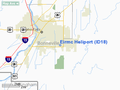
Eirmc Heliport
Address:
Bonneville County, ID
Tel:
208-529-6022
Images
and information placed above are from
http://www.airport-data.com/airport/ID18/
We
thank them for the data!
| General
Info |
| Country |
United
States |
| State |
IDAHO
|
| FAA ID |
ID18 |
| Latitude |
43-28-15.691N
|
| Longitude |
111-59-29.890W
|
| Elevation |
4713 feet
|
| Near City |
IDAHO
FALLS |
We don't guarantee the information is fresh and accurate. The data may
be wrong or outdated.
For more up-to-date information please refer to other sources.
|
|


