 |
|
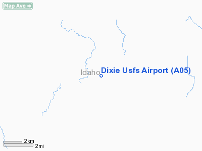
Dixie U.S. Forest Service Airport |
|
|
Location
& QuickFacts
|
FAA
Information Effective: |
2007-07-05 |
|
Airport
Identifier: |
A05 |
|
Airport
Status: |
Operational |
|
Longitude/Latitude: |
115-31-03.4560W/45-31-14.6660N
-115.517627/45.520741 (Estimated) |
|
Elevation: |
5148 ft / 1569.11 m (Surveyed) |
|
Land: |
35 acres |
|
From
nearest city: |
3 nautical miles SW of Dixie, ID |
|
Location: |
Idaho County, ID |
|
Magnetic Variation: |
18E (1985) |
Owner & Manager
|
Ownership: |
Publicly owned |
|
Owner: |
U S Forest Service |
|
Address: |
Federal Building
Missoula, MT 59801 |
|
Phone number: |
406-329-3511 |
|
Manager: |
Nezperce Forest, Air Officer |
|
Address: |
Rt 2, Box 475
Grangeville, ID 83530 |
|
Phone number: |
208-983-4060 |
Airport
Operations and Facilities
|
Airport
Use: |
Open
to public |
|
Wind
indicator: |
Yes |
|
Segmented Circle: |
No |
|
Control
Tower: |
No |
|
Landing
fee charge: |
No |
|
Sectional chart: |
Great Falls |
|
Region: |
ANM - Northwest Mountain |
|
Boundary
ARTCC: |
ZSE - Seattle |
|
Tie-in
FSS: |
BOI - Boise |
|
FSS
on Airport: |
No |
|
FSS
Phone: |
208-332-0200 |
|
FSS
Toll Free: |
1-800-WX-BRIEF |
|
NOTAMs
Facility: |
BOI (NOTAM-d service avaliable) |
Airport Communications
Airport Services
|
Airframe
Repair: |
NONE |
|
Power
Plant Repair: |
NONE |
|
Runway Information
Runway 18/36
|
Dimension: |
4500
x 100 ft / 1371.6 x 30.5 m |
|
Surface: |
TURF, Good Condition |
|
|
Runway 18 |
Runway 36 |
|
Traffic
Pattern: |
Left |
Left |
|
Obstruction: |
30 ft trees, 50.0 ft from runway, 1:1 slope
to clear |
550 ft hill, 3500.0 ft from runway, 6:1 slope
to clear |
|
Radio Navigation
Aids
|
ID |
Type |
Name |
Ch |
Freq |
Var |
Dist |
|
GVV |
NDB |
Grain |
|
280.00 |
18E |
38.8 nm |
|
IOM |
NDB |
Mc Call |
|
363.00 |
17E |
49.6 nm |
Remarks
- AIRSTRIP
IS LOCATED IN HIGH TIMBER MOUNTAIN BASIN.
- BASE
HELIPORT FOR INITIAL ATTACK FIRE SUPPRESSION, 1 COPTER WORKING JUN-SEP.
- RECOMMEND
LANDING RY 36; WHEN WIND CONDITIONS PERMIT.
- RECOMMEND
DEPARTURE ON RWY 18; MAKE RIGHT TURN DOWN CROOKED CREEK AFTER DEPARTURE.
- NO
WINTER MAINTENANCE.
- NO
TELEPHONE AVBL AT AIRPORT.
Based
Aircraft
|
Aircraft
based on field: |
1 |
|
Helicopters: |
1 |
Operational Statistics
Time Period: 2004-05-26
- 2005-05-25
|
Aircraft
Operations: |
25/Week |
|
Air
Taxi: |
23.1% |
|
General
Aviation Itinerant: |
76.9% |
Dixie U S Forest Service Airport
Address:
Idaho County, ID
Tel:
406-329-3511, 208-983-4060
Images
and information placed above are from
http://www.airport-data.com/airport/A05/
We
thank them for the data!
| General
Info |
| Country |
United
States |
| State |
IDAHO
|
| FAA ID |
A05 |
| Latitude |
45-31-14.666N
|
| Longitude |
115-31-03.456W
|
| Elevation |
5148 feet
|
| Near City |
DIXIE
|
We don't guarantee the information is fresh and accurate. The data may
be wrong or outdated.
For more up-to-date information please refer to other sources.
|
|


