 |
|
|
|
|
|
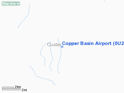
Location
& QuickFacts
|
FAA
Information Effective: |
2007-07-05 |
|
Airport
Identifier: |
0U2 |
|
Airport
Status: |
Operational |
|
Longitude/Latitude: |
113-49-53.1260W/43-48-06.6620N
-113.831424/43.801851 (Estimated) |
|
Elevation: |
7920 ft / 2414.02 m (Estimated) |
|
Land: |
20 acres |
|
From
nearest city: |
12 nautical miles SW of Mackay, ID |
|
Location: |
Custer County, ID |
|
Magnetic Variation: |
16E (1985) |
Owner
& Manager
|
Ownership: |
Publicly
owned |
|
Owner: |
State Of Id,itd Div Aero |
|
Address: |
P O Box 7129
Boise, ID 83707-1129 |
|
Phone
number: |
208-334-8775 |
|
Manager: |
Div Admin |
|
Address: |
P O Box 7129
Boise, ID 83707-1129 |
|
Phone number: |
208-334-8775 |
Airport Operations and Facilities
|
Airport
Use: |
Open
to public |
|
Wind
indicator: |
Yes |
|
Segmented Circle: |
Yes |
|
Control
Tower: |
No |
|
Landing
fee charge: |
No |
|
Sectional chart: |
Salt Lake City |
|
Region: |
ANM - Northwest Mountain |
|
Boundary
ARTCC: |
ZLC - Salt Lake City |
|
Tie-in
FSS: |
BOI - Boise |
|
FSS
on Airport: |
No |
|
FSS
Phone: |
208-332-0200 |
|
FSS
Toll Free: |
1-800-WX-BRIEF |
|
NOTAMs
Facility: |
BOI (NOTAM-d service avaliable) |
Airport Communications
Airport Services
|
Airframe
Repair: |
NONE |
|
Power
Plant Repair: |
NONE |
|
Bottled
Oxygen: |
NONE |
|
Bulk
Oxygen: |
NONE |
|
Runway Information
Runway 12/30
|
Dimension: |
4700
x 100 ft / 1432.6 x 30.5 m |
|
Surface: |
TURF, Fair Condition |
|
|
Runway 12 |
Runway 30 |
|
Traffic
Pattern: |
Left |
Left |
|
Obstruction: |
14 ft road, 100 ft left of centerline |
, 50:1 slope to clear |
|
Radio Navigation
Aids
|
ID |
Type |
Name |
Ch |
Freq |
Var |
Dist |
|
AOC |
NDB |
Arco |
|
200.00 |
15E |
24.5 nm |
|
LLJ |
NDB |
Challis |
|
397.00 |
17E |
46.2 nm |
|
HLE |
NDB/DME |
Hailey |
025X |
220.00 |
16E |
33.6 nm |
Remarks
- NO
WINTER MAINTENANCE.
- NOTE:
DENSITY ALT MAY EXCEED 10000' DURG SUMMER.
- ARPT
LCTD IN HIGH MTN VALLEY SURROUNDED BY HIGH MTNS.
- LIVESTOCK
ON & INVOF ARPT.
- TWY
TO MIDFIELD TIEDOWNS 15 FT WIDE; -1 FT DITCH ADJACENT TO EDGES OF TWY.
- ESTABD
PRIOR TO 12/31/58.
Operational Statistics
Time Period: 2004-08-18
- 2005-08-17
|
Aircraft
Operations: |
16/Week |
|
Air
Taxi: |
25.0% |
|
General
Aviation Itinerant: |
75.0% |
Copper Basin Airport
Address:
Custer County, ID
Tel:
208-334-8775
Images
and information placed above are from
http://www.airport-data.com/airport/0U2/
We
thank them for the data!
| General
Info |
| Country |
United
States |
| State |
IDAHO
|
| FAA ID |
0U2 |
| Latitude |
43-48-06.662N
|
| Longitude |
113-49-53.126W
|
| Elevation |
7920 feet
|
| Near City |
MACKAY
|
We don't guarantee the information is fresh and accurate. The data may
be wrong or outdated.
For more up-to-date information please refer to other sources.
|
|


