 |
|
Cold Meadows U.S. Forest Service Airport |
|
|
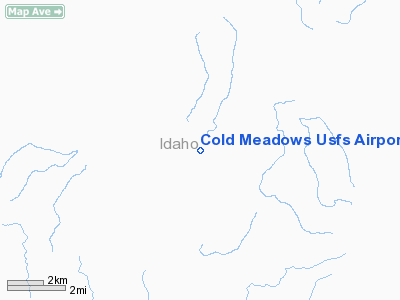
Location
& QuickFacts
|
FAA
Information Effective: |
2007-07-05 |
|
Airport
Identifier: |
U81 |
|
Airport
Status: |
Operational |
|
Longitude/Latitude: |
114-56-58.3710W/45-17-29.6890N
-114.949547/45.291580 (Estimated) |
|
Elevation: |
7030 ft / 2142.74 m (Surveyed) |
|
Land: |
22 acres |
|
From
nearest city: |
0 nautical miles NW of Cold Meadows Guard
Station, ID |
|
Location: |
Idaho County, ID |
|
Magnetic Variation: |
17E (1985) |
Owner
& Manager
|
Ownership: |
Publicly
owned |
|
Owner: |
U S Forest Service |
|
Address: |
324 25th St
Ogden, UT 84401 |
|
Phone
number: |
801-625-5511 |
|
Manager: |
Krassel District Ranger |
|
Address: |
500 North Mission St.
Mc Call, ID 83638 |
|
Phone number: |
208-634-0600 |
Airport Operations and Facilities
|
Airport
Use: |
Open
to public |
|
Wind
indicator: |
Yes |
|
Segmented Circle: |
Yes |
|
Control
Tower: |
No |
|
Landing
fee charge: |
No |
|
Sectional chart: |
Great Falls |
|
Region: |
ANM - Northwest Mountain |
|
Boundary
ARTCC: |
ZLC - Salt Lake City |
|
Tie-in
FSS: |
BOI - Boise |
|
FSS
on Airport: |
No |
|
FSS
Phone: |
208-332-0200 |
|
FSS
Toll Free: |
1-800-WX-BRIEF |
|
NOTAMs
Facility: |
BOI (NOTAM-d service avaliable) |
Airport Communications
Airport Services
|
Airframe
Repair: |
NONE |
|
Power
Plant Repair: |
NONE |
|
Bottled
Oxygen: |
NONE |
|
Bulk
Oxygen: |
NONE |
|
Runway Information
Runway 16/34
|
Dimension: |
4550 x 90 ft / 1386.8 x 27.4 m
RY 16/34 SOUTH 3500 FT VERY ROUGH.
CENTER 20 FT PORTION OF RY LENGTH IS DIRT. |
|
Surface: |
TURF-DIRT, Fair Condition |
|
|
Runway 16 |
Runway 34 |
|
Traffic
Pattern: |
Left |
Left |
|
Obstruction: |
25 ft trees, 60 ft right of centerline |
65 ft hill, 450.0 ft from runway, 6:1 slope
to clear |
|
Radio Navigation
Aids
|
ID |
Type |
Name |
Ch |
Freq |
Var |
Dist |
|
LKT |
VOR/DME |
Salmon |
082X |
113.50 |
18E |
40.1 nm |
Remarks
- NO
WINTER MAINTENANCE.
- VERY
HIGH DENSITY ALT FACTOR DURING SUMMER MONTHS.
- RODENT
ACTIVITY ON AND INVOF ARPT.
- BE
ADVISED USFS RECOMMENDS LEFT TURNOUT DOWN COTTON WOOD CREEK AFTER DEPARTING
RY 16.
- +60'
TREES ADJ TO BOTH SIDES OF RY 16/34.
- NO
TELEPHONE AVBL AT ARPT.
- RY
MAY BE SOFT IN EARLY SPRING.
- RUBBER
WATER BAR STRIPS ON RY.
- BIG
GAME ANIMALS AND LIVESTOCK ON & INVOF RY.
- ESTABD
PRIOR TO 31 DEC 1958.
Operational Statistics
Time Period: 2003-09-25
- 2004-09-23
|
Aircraft
Operations: |
39/Week |
|
Air
Taxi: |
50.0% |
|
General
Aviation Itinerant: |
50.0% |
Cold Meadows U S Forest Service Airport
Address:
Idaho County, ID
Tel:
801-625-5511,
208-634-0600
Images
and information placed above are from
http://www.airport-data.com/airport/U81/
We
thank them for the data!
| General
Info |
| Country |
United
States |
| State |
IDAHO
|
| FAA ID |
U81 |
| Latitude |
45-17-29.689N
|
| Longitude |
114-56-58.371W
|
| Elevation |
7030 feet
|
| Near City |
COLD MEADOWS
GUARD STATION |
We don't guarantee the information is fresh and accurate. The data may
be wrong or outdated.
For more up-to-date information please refer to other sources.
|
|


