 |
|
Cayuse Creek U.S. Forest Service Airport |
|
|
Location
& QuickFacts
|
FAA
Information Effective: |
2007-07-05 |
|
Airport
Identifier: |
2ID7 |
|
Airport
Status: |
Operational |
|
Longitude/Latitude: |
115-04-23.4520W/46-39-59.7030N
-115.073181/46.666584 (Estimated) |
|
Elevation: |
3500 ft / 1066.80 m (Surveyed) |
|
Land: |
10 acres |
|
From
nearest city: |
0 nautical miles N of Cayuse Creek, ID |
|
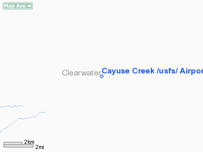
Location: |
Clearwater County, ID |
|
Magnetic Variation: |
18E (1985) |
Owner & Manager
|
Ownership: |
Publicly owned |
|
Owner: |
U S Forest Service |
|
Address: |
12730 Highway 12
Orofino, ID 83544 |
|
Phone number: |
208-476-4541 |
|
Manager: |
Chuck Petersen |
|
Address: |
12730 Highway 12
Orofino, ID 83544 |
|
Phone number: |
208-476-4541 |
Airport
Operations and Facilities
|
Airport
Use: |
Private |
|
Wind
indicator: |
Yes |
|
Segmented Circle: |
Yes
NON STD SEGMENTED CIRCLE. |
|
Control Tower: |
No |
|
Landing fee charge: |
No |
|
Sectional chart: |
Great Falls |
|
Region: |
ANM - Northwest Mountain |
|
Boundary ARTCC: |
ZSE - Seattle |
|
Tie-in FSS: |
BOI - Boise |
|
FSS on Airport: |
No |
|
FSS Phone: |
208-332-0200 |
|
FSS Toll Free: |
1-800-WX-BRIEF |
Airport Services
|
Airframe
Repair: |
NONE |
|
Power
Plant Repair: |
NONE |
|
Bottled
Oxygen: |
NONE |
|
Bulk
Oxygen: |
NONE |
|
Runway Information
Runway 02/20
|
Dimension: |
1800
x 100 ft / 548.6 x 30.5 m |
|
Surface: |
TURF, Poor Condition |
|
|
Runway 02 |
Runway 20 |
|
Traffic
Pattern: |
Left |
Left |
|
Runway
End Identifier: |
No |
No |
|
Centerline
Lights: |
No |
No |
|
Touchdown
Lights: |
No |
No |
|
Radio Navigation
Aids
|
ID |
Type |
Name |
Ch |
Freq |
Var |
Dist |
|
INE |
NDB |
Konna |
|
521.00 |
17E |
37.9 nm |
|
HMM |
NDB |
Hamilton |
|
410.00 |
19E |
46.0 nm |
|
MSO |
VOR/DME |
Missoula |
075X |
112.80 |
17E |
43.2 nm |
Remarks
- NORMAL
LNDG RWY 20.
- RECOMMENDED
FOR EMERG USE ONLY TO EXPERIENCED PILOTS WITH EARLY MORNING & LATE
EVENING OPNS DURG SUMMER MONTHS.
- NO
WINTER MAINTENANCE.
- ESTABD
PRIOR TO 1959.
Operational
Statistics
|
Aircraft
Operations: |
10/Week |
|
General
Aviation Itinerant: |
100.0% |
Cayuse Creek U S Forest Service Airport
Address:
Clearwater County, ID
Tel:
208-476-4541
Images
and information placed above are from
http://www.airport-data.com/airport/2ID7/
We
thank them for the data!
| General
Info |
| Country |
United
States |
| State |
IDAHO
|
| FAA ID |
2ID7 |
| Latitude |
46-39-59.703N
|
| Longitude |
115-04-23.452W
|
| Elevation |
3500 feet
|
| Near City |
CAYUSE
CREEK |
We don't guarantee the information is fresh and accurate. The data may
be wrong or outdated.
For more up-to-date information please refer to other sources.
|
|


