 |
|
|
|
|
|
Location
& QuickFacts
|
FAA
Information Effective: |
2007-07-05 |
|
Airport
Identifier: |
U70 |
|
Airport
Status: |
Operational |
|
Longitude/Latitude: |
116-00-58.4720W/44-29-37.6170N
-116.016242/44.493783 (Estimated) |
|
Elevation: |
4742 ft / 1445.36 m (Surveyed) |
|
Land: |
75 acres |
|
From
nearest city: |
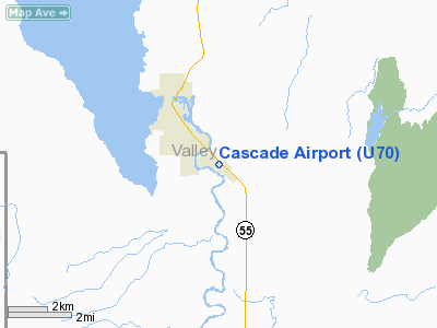
2 nautical miles SE of Cascade, ID |
|
Location: |
Valley County, ID |
|
Magnetic Variation: |
17E (1985) |
Owner & Manager
|
Ownership: |
Publicly owned |
|
Owner: |
City Of Cascade |
|
Address: |
Po Box 649
Cascade, ID 83611 |
|
Phone number: |
208-382-4279 |
|
Manager: |
Ray Arnold |
|
Address: |
Box 1094
Cascade, ID 83611 |
|
Phone number: |
208-382-4844 |
Airport
Operations and Facilities
|
Airport
Use: |
Open
to public |
|
Wind
indicator: |
Yes |
|
Segmented Circle: |
Yes |
|
Control
Tower: |
No |
|
Lighting
Schedule: |
DUSK-DAWN |
|
Beacon
Color: |
Clear-Green (lighted land airport) |
|
Landing
fee charge: |
No |
|
Sectional chart: |
Salt Lake City |
|
Region: |
ANM - Northwest Mountain |
|
Boundary
ARTCC: |
ZLC - Salt Lake City |
|
Tie-in
FSS: |
BOI - Boise |
|
FSS
on Airport: |
No |
|
FSS
Phone: |
208-332-0200 |
|
FSS
Toll Free: |
1-800-WX-BRIEF |
|
NOTAMs
Facility: |
BOI (NOTAM-d service avaliable) |
|
Federal Agreements: |
NGY |
Airport Communications
Airport
Services
|
Fuel
available: |
100LLA |
|
Airframe
Repair: |
MINOR |
|
Power
Plant Repair: |
MAJOR |
|
Bottled
Oxygen: |
LOW |
|
Bulk
Oxygen: |
NONE |
|
Runway Information
Runway 12/30
|
Dimension: |
4300
x 60 ft / 1310.6 x 18.3 m |
|
Surface: |
ASPH, Fair Condition |
|
Weight
Limit: |
Single wheel: 12500 lbs. |
|
Edge
Lights: |
Medium |
|
|
Runway 12 |
Runway 30 |
|
Traffic
Pattern: |
Left |
Right |
|
Markings: |
Basic, Fair Condition |
Basic, Fair Condition |
|
Obstruction: |
, 50:1 slope to clear |
4 ft fence, 300.0 ft from runway, 25:1 slope
to clear |
|
Radio Navigation
Aids
|
ID |
Type |
Name |
Ch |
Freq |
Var |
Dist |
|
IOM |
NDB |
Mc Call |
|
363.00 |
17E |
19.1 nm |
|
DNJ |
VORTAC |
Donnelly |
109X |
116.20 |
19E |
18.3 nm |
Remarks
- RETROREFLECTIVE
REFLECTORS ON TWYS & RAMP EDGES.
- RY
12 +300 FT RIDGE AT 1.25 MILES ON CNTRLN.
- ESTABD
PRIOR TO 15 MAY 1959.
Based
Aircraft
|
Aircraft
based on field: |
13 |
|
Single
Engine Airplanes: |
12 |
|
Multi
Engine Airplanes: |
1 |
Operational Statistics
Time Period: 2003-11-19
- 2004-11-17
|
Aircraft
Operations: |
258/Week |
|
Air
Taxi: |
44.8% |
|
General
Aviation Local: |
8.2% |
|
General
Aviation Itinerant: |
47.0% |
Cascade Airport
Address:
Valley County, ID
Tel:
208-382-4279, 208-382-4844
Images
and information placed above are from
http://www.airport-data.com/airport/U70/
We
thank them for the data!
| General
Info |
| Country |
United
States |
| State |
IDAHO
|
| FAA ID |
U70 |
| Latitude |
44-29-37.617N
|
| Longitude |
116-00-58.472W
|
| Elevation |
4742 feet
|
| Near City |
CASCADE
|
We don't guarantee the information is fresh and accurate. The data may
be wrong or outdated.
For more up-to-date information please refer to other sources.
|
|


