 |
|
|
|
|
|
Location
& QuickFacts
|
FAA
Information Effective: |
2007-07-05 |
|
Airport
Identifier: |
U92 |
|
Airport
Status: |
Operational |
|
Longitude/Latitude: |
113-36-06.0790W/43-40-33.6470N
-113.601689/43.676013 (Estimated) |
|
Elevation: |
6180 ft / 1883.66 m (Estimated) |
|
Land: |
24 acres |
|
From
nearest city: |
1 nautical miles W of Grouse, ID |
|
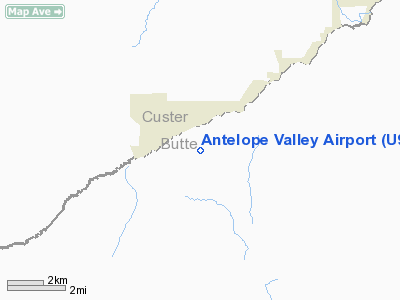
Location: |
Butte County, ID |
|
Magnetic Variation: |
16E (1985) |
Owner
& Manager
|
Ownership: |
Publicly
owned |
|
Owner: |
State Of Id,itd Div Aero |
|
Address: |
P O Box 7129
Boise, ID 83707-1129 |
|
Phone
number: |
208-334-8775 |
|
Manager: |
Div Admin |
|
Address: |
P O Box 7129
Boise, ID 83707-1129 |
|
Phone number: |
208-334-8775 |
Airport Operations and Facilities
|
Airport
Use: |
Open
to public |
|
Wind
indicator: |
Yes |
|
Segmented Circle: |
Yes |
|
Control
Tower: |
No |
|
Landing
fee charge: |
No |
|
Sectional chart: |
Salt Lake City |
|
Region: |
ANM - Northwest Mountain |
|
Boundary
ARTCC: |
ZLC - Salt Lake City |
|
Tie-in
FSS: |
BOI - Boise |
|
FSS
on Airport: |
No |
|
FSS
Phone: |
208-332-0200 |
|
FSS
Toll Free: |
1-800-WX-BRIEF |
|
NOTAMs
Facility: |
BOI (NOTAM-d service avaliable) |
Airport Communications
Airport Services
|
Airframe
Repair: |
NONE |
|
Power
Plant Repair: |
NONE |
|
Bottled
Oxygen: |
NONE |
|
Bulk
Oxygen: |
NONE |
|
Runway Information
Runway 05/23
|
Dimension: |
3450
x 130 ft / 1051.6 x 39.6 m |
|
Surface: |
TURF, Good Condition |
|
|
Runway 05 |
Runway 23 |
|
Traffic
Pattern: |
Left |
Left |
|
Obstruction: |
15 ft road, 120 ft right of centerline |
20 ft pline, 370.0 ft from runway, 18:1 slope
to clear |
|
Radio Navigation
Aids
|
ID |
Type |
Name |
Ch |
Freq |
Var |
Dist |
|
AOC |
NDB |
Arco |
|
200.00 |
15E |
12.2 nm |
|
HLE |
NDB/DME |
Hailey |
025X |
220.00 |
16E |
34.9 nm |
Remarks
- NO
WINTER MAINT.
- RECOMMEND
LNDG RWY 05; TKOF RWY 23 WHEN WIND CONDITIONS ALLOW.
- ARPT
LCTD IN MOUNTAIN VALLEY SURROUNDED BY HIGH TERRAIN.
- FARM
MACHINERY & TRUCKS FREQUENTLY PARKED ON THE APCH TO RY 23.
- +5
FT SAGEBRUSH ADJACENT TO BOTH RY EDGES AND RY 05 THLD.
- RY
05 +5 FT BRUSH 0 FT ON CNTRLN; +4 FT FENCE 0 FT 115 FT R.
- RY
23 +30 FT PLINE 250 FT 50 FT L; +4 FT FENCE 100 FT ON CNTRLN; +15 FT
ROAD 200 FT ON CNTRLN; 450 FT MTN 4000 FT 200 FT L.
- ESTABD
PRIOR TO 1959.
Operational Statistics
Time Period: 2004-08-18
- 2005-08-17
|
Aircraft
Operations: |
15/Week |
|
General
Aviation Itinerant: |
100.0% |
Antelope Valley Airport
Address:
Butte County, ID
Tel:
208-334-8775
Images
and information placed above are from
http://www.airport-data.com/airport/U92/
We
thank them for the data!
| General
Info |
| Country |
United
States |
| State |
IDAHO
|
| FAA ID |
U92 |
| Latitude |
43-40-33.647N
|
| Longitude |
113-36-06.079W
|
| Elevation |
6180 feet
|
| Near City |
GROUSE
|
We don't guarantee the information is fresh and accurate. The data may
be wrong or outdated.
For more up-to-date information please refer to other sources.
|
|


