 |
|
|
|
|
|
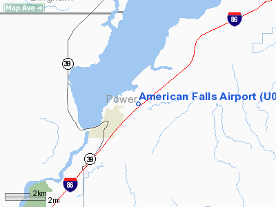
Location
& QuickFacts
|
FAA
Information Effective: |
2007-07-05 |
|
Airport
Identifier: |
U01 |
|
Airport
Status: |
Operational |
|
Longitude/Latitude: |
112-49-30.6720W/42-47-50.3400N
-112.825187/42.797317 (Estimated) |
|
Elevation: |
4419 ft / 1346.91 m (Estimated) |
|
Land: |
228 acres |
|
From
nearest city: |
2 nautical miles NE of American Falls, ID |
|
Location: |
Power County, ID |
|
Magnetic Variation: |
16E (1985) |
Owner
& Manager
|
Ownership: |
Publicly
owned |
|
Owner: |
Power County |
|
Address: |
543 Bannock Avenue
American Falls, ID 83211 |
|
Phone
number: |
208-226-7611 |
|
Manager: |
Stan Bearup |
|
Address: |
2683 Airport Rd
American Falls, ID 83211-5401 |
|
Phone number: |
208-220-0837 |
Airport Operations and Facilities
|
Airport
Use: |
Open
to public |
|
Wind
indicator: |
Yes |
|
Segmented Circle: |
Yes |
|
Control
Tower: |
No |
|
Lighting
Schedule: |
DUSK-DAWN
ACTVT MIRL RY 03/21 & TRCV RY 21 - CTAF. |
|
Beacon
Color: |
Clear-Green (lighted land airport) |
|
Landing
fee charge: |
No |
|
Sectional chart: |
Salt Lake City |
|
Region: |
ANM - Northwest Mountain |
|
Boundary
ARTCC: |
ZLC - Salt Lake City |
|
Tie-in
FSS: |
BOI - Boise |
|
FSS
on Airport: |
No |
|
FSS
Phone: |
208-332-0200 |
|
FSS
Toll Free: |
1-800-WX-BRIEF |
|
NOTAMs
Facility: |
BOI (NOTAM-d service avaliable) |
Airport Communications
|
CTAF: |
122.800 |
|
Unicom: |
122.800 |
Airport Services
|
Fuel
available: |
100LLA |
|
Airframe
Repair: |
MAJOR |
|
Power
Plant Repair: |
MAJOR |
|
Bottled
Oxygen: |
NONE |
|
Bulk
Oxygen: |
NONE |
|
Runway Information
Runway 03/21
|
Dimension: |
4900
x 50 ft / 1493.5 x 15.2 m |
|
Surface: |
ASPH, Good Condition |
|
Edge
Lights: |
Medium |
|
|
Runway 03 |
Runway 21 |
|
Longitude: |
112-49-56.4160W |
112-49-04.9280W |
|
Latitude: |
42-47-35.3060N |
42-48-05.3720N |
|
Elevation: |
4413.00 ft |
4413.00 ft |
|
Alignment: |
52 |
127 |
|
Traffic
Pattern: |
Left |
Left |
|
Markings: |
Basic, Good Condition |
Basic, Good Condition |
|
Crossing
Height: |
0.00 ft |
24.00 ft |
|
VASI: |
|
tri-color on left side |
|
Visual
Glide Angle: |
0.00° |
3.50° |
|
Obstruction: |
4 ft fence, 200.0 ft from runway, 30 ft right
of centerline
HAS A 4 FT HIGH FENCE 0 FT FROM THLD AND 30 FT R. |
24 ft hill, 700.0 ft from runway, 20:1 slope
to clear |
|
Radio Navigation
Aids
|
ID |
Type |
Name |
Ch |
Freq |
Var |
Dist |
|
SWU |
NDB |
Sweden |
|
350.00 |
15E |
48.0 nm |
|
MLD |
VOR/DME |
Malad City |
121X |
117.40 |
17E |
39.5 nm |
|
BYI |
VOR/DME |
Burley |
088X |
114.10 |
18E |
47.8 nm |
|
PIH |
VORTAC |
Pocatello |
073X |
112.60 |
17E |
8.8 nm |
Remarks
- ULTRALITE
AGRICULTURE ACFT & HELICOPTERS OPS DURING SUMMER MONTHS.
- IRREGULAR
SNOW REMOVAL.
- NO
LINE OF SITE BETWEEN RUNWAY ENDS.
- ESTABD
PRIOR TO 1959.
Based
Aircraft
|
Aircraft
based on field: |
32 |
|
Single
Engine Airplanes: |
29 |
|
Multi
Engine Airplanes: |
1 |
|
Helicopters: |
2 |
Operational Statistics
Time Period: 2006-01-28
- 2007-01-27
|
Aircraft
Operations: |
50/Day |
|
General
Aviation Local: |
27.7% |
|
General
Aviation Itinerant: |
72.1% |
|
Military: |
0.1% |
American Falls Airport
Address:
Power County, ID
Tel:
208-226-7611,
208-220-0837
Images
and information placed above are from
http://www.airport-data.com/airport/U01/
We
thank them for the data!
| General
Info |
| Country |
United
States |
| State |
IDAHO
|
| FAA ID |
U01 |
| Latitude |
42-47-50.340N
|
| Longitude |
112-49-30.672W
|
| Elevation |
4419 feet
|
| Near City |
AMERICAN
FALLS |
We don't guarantee the information is fresh and accurate. The data may
be wrong or outdated.
For more up-to-date information please refer to other sources.
|
|


