 |
|
|
|
|
|
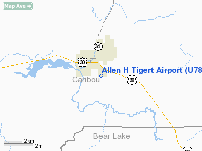
Location
& QuickFacts
|
FAA
Information Effective: |
2007-07-05 |
|
Airport
Identifier: |
U78 |
|
Airport
Status: |
Operational |
|
Longitude/Latitude: |
111-34-47.8040W/42-38-29.7160N
-111.579946/42.641588 (Estimated) |
|
Elevation: |
5839 ft / 1779.73 m (Surveyed) |
|
Land: |
130 acres |
|
From
nearest city: |
1 nautical miles SE of Soda Springs, ID |
|
Location: |
Caribou County, ID |
|
Magnetic Variation: |
15E (1985) |
Owner
& Manager
|
Ownership: |
Publicly
owned |
|
Owner: |
City Of Soda Springs |
|
Address: |
9 West 2nd South
Soda Springs, ID 83276 |
|
Phone
number: |
208-547-2600 |
|
Manager: |
Debbie Lish |
|
Address: |
9 West 2nd South
Soda Springs, ID 83276 |
|
Phone number: |
208-547-2600 |
Airport Operations and Facilities
|
Airport
Use: |
Open
to public |
|
Wind
indicator: |
Yes |
|
Segmented Circle: |
Yes |
|
Control
Tower: |
No |
|
Lighting
Schedule: |
DUSK-DAWN
ACTVT LIRL RY 16/34 & TRCV RYS 16 & 34 - CLICK CTAF
5 TIMES. |
|
Beacon
Color: |
Clear-Green (lighted land airport) |
|
Landing
fee charge: |
No |
|
Sectional chart: |
Salt Lake City |
|
Region: |
ANM - Northwest Mountain |
|
Boundary
ARTCC: |
ZLC - Salt Lake City |
|
Tie-in
FSS: |
BOI - Boise |
|
FSS
on Airport: |
No |
|
FSS
Phone: |
208-332-0200 |
|
FSS
Toll Free: |
1-800-WX-BRIEF |
|
NOTAMs
Facility: |
U78 (NOTAM-d service avaliable) |
|
Federal Agreements: |
1 |
Airport Communications
|
CTAF: |
122.800 |
|
Unicom: |
122.800 |
Airport Services
|
Fuel
available: |
100 |
|
Airframe
Repair: |
NONE |
|
Power
Plant Repair: |
NONE |
|
Bottled
Oxygen: |
NONE |
|
Bulk
Oxygen: |
NONE |
|
Runway Information
Runway 13/31
|
Dimension: |
2500
x 50 ft / 762.0 x 15.2 m |
|
Surface: |
ASPH, Fair Condition |
|
|
Runway 13 |
Runway 31 |
|
Traffic
Pattern: |
Left |
Left |
|
Markings: |
Basic, Good Condition |
Basic, Good Condition |
|
Obstruction: |
41 ft tree, 1200.0 ft from runway, 50 ft left
of centerline, 24:1 slope to clear
+12' PARKED ACFT AT 0' 115' L. |
28 ft rr, 600.0 ft from runway, 14:1 slope
to clear
+9' ROAD AT 60' ON CNTRLN. |
|
Runway 16/34
|
Dimension: |
3500
x 50 ft / 1066.8 x 15.2 m |
|
Surface: |
ASPH, Fair Condition |
|
Weight
Limit: |
Single wheel: 12000 lbs. |
|
Edge
Lights: |
Non-standard lighting system
NSTD LIRL FIRST 300 FT RY 16 NOT LIGHTED. |
|
|
Runway 16 |
Runway 34 |
|
Traffic
Pattern: |
Left |
Left |
|
Markings: |
Basic, Poor Condition
MARKING BADLY FADED |
Basic, Poor Condition
MARKING BADLY FADED |
|
Crossing
Height: |
25.00 ft |
15.00 ft |
|
Displaced
threshold: |
300.00 ft
THLD DSPLCD 300 FT AT NIGHT; 3200 FT OF RY 16/34 LGTD AT NIGHT. |
0.00 ft |
|
VASI: |
tri-color on left side |
tri-color on left side |
|
Visual
Glide Angle: |
4.00° |
3.00° |
|
Obstruction: |
16 ft road, 200.0 ft from runway, 100 ft right
of centerline
31:1 FM DSPLCD THR.
+16' HWY CROSSES PRIM SFC 50' FM EOR; NUMEROUS HIGH VEHICLES;
NUMEROUS CLOSE IN OBSTNS ON APCH TO RY 16. |
, 50:1 slope to clear |
|
Radio Navigation
Aids
|
ID |
Type |
Name |
Ch |
Freq |
Var |
Dist |
|
MLD |
VOR/DME |
Malad City |
121X |
117.40 |
17E |
46.9 nm |
|
LGU |
VOR/DME |
Logan |
035X |
109.80 |
16E |
49.6 nm |
|
PIH |
VORTAC |
Pocatello |
073X |
112.60 |
17E |
49.3 nm |
Remarks
- SHARPLY
DESCENDING TRRN NEAR END RYS 31 & 34.
- NUMEROUS
OBSTNS ON APCH TO RYS 13 & 16.
- ESTABD
PRIOR TO 15 MAY 1959.
Based
Aircraft
|
Aircraft
based on field: |
8 |
|
Single
Engine Airplanes: |
8 |
Operational Statistics
Time Period: 2003-05-08
- 2004-05-06
|
Aircraft
Operations: |
199/Week |
|
General
Aviation Local: |
22.3% |
|
General
Aviation Itinerant: |
77.7% |
Allen H Tigert Airport
Address:
Caribou County, ID
Tel:
208-547-2600
Images
and information placed above are from
http://www.airport-data.com/airport/U78/
We
thank them for the data!
| General
Info |
| Country |
United
States |
| State |
IDAHO
|
| FAA ID |
U78 |
| Latitude |
42-38-29.716N
|
| Longitude |
111-34-47.804W
|
| Elevation |
5839 feet
|
| Near City |
SODA SPRINGS
|
We don't guarantee the information is fresh and accurate. The data may
be wrong or outdated.
For more up-to-date information please refer to other sources.
|
|


