|
|
| Barrow County Airport |
 |
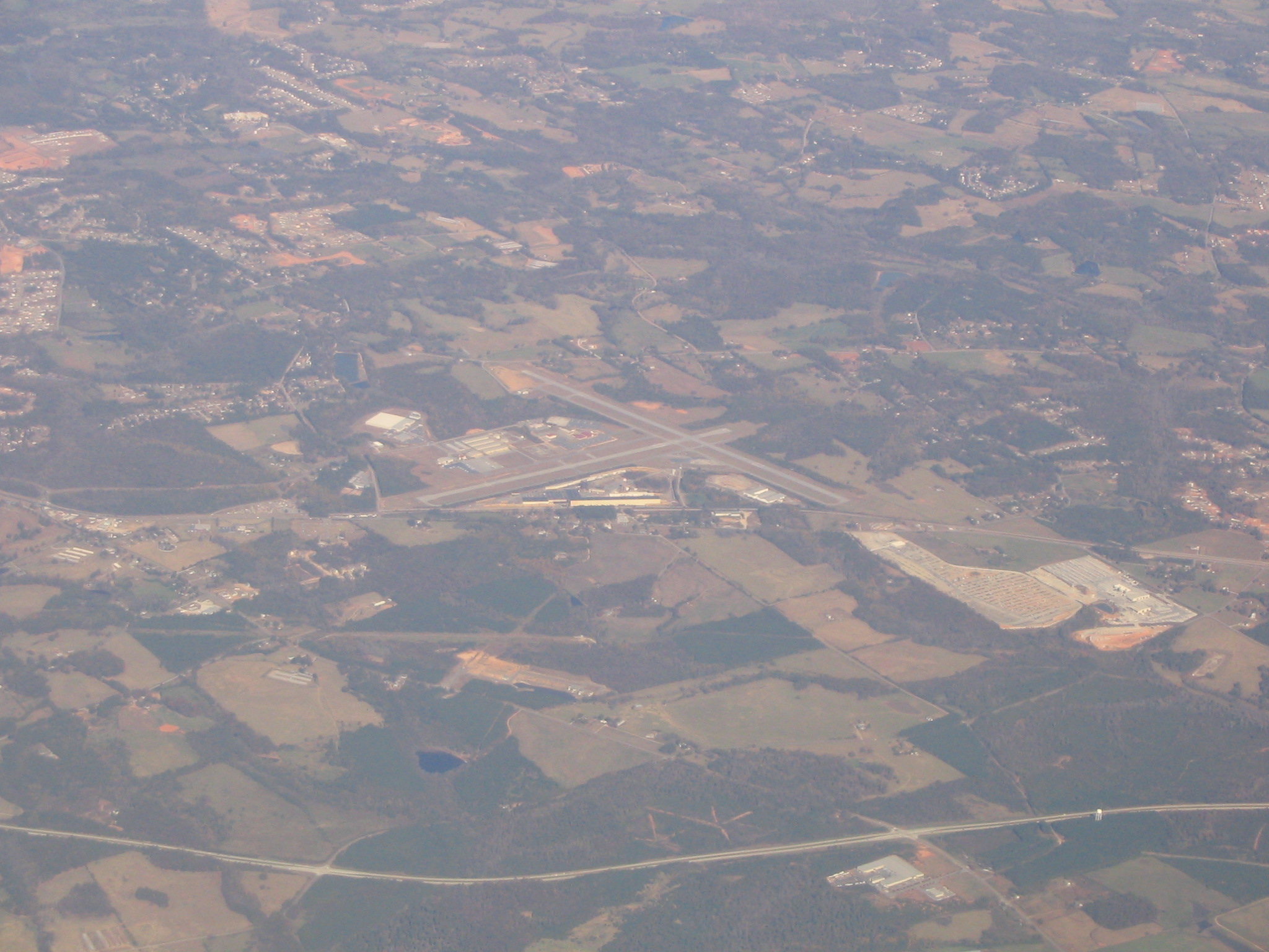
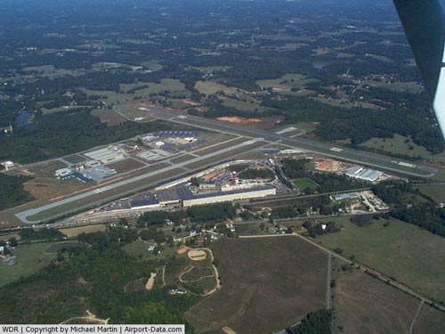
| Aerial view, November 2005 |
| IATA: WDR â ICAO: KWDR â FAA LID: WDR |
| Summary |
| Airport type |
Public |
| Owner |
Barrow County Airport Authority |
| Serves |
Barrow County, Georgia |
| Location |
Winder, Georgia |
| Elevation AMSL |
943 ft / 287 m |
| Coordinates |
33°58â²58â³N 083°40â²03â³W / 33.98278°N 83.6675°W / 33.98278; -83.6675 |
| Website |
www.WDRairport.com |
| Runways |
| Direction |
Length |
Surface |
| ft |
m |
| 13/31 |
5,500 |
1,676 |
Asphalt |
| 5/23 |
3,610 |
1,100 |
Asphalt |
| Statistics (2009) |
| Aircraft operations |
28,400 |
| Based aircraft |
88 |
| Source: FAA and airport website |
Barrow County Airport (IATA: WDR, ICAO: KWDR, FAA LID: WDR) is a public use airport in Barrow County, Georgia, United States. It is owned by the Barrow County Airport Authority and located three nautical miles (6 km) east of the central business district of Winder, Georgia. According to the FAA's National Plan of Integrated Airport Systems for 2009â2013, it is categorized as a general aviation airport.
The airport was previously known as Northeast Georgia Regional Airport and prior to December 2005 it was known as Winder-Barrow Airport. It is home to The Flight School (a Cessna Pilot Center), and the 148th medical company (air ambulance) of the Georgia Army National Guard.
Facilities and aircraft
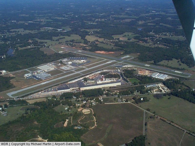
Barrow County Airport covers an area of 374 acres (151 ha) at an elevation of 943 feet (287 m) above mean sea level. It has two asphalt paved runways: 13/31 is 5,500 by 100 feet (1,676 x 30 m) and 5/23 is 3,610 by 100 feet (1,100 x 30 m).
For the 12-month period ending April 22, 2009, the airport had 28,400 aircraft operations, an average of 77 per day: 82% general aviation and 18% military. At that time there were 88 aircraft based at this airport: 83% single-engine, 8% multi-engine, 3% helicopter and 6% military.
The above content comes from Wikipedia and is published under free licenses – click here to read more.
|
 |
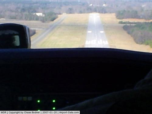
(Click on the photo to enlarge) |
|
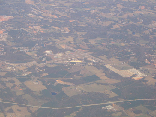
 |
(Click on the photo to enlarge) |
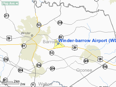
Location
& QuickFacts
|
FAA Information Effective: |
2007-07-05 |
|
Airport
Identifier: |
WDR |
|
Airport
Status: |
Operational |
|
Longitude/Latitude: |
083-40-02.7000W/33-58-58.3000N
-83.667417/33.982861 (Estimated) |
|
Elevation: |
943 ft / 287.43 m (Surveyed) |
|
Land: |
374 acres |
|
From
nearest city: |
3 nautical miles E of Winder, GA |
|
Location: |
Barrow County, GA |
|
Magnetic Variation: |
03W (1985) |
Owner
& Manager
|
Ownership: |
Publicly owned |
|
Owner: |
Barrow County Arpt Auth. |
|
Address: |
841 Ronald Wood Road
Winder, GA 30680 |
|
Phone
number: |
770-307-3013 |
|
Manager: |
Tim Whitman |
|
Address: |
841 Ronald Wood Rd
Winder, GA 30680 |
|
Phone number: |
770-307-3013 |
Airport
Operations and Facilities
|
Airport Use: |
Open to public |
|
Wind
indicator: |
Yes |
|
Segmented
Circle: |
Yes |
|
Control
Tower: |
No |
|
Lighting
Schedule: |
DUSK-DAWN
HIRL RY 13/31 PRESET LOW INTST; TO INCR INTST AND ACTVT
MIRL RY 05/23, PAPI RYS 13, 31, REIL RY 31 AND TWY LGTS
- CTAF. |
|
Beacon
Color: |
Clear-Green (lighted land airport) |
|
Landing
fee charge: |
No |
|
Sectional
chart: |
Atlanta |
|
Region: |
ASO - Southern |
|
Boundary
ARTCC: |
ZTL - Atlanta |
|
Tie-in
FSS: |
MCN - Macon |
|
FSS
on Airport: |
No |
|
FSS
Toll Free: |
1-800-WX-BRIEF |
|
NOTAMs
Facility: |
WDR (NOTAM-d service avaliable) |
|
Federal Agreements: |
NGY3 |
Airport
Communications
|
CTAF: |
123.000 |
|
Unicom: |
123.000 |
Airport
Services
|
Fuel available: |
100LLA1+ |
|
Airframe Repair: |
MAJOR |
|
Power Plant Repair: |
MAJOR |
|
Bottled
Oxygen: |
NONE |
|
Bulk
Oxygen: |
NONE |
|
Runway Information
Runway 05/23
|
Dimension: |
3610 x 100 ft / 1100.3 x 30.5 m |
|
Surface: |
ASPH, Fair Condition |
|
Weight
Limit: |
Single wheel: 20000 lbs. |
|
Edge
Lights: |
Medium |
|
|
Runway 05 |
Runway 23 |
|
Longitude: |
083-40-23.1500W |
083-39-52.4500W |
|
Latitude: |
33-58-40.0600N |
33-59-04.9900N |
|
Elevation: |
935.00
ft |
917.00
ft |
|
Alignment: |
46 |
127 |
|
Traffic
Pattern: |
Left |
Left |
|
Markings: |
Basic, Poor Condition
& 23 BLACKING ON OLD RUNWAY NUMBERS FADED ALLOWING OLD
NUMBERS TO SHOW THROUGH. |
Basic, Poor Condition |
|
Obstruction: |
48 ft tree, 2120.0 ft from runway, 280 ft left
of centerline, 40:1 slope to clear |
11 ft tree, 475.0 ft from runway, 140 ft left
of centerline, 25:1 slope to clear |
|
Runway 13/31
|
Dimension: |
5500 x 100 ft / 1676.4 x 30.5 m |
|
Surface: |
ASPH, Good Condition |
|
Weight
Limit: |
Single wheel: 20000 lbs. |
|
Edge
Lights: |
High |
|
|
Runway 13 |
Runway 31 |
|
Longitude: |
083-40-24.8500W |
083-39-33.8300W |
|
Latitude: |
33-59-19.1600N |
33-58-45.1700N |
|
Elevation: |
935.00
ft |
909.00
ft |
|
Alignment: |
127 |
127 |
|
ILS
Type: |
|
LOCALIZER |
|
Traffic
Pattern: |
Left |
Left |
|
Markings: |
Non-precision instrument, Fair Condition |
Non-precision instrument, Fair Condition |
|
Displaced
threshold: |
0.00 ft |
340.00
ft |
|
VASI: |
4-light PAPI on left side |
4-light PAPI on left side |
|
Visual
Glide Angle: |
3.00° |
4.00° |
|
Runway
End Identifier: |
|
Yes |
|
Obstruction: |
21 ft tree, 494.0 ft from runway, 290 ft right
of centerline, 14:1 slope to clear |
23 ft rr, 361.0 ft from runway, 200 ft left
of centerline, 7:1 slope to clear
RY 31 APCH RATIO 34:1 TO DSPLCD THLD. |
|
Radio Navigation
Aids
|
ID |
Type |
Name |
Ch |
Freq |
Var |
Dist |
|
BMW |
NDB |
Barrow County |
|
404.00 |
03W |
4.8 nm |
|
DDA |
NDB |
Commerce |
|
244.00 |
03W |
8.7 nm |
|
JNM |
NDB |
Monroe |
|
392.00 |
03W |
15.0 nm |
|
FKV |
NDB |
Flowery Branch |
|
365.00 |
03W |
17.8 nm |
|
VOF |
NDB |
Alcovy |
|
370.00 |
03W |
22.0 nm |
|
BJT |
NDB |
Bulldog |
|
221.00 |
03W |
22.4 nm |
|
AJR |
NDB |
Habersham |
|
347.00 |
03W |
31.7 nm |
|
BR |
NDB |
Redan |
|
266.00 |
02W |
38.0 nm |
|
VV |
NDB |
Junne |
|
353.00 |
05W |
38.1 nm |
|
DJD |
NDB |
Canton |
|
415.00 |
04W |
43.9 nm |
|
IIY |
NDB |
Washington/wilkes County |
|
435.00 |
03W |
44.4 nm |
|
JZP |
NDB |
Pickens County |
|
285.00 |
04W |
48.6 nm |
|
DOB |
TACAN |
Dobbins |
077X |
|
01W |
42.1 nm |
|
PDK |
VOR/DME |
Peachtree |
113X |
116.60 |
02W |
32.1 nm |
|
AHN |
VORTAC |
Athens |
33 |
109.60 |
00E |
17.2 nm |
|
ATL |
VORTAC |
Atlanta |
116X |
116.90 |
00W |
43.8 nm |
|
ODF |
VORTAC |
Foothills |
081X |
113.40 |
00E |
46.6 nm |
|
ATL |
VOT |
Atlanta Muni |
|
111.00 |
|
42.6 nm |
Remarks
- DEER
ON AND INVOF ARPT.
- GCO
AVBL ON FREQ 121.725 THRU FLT SVCS.
- EXISTED
PRIOR TO 1959.
Based
Aircraft
|
Aircraft
based on field: |
176 |
|
Single
Engine Airplanes: |
131 |
|
Multi
Engine Airplanes: |
20 |
|
Jet Engine
Airplanes: |
2 |
|
Helicopters: |
3 |
|
Military: |
20 |
Operational Statistics
Time Period: 2004-01-08
- 2005-01-06
|
Aircraft
Operations: |
184/Day |
|
General
Aviation Local: |
28.4% |
|
General
Aviation Itinerant: |
44.8% |
|
Military: |
26.9% |
Winder-barrow Airport
Address:
Barrow County, GA
Tel:
770-307-3013
Images
and information placed above are from
http://www.airport-data.com/airport/WDR/
We
thank them for the data!
| General
Info |
| Country |
United
States |
| State |
GEORGIA
|
| FAA ID |
WDR
|
| Latitude |
33-58-58.346N
|
| Longitude |
083-40-02.690W
|
| Elevation |
943 feet
|
| Near City |
WINDER
|
We don't guarantee the information is fresh and accurate. The data may
be wrong or outdated.
For more up-to-date information please refer to other sources.
|
|