|
|
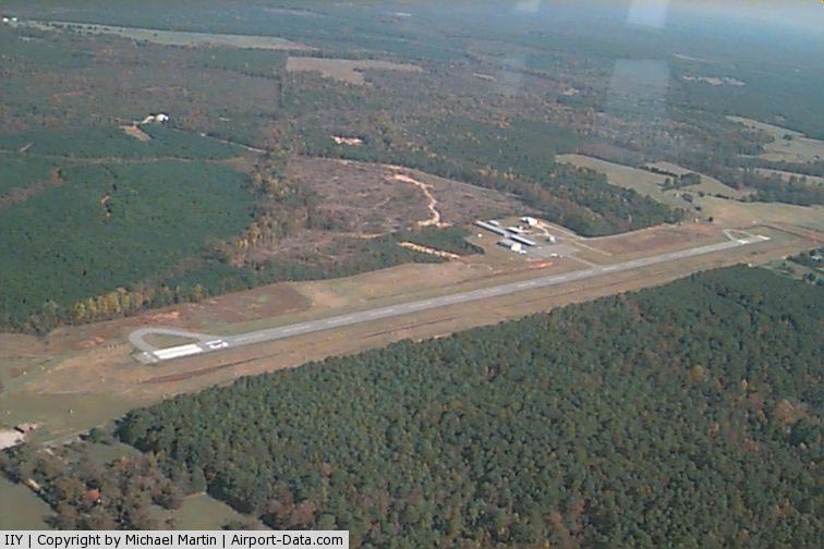
Washington - Wilkes County Airport |
|
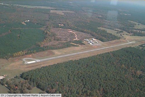 |
(Click on the photo to enlarge) |
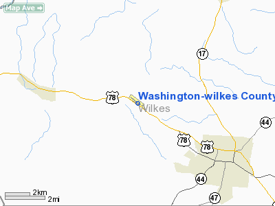
Location
& QuickFacts
|
FAA Information Effective: |
2007-07-05 |
|
Airport
Identifier: |
IIY |
|
Airport
Status: |
Operational |
|
Longitude/Latitude: |
082-48-56.9200W/33-46-45.7900N
-82.815811/33.779386 (Estimated) |
|
Elevation: |
645 ft / 196.60 m (Surveyed) |
|
Land: |
93
acres |
|
From
nearest city: |
4 nautical miles NW of Washington, GA |
|
Location: |
Wilkes County, GA |
|
Magnetic Variation: |
03W (1985) |
Owner
& Manager
|
Ownership: |
Publicly owned |
|
Owner: |
City Of Washington
AND WILKES COUNTY |
|
Address: |
23 Court Street, Room 222
Washington, GA 30673 |
|
Phone number: |
706-678-2511 |
|
Manager: |
Chris Hughes |
|
Address: |
351 Airport Road
Washington, GA 30673 |
|
Phone number: |
706-678-2662 |
Airport
Operations and Facilities
|
Airport Use: |
Open to public |
|
Wind
indicator: |
Yes |
|
Segmented
Circle: |
Yes |
|
Control
Tower: |
No |
|
Lighting
Schedule: |
DUSK-DAWN
ACTVT MIRL RY 13/31, PAPI RYS 13 AND 31 - CTAF. |
|
Beacon
Color: |
Clear-Green (lighted land airport) |
|
Landing
fee charge: |
No |
|
Sectional
chart: |
Atlanta |
|
Region: |
ASO - Southern |
|
Boundary
ARTCC: |
ZTL - Atlanta |
|
Tie-in
FSS: |
MCN - Macon |
|
FSS
on Airport: |
No |
|
FSS
Toll Free: |
1-800-WX-BRIEF |
|
NOTAMs
Facility: |
IIY (NOTAM-d service avaliable) |
|
Federal Agreements: |
N1 |
Airport
Communications
|
CTAF: |
122.700 |
|
Unicom: |
122.700 |
Airport
Services
|
Fuel available: |
100LLA |
|
Airframe Repair: |
MAJOR |
|
Power Plant Repair: |
MINOR |
|
Bottled
Oxygen: |
NONE |
|
Bulk
Oxygen: |
NONE |
|
Runway Information
Runway 13/31
|
Dimension: |
4020 x 75 ft / 1225.3 x 22.9 m |
|
Surface: |
ASPH, Fair Condition |
|
Weight
Limit: |
Single wheel: 30000 lbs. |
|
Edge
Lights: |
Medium |
|
|
Runway 13 |
Runway 31 |
|
Longitude: |
082-49-16.1750W |
082-48-37.6200W |
|
Latitude: |
33-46-57.4920N |
33-46-34.1300N |
|
Elevation: |
645.00
ft |
640.00
ft |
|
Alignment: |
126 |
127 |
|
Traffic
Pattern: |
Left |
Left |
|
Markings: |
Non-precision instrument, Fair Condition |
Non-precision instrument, Fair Condition |
|
Crossing
Height: |
31.00
ft |
32.00
ft |
|
VASI: |
2-light PAPI on left side |
2-light PAPI on left side |
|
Visual
Glide Angle: |
3.00° |
3.00° |
|
Obstruction: |
75 ft trees, 2300.0 ft from runway, 440 ft
right of centerline, 28:1 slope to clear |
50 ft trees, 1850.0 ft from runway, 120 ft
right of centerline, 33:1 slope to clear |
|
Radio Navigation
Aids
|
ID |
Type |
Name |
Ch |
Freq |
Var |
Dist |
|
IIY |
NDB |
Washington/wilkes County |
|
435.00 |
03W |
0.3 nm |
|
VV |
NDB |
Junne |
|
353.00 |
05W |
13.0 nm |
|
AA |
NDB |
Cedar |
|
341.00 |
04W |
17.9 nm |
|
HQU |
NDB |
Thomson-mcduffie |
|
333.00 |
04W |
21.3 nm |
|
BJT |
NDB |
Bulldog |
|
221.00 |
03W |
22.7 nm |
|
DDA |
NDB |
Commerce |
|
244.00 |
03W |
39.1 nm |
|
BMW |
NDB |
Barrow County |
|
404.00 |
03W |
39.7 nm |
|
UMB |
NDB |
Culvr |
|
380.00 |
04W |
41.5 nm |
|
AND |
NDB |
Anderson County |
|
230.00 |
04W |
43.5 nm |
|
EMR |
NDB |
Emory |
|
385.00 |
04W |
45.2 nm |
|
JNM |
NDB |
Monroe |
|
392.00 |
03W |
45.6 nm |
|
GIW |
NDB |
Coronaca |
|
239.00 |
04W |
46.2 nm |
|
HIT |
NDB |
Kaolin |
|
360.00 |
05W |
46.2 nm |
|
VOF |
NDB |
Alcovy |
|
370.00 |
03W |
49.1 nm |
|
AHN |
VORTAC |
Athens |
33 |
109.60 |
00E |
27.3 nm |
|
IRQ |
VORTAC |
Colliers |
086X |
113.90 |
04W |
33.0 nm |
|
ELW |
VORTAC |
Electric City |
023X |
108.60 |
00E |
38.5 nm |
|
GRD |
VORTAC |
Greenwood |
102X |
115.50 |
01W |
43.5 nm |
Remarks
- AREAS
BEYOND WHITE RY END STRIPES DESIGNATED NON-MOVEMENT AREAS.
Based
Aircraft
|
Aircraft
based on field: |
15 |
|
Single
Engine Airplanes: |
13 |
|
Multi
Engine Airplanes: |
1 |
|
Ultralights: |
1 |
Operational Statistics
Time Period: 2005-04-12
- 2006-04-11
|
Aircraft
Operations: |
116/Week |
|
General
Aviation Local: |
50.0% |
|
General
Aviation Itinerant: |
50.0% |
Washington-wilkes County Airport
Address:
Wilkes County, GA
Tel:
706-678-2511, 706-678-2662
Images
and information placed above are from
http://www.airport-data.com/airport/IIY/
We
thank them for the data!
| General
Info |
| Country |
United
States |
| State |
GEORGIA
|
| FAA ID |
IIY
|
| Latitude |
33-46-45.790N
|
| Longitude |
082-48-56.920W
|
| Elevation |
645 feet
|
| Near City |
WASHINGTON
|
We don't guarantee the information is fresh and accurate. The data may
be wrong or outdated.
For more up-to-date information please refer to other sources.
|
|