 |
|
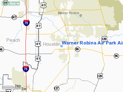
Warner Robins Air Park Airport |
|
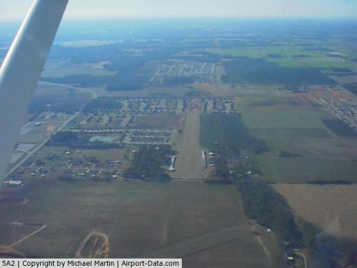 |
(Click on the photo to enlarge) |
Location
& QuickFacts
|
FAA Information Effective: |
2007-07-05 |
|
Airport
Identifier: |
5A2 |
|
Airport
Status: |
Operational |
|
Longitude/Latitude: |
083-40-29.6620W/32-33-33.5280N
-83.674906/32.559313 (Estimated) |
|
Elevation: |
409 ft / 124.66 m (Surveyed) |
|
Land: |
39
acres |
|
From
nearest city: |
4 nautical miles SW of Warner Robins, GA |
|
Location: |
Houston County, GA |
|
Magnetic Variation: |
02W (1985) |
Owner
& Manager
|
Ownership: |
Privately owned |
|
Owner: |
Progressive Steel Inc. |
|
Address: |
123 Air Park Drive
Warner Robins, GA 31088 |
|
Phone
number: |
478-929-0302 |
|
Manager: |
Rodney Bogue |
|
Address: |
123 Air Park Drive
Warner Robins, GA 31088 |
|
Phone number: |
478-929-0302 |
Airport
Operations and Facilities
|
Airport Use: |
Open to public |
|
Wind
indicator: |
Yes |
|
Segmented
Circle: |
No |
|
Control
Tower: |
No |
|
Lighting
Schedule: |
RDO-CTL |
|
Landing
fee charge: |
No |
|
Sectional
chart: |
Atlanta |
|
Region: |
ASO - Southern |
|
Boundary
ARTCC: |
ZTL - Atlanta |
|
Tie-in
FSS: |
MCN - Macon |
|
FSS
on Airport: |
No |
|
FSS
Toll Free: |
1-800-WX-BRIEF |
|
NOTAMs
Facility: |
MCN (NOTAM-d service avaliable) |
Airport
Communications
Airport
Services
|
Bottled
Oxygen: |
NONE |
|
Bulk
Oxygen: |
NONE |
|
Runway Information
Runway 09/27
|
Dimension: |
2833 x 130 ft / 863.5 x 39.6 m |
|
Surface: |
TURF, Good Condition |
|
Edge
Lights: |
Low
ACTVT LIRL RY 09/27 - CTAF. |
|
|
Runway 09 |
Runway 27 |
|
Traffic
Pattern: |
Left |
Left |
|
Displaced
threshold: |
0.00 ft |
300.00 ft
RY 27 DSPLCD THLD MKD WITH LGTS . |
|
Runway
End Identifier: |
No |
No |
|
Centerline
Lights: |
No |
No |
|
Touchdown
Lights: |
No |
No |
|
Obstruction: |
6 ft fence, 60.0 ft from runway, 100 ft left
of centerline, 10:1 slope to clear |
15 ft road, 25.0 ft from runway, 1:1 slope
to clear
APCH RATIO 20:1 TO DSPLCD THR; ROAD CLEARANCE. |
|
Radio Navigation
Aids
|
ID |
Type |
Name |
Ch |
Freq |
Var |
Dist |
|
BEP |
NDB |
Bay Creek |
|
350.00 |
03W |
7.7 nm |
|
IZS |
NDB |
Montezuma |
|
426.00 |
04W |
20.4 nm |
|
LKG |
NDB |
Lindbergh |
|
242.00 |
03W |
31.9 nm |
|
OP |
NDB |
Yates |
|
339.00 |
03W |
33.7 nm |
|
DB |
NDB |
Creke |
|
251.00 |
04W |
34.0 nm |
|
OHY |
NDB |
Coney |
|
400.00 |
02W |
35.1 nm |
|
EZM |
NDB |
Eastman |
|
366.00 |
04W |
36.8 nm |
|
UMB |
NDB |
Culvr |
|
380.00 |
04W |
44.1 nm |
|
HIT |
NDB |
Kaolin |
|
360.00 |
05W |
46.2 nm |
|
JHH |
NDB |
Griffin |
|
412.00 |
04W |
46.8 nm |
|
MQW |
NDB |
Mc Rae |
|
280.00 |
03W |
48.9 nm |
|
MCN |
VORTAC |
Macon |
089X |
114.20 |
01E |
8.0 nm |
|
VNA |
VORTAC |
Vienna |
112X |
116.50 |
01E |
22.7 nm |
|
DBN |
VORTAC |
Dublin |
078X |
113.10 |
01W |
42.6 nm |
Remarks
- PRVDD
ALL OPNS CONDUCTED IN VFR WX CONDS.
Based Aircraft
|
Aircraft
based on field: |
31 |
|
Single
Engine Airplanes: |
30 |
|
Ultralights: |
1 |
Operational Statistics
Time Period: 2005-08-09
- 2006-08-08
|
Aircraft
Operations: |
39/Week |
|
General
Aviation Local: |
50.0% |
|
General
Aviation Itinerant: |
50.0% |
Warner Robins Air Park Airport
Address:
Houston County, GA
Tel:
478-929-0302
Images
and information placed above are from
http://www.airport-data.com/airport/5A2/
We
thank them for the data!
| General
Info |
| Country |
United
States |
| State |
GEORGIA
|
| FAA ID |
5A2
|
| Latitude |
32-33-33.528N
|
| Longitude |
083-40-29.662W
|
| Elevation |
409 feet
|
| Near City |
WARNER
ROBINS |
We don't guarantee the information is fresh and accurate. The data may
be wrong or outdated.
For more up-to-date information please refer to other sources.
|
|


