 |
|
|
|
|
|
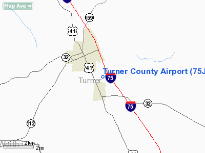
Location
& QuickFacts
|
FAA Information Effective: |
2007-07-05 |
|
Airport
Identifier: |
75J |
|
Airport
Status: |
Operational |
|
Longitude/Latitude: |
083-37-55.6030W/31-41-07.6500N
-83.632112/31.685458 (Estimated) |
|
Elevation: |
389 ft / 118.57 m (Surveyed) |
|
Land: |
115 acres |
|
From
nearest city: |
2 nautical miles SE of Ashburn, GA |
|
Location: |
Turner County, GA |
|
Magnetic Variation: |
02W (1985) |
Owner
& Manager
|
Ownership: |
Publicly owned |
|
Owner: |
Turner County |
|
Address: |
Po Box 191
Ashburn, GA 31714 |
|
Phone
number: |
229-567-1215 |
|
Manager: |
Mike Mastrario |
|
Address: |
280 East College Ave
Ashburn, GA 31714 |
|
Phone number: |
229-567-3563 |
Airport
Operations and Facilities
|
Airport Use: |
Open to public |
|
Wind
indicator: |
Yes |
|
Segmented
Circle: |
Yes |
|
Control
Tower: |
No |
|
Lighting
Schedule: |
DUSK-DAWN
AFT 0000, ACTVT MIRL RY 16/34 & PAPI RY 34 - CTAF. |
|
Beacon
Color: |
Clear-Green (lighted land airport)
ROTG BCN LCTD ON WATER TANK 1/4 MILE NW OF ARPT. |
|
Landing
fee charge: |
No |
|
Sectional
chart: |
Jacksonville |
|
Region: |
ASO - Southern |
|
Boundary
ARTCC: |
ZJX - Jacksonville |
|
Tie-in
FSS: |
MCN - Macon |
|
FSS
on Airport: |
No |
|
FSS
Toll Free: |
1-800-WX-BRIEF |
|
NOTAMs
Facility: |
MCN (NOTAM-d service avaliable) |
|
Federal Agreements: |
NGY |
Airport
Communications
|
CTAF: |
122.700 |
|
Unicom: |
122.700 |
Airport
Services
|
Bottled
Oxygen: |
NONE |
|
Bulk
Oxygen: |
NONE |
|
Runway Information
Runway 16/34
|
Dimension: |
3204 x 50 ft / 976.6 x 15.2 m |
|
Surface: |
ASPH, Good Condition |
|
Weight
Limit: |
Single wheel: 30000 lbs. |
|
Edge
Lights: |
Medium |
|
|
Runway 16 |
Runway 34 |
|
Traffic
Pattern: |
Left |
Left |
|
Markings: |
Basic, Good Condition |
Basic, Good Condition |
|
VASI: |
|
2-light PAPI on left side |
|
Obstruction: |
36 ft trees, 704.0 ft from runway, 180 ft left
of centerline, 14:1 slope to clear |
20 ft trees, 440.0 ft from runway, 150 ft left
of centerline, 12:1 slope to clear |
|
Radio Navigation
Aids
|
ID |
Type |
Name |
Ch |
Freq |
Var |
Dist |
|
SUR |
NDB |
Fitzgerald |
|
362.00 |
03W |
18.0 nm |
|
TM |
NDB |
Tifto |
|
409.00 |
03W |
21.6 nm |
|
OHY |
NDB |
Coney |
|
400.00 |
02W |
22.1 nm |
|
AB |
NDB |
Putny |
|
227.00 |
02W |
35.7 nm |
|
EZM |
NDB |
Eastman |
|
366.00 |
04W |
36.4 nm |
|
LKG |
NDB |
Lindbergh |
|
242.00 |
03W |
38.1 nm |
|
OWC |
NDB |
Coffee County |
|
390.00 |
03W |
40.0 nm |
|
CXU |
NDB |
Camilla |
|
369.00 |
02W |
42.0 nm |
|
GTP |
NDB |
Patten |
|
245.00 |
02W |
44.9 nm |
|
IZS |
NDB |
Montezuma |
|
426.00 |
04W |
45.2 nm |
|
MQW |
NDB |
Mc Rae |
|
280.00 |
03W |
45.4 nm |
|
BEP |
NDB |
Bay Creek |
|
350.00 |
03W |
46.9 nm |
|
IFM |
VOR |
Tift Myers |
|
112.50 |
01W |
17.1 nm |
|
MGR |
VOR/DME |
Moultrie |
025X |
108.80 |
02W |
37.3 nm |
|
VNA |
VORTAC |
Vienna |
112X |
116.50 |
01E |
32.5 nm |
|
PZD |
VORTAC |
Pecan |
108X |
116.10 |
02W |
33.9 nm |
|
VAD |
VORTAC |
Moody |
080X |
113.30 |
03W |
49.1 nm |
Remarks
Based Aircraft
|
Aircraft
based on field: |
2 |
|
Single
Engine Airplanes: |
2 |
Operational Statistics
Time Period: 2006-04-11
- 2007-04-10
|
Aircraft
Operations: |
59/Week |
|
General
Aviation Local: |
52.5% |
|
General
Aviation Itinerant: |
47.5% |
Turner County Airport
Address:
Turner County, GA
Tel:
229-567-1215,
229-567-3563
Images
and information placed above are from
http://www.airport-data.com/airport/75J/
We
thank them for the data!
| General
Info |
| Country |
United
States |
| State |
GEORGIA
|
| FAA ID |
75J
|
| Latitude |
31-41-07.650N
|
| Longitude |
083-37-55.603W
|
| Elevation |
389 feet
|
| Near City |
ASHBURN
|
We don't guarantee the information is fresh and accurate. The data may
be wrong or outdated.
For more up-to-date information please refer to other sources.
|
|


