 |
|
|
|
|
|
Location
& QuickFacts
|
FAA Information Effective: |
2007-07-05 |
|
Airport
Identifier: |
CZL |
|
Airport
Status: |
Operational |
|
Longitude/Latitude: |
084-56-20.9840W/34-27-19.6200N
-84.939162/34.455450 (Estimated) |
|
Elevation: |
647 ft / 197.21 m (Estimated) |
|
Land: |
125 acres |
|
From
nearest city: |
3 nautical miles S of Calhoun, GA |
|
Location: |
Gordon County, GA |
|
Magnetic Variation: |
02W (1990) |
Owner
& Manager
|
Ownership: |
Publicly owned |
|
Owner: |
Calhoun-gordon Co Arpt Auth |
|
Address: |
Box 248
Calhoun, GA 30701 |
|
Phone number: |
706-602-8000 |
|
Manager: |
Dwight Albritton |
|
Address: |
1957 Hwy 41 S
Calhoun, GA 30701 |
|
Phone number: |
706-602-8000 |
Airport
Operations and Facilities
|
Airport Use: |
Open to public |
|
Wind
indicator: |
Yes |
|
Segmented
Circle: |
Yes |
|
Control
Tower: |
No |
|
Lighting
Schedule: |
DUSK-DAWN
MIRL RY 17/35 PRESET ON LOW INTST DUSK-2100; TO INCR INTST
& ACTVT AFTER 2100 - CTAF. |
|
Beacon
Color: |
Clear-Green (lighted land airport) |
|
Landing
fee charge: |
No |
|
Sectional
chart: |
Atlanta |
|
Region: |
ASO - Southern |
|
Boundary
ARTCC: |
ZTL - Atlanta |
|
Tie-in
FSS: |
MCN - Macon |
|
FSS
on Airport: |
No |
|
FSS
Toll Free: |
1-800-WX-BRIEF |
|
NOTAMs
Facility: |
MCN (NOTAM-d service avaliable) |
|
Federal Agreements: |
NGY |
Airport
Communications
|
CTAF: |
122.800 |
|
Unicom: |
122.800 |
Airport
Services
|
Fuel available: |
100LLA1+
SELF-SERVICE FUEL AVBL WITH CREDIT CARD. |
|
Airframe Repair: |
NONE |
|
Power Plant Repair: |
NONE |
|
Runway Information
Runway 17/35
|
Dimension: |
6000 x 100 ft / 1828.8 x 30.5 m |
|
Surface: |
ASPH, Good Condition |
|
Weight
Limit: |
Single wheel: 15000 lbs.
Dual wheel: 100000 lbs.
Dual
tandem wheel: 100000 lbs. |
|
Edge
Lights: |
Medium |
|
|
Runway 17 |
Runway 35 |
|
Longitude: |
084-56-28.3390W |
084-56-13.6290W |
|
Latitude: |
34-27-48.6630N |
34-26-50.5780N |
|
Elevation: |
639.00
ft |
651.00
ft |
|
Alignment: |
127 |
127 |
|
ILS
Type: |
|
LOCALIZER |
|
Traffic
Pattern: |
Left |
Left |
|
Markings: |
Non-precision instrument, Good Condition |
Non-precision instrument, Good Condition |
|
Crossing
Height: |
51.00
ft |
0.00 ft |
|
Displaced
threshold: |
0.00 ft |
1000.00
ft |
|
VASI: |
2-light PAPI on left side |
2-light PAPI on left side |
|
Visual
Glide Angle: |
4.00° |
0.00° |
|
Obstruction: |
26 ft trees, 382.0 ft from runway, 127 ft right
of centerline, 7:1 slope to clear |
66 ft pole, 398.0 ft from runway, 280 ft right
of centerline, 3:1 slope to clear
RUNWAY 35 APPROACH SLOPE 10:1 TO DISPLACED THRESHOLD, POWERPOLE
/ POWERLINES 360 FT OUT AND 410 FT RIGHT. |
|
Radio Navigation
Aids
|
ID |
Type |
Name |
Ch |
Freq |
Var |
Dist |
|
OUK |
NDB |
Calhoun |
|
323.00 |
02W |
3.3 nm |
|
OYD |
NDB |
Floyd |
|
388.00 |
02W |
14.6 nm |
|
EVZ |
NDB |
Cartersville |
|
308.00 |
04W |
16.1 nm |
|
UWI |
NDB |
Whitfield |
|
400.00 |
03W |
20.1 nm |
|
JZP |
NDB |
Pickens County |
|
285.00 |
04W |
23.7 nm |
|
DJD |
NDB |
Canton |
|
415.00 |
04W |
25.5 nm |
|
FTP |
NDB |
Fort Payne |
|
426.00 |
01W |
36.6 nm |
|
HDI |
NDB |
Hardwick |
|
369.00 |
01W |
42.0 nm |
|
CQN |
NDB |
Daisy |
|
341.00 |
02W |
44.1 nm |
|
FT |
NDB |
Flanc |
|
344.00 |
02W |
44.3 nm |
|
APT |
NDB |
Jasper |
|
382.00 |
02W |
48.3 nm |
|
DOB |
TACAN |
Dobbins |
077X |
|
01W |
39.0 nm |
|
PDK |
VOR/DME |
Peachtree |
113X |
116.60 |
02W |
47.2 nm |
|
RMG |
VORTAC |
Rome |
101X |
115.40 |
01E |
19.7 nm |
|
GQO |
VORTAC |
Choo Choo |
105X |
115.80 |
01E |
32.2 nm |
Based
Aircraft
|
Aircraft
based on field: |
75 |
|
Single
Engine Airplanes: |
64 |
|
Multi
Engine Airplanes: |
5 |
|
Jet Engine
Airplanes: |
6 |
Operational Statistics
Time Period: 2004-05-13
- 2005-05-12
|
Aircraft
Operations: |
55/Day |
|
General
Aviation Local: |
50.0% |
|
General
Aviation Itinerant: |
50.0% |
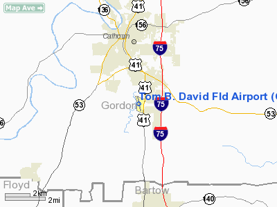
Tom B. David Fld Airport
Address:
Gordon County, GA
Tel:
706-602-8000
Images
and information placed above are from
http://www.airport-data.com/airport/CZL/
We
thank them for the data!
| General
Info |
| Country |
United
States |
| State |
GEORGIA
|
| FAA ID |
CZL
|
| Latitude |
34-27-24.418N
|
| Longitude |
084-56-22.198W
|
| Elevation |
647 feet
|
| Near City |
CALHOUN
|
We don't guarantee the information is fresh and accurate. The data may
be wrong or outdated.
For more up-to-date information please refer to other sources.
|
|


