|
|
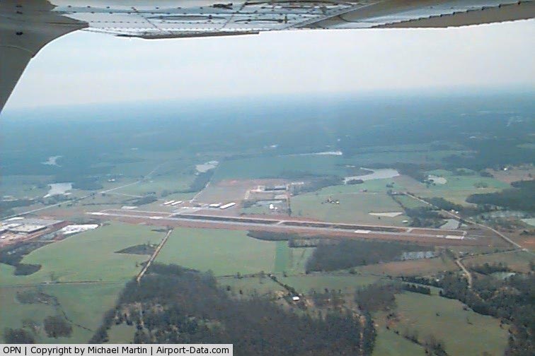
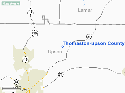
Thomaston - Upson County Airport |
|
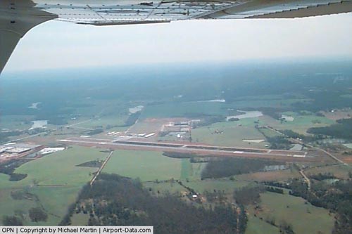 |
(Click on the photo to enlarge) |
Location
& QuickFacts
|
FAA
Information Effective: |
2007-07-05 |
|
Airport
Identifier: |
OPN |
|
Airport
Status: |
Operational |
|
Longitude/Latitude: |
084-15-50.8810W/32-57-18.0060N
-84.264134/32.955002 (Estimated) |
|
Elevation: |
798 ft / 243.23 m (Surveyed) |
|
Land: |
248 acres |
|
From
nearest city: |
5 nautical miles NE of Thomaston, GA |
|
Location: |
Upson County, GA |
|
Magnetic Variation: |
03W (1995) |
Owner
& Manager
|
Ownership: |
Publicly
owned |
|
Owner: |
City Of Thomaston |
|
Address: |
P O Box 672
Thomaston, GA 30286 |
|
Phone
number: |
706-647-6633 |
|
Manager: |
Mitch Ellerbee |
|
Address: |
2347 Del Ray Road
Thomaston, GA 30286 |
|
Phone number: |
706-647-4500 |
Airport Operations and Facilities
|
Airport
Use: |
Open
to public |
|
Wind
indicator: |
Yes |
|
Segmented Circle: |
Yes |
|
Control
Tower: |
No |
|
Lighting
Schedule: |
DUSK-DAWN
ACTVT MALSR RY 30 AND PAPI RYS 12 & 30 - CTAF. MIRL
RY 12/30 PRESET MED INTST DUSK-2200; AFTER 2200 ACTVT -
CTAF. |
|
Beacon
Color: |
Clear-Green (lighted land airport) |
|
Landing
fee charge: |
No |
|
Sectional chart: |
Atlanta |
|
Region: |
ASO - Southern |
|
Boundary
ARTCC: |
ZTL - Atlanta |
|
Tie-in
FSS: |
MCN - Macon |
|
FSS
on Airport: |
No |
|
FSS
Toll Free: |
1-800-WX-BRIEF |
|
NOTAMs
Facility: |
OPN (NOTAM-d service avaliable) |
|
Federal Agreements: |
NGY |
Airport Communications
|
CTAF: |
122.800 |
|
Unicom: |
122.800
|
Airport
Services
|
Fuel
available: |
100LLA1+ |
|
Airframe
Repair: |
MINOR |
|
Power
Plant Repair: |
MINOR |
|
Runway Information
Runway 12/30
|
Dimension: |
6351
x 100 ft / 1935.8 x 30.5 m |
|
Surface: |
ASPH, Good Condition |
|
Weight
Limit: |
Single wheel: 20000 lbs.
Dual wheel: 50000 lbs. |
|
Edge
Lights: |
Medium |
|
|
Runway 12 |
Runway 30 |
|
Longitude: |
084-16-23.2840W |
084-15-18.3560W |
|
Latitude: |
32-57-33.4500N |
32-57-02.5670N |
|
Elevation: |
786.00 ft |
798.00 ft |
|
Alignment: |
119 |
127 |
|
ILS
Type: |
|
ILS/DME |
|
Traffic
Pattern: |
Left |
Left |
|
Markings: |
Precision instrument, Good Condition |
Precision instrument, Fair Condition |
|
Crossing
Height: |
27.00 ft |
27.00 ft |
|
Displaced
threshold: |
650.00 ft |
0.00 ft |
|
VASI: |
2-light PAPI on left side |
2-light PAPI on left side |
|
Visual
Glide Angle: |
3.00° |
3.00° |
|
Approach
lights: |
|
MALSR |
|
Obstruction: |
38 ft trees, 1720.0 ft from runway, 490 ft
right of centerline, 40:1 slope to clear |
25 ft trees, 1200.0 ft from runway, 500 ft
left of centerline, 40:1 slope to clear |
|
Radio Navigation
Aids
|
ID |
Type |
Name |
Ch |
Freq |
Var |
Dist |
|
OP |
NDB |
Yates |
|
339.00 |
03W |
4.4 nm |
|
JHH |
NDB |
Griffin |
|
412.00 |
04W |
13.9 nm |
|
FF |
NDB |
Pecat |
|
316.00 |
02W |
23.6 nm |
|
EQQ |
NDB |
Coweta County |
|
234.00 |
03W |
29.0 nm |
|
PIM |
NDB |
Pine Mountain |
|
272.00 |
03W |
31.4 nm |
|
IZS |
NDB |
Montezuma |
|
426.00 |
04W |
37.6 nm |
|
BEP |
NDB |
Bay Creek |
|
350.00 |
03W |
39.1 nm |
|
BR |
NDB |
Redan |
|
266.00 |
02W |
41.6 nm |
|
VOF |
NDB |
Alcovy |
|
370.00 |
03W |
47.2 nm |
|
LKG |
NDB |
Lindbergh |
|
242.00 |
03W |
47.6 nm |
|
MCN |
VORTAC |
Macon |
089X |
114.20 |
01E |
35.0 nm |
|
ATL |
VORTAC |
Atlanta |
116X |
116.90 |
00W |
41.4 nm |
|
CSG |
VORTAC |
Columbus |
118X |
117.10 |
01E |
43.2 nm |
|
LGC |
VORTAC |
Lagrange |
103X |
115.60 |
01E |
47.8 nm |
|
ATL |
VOT |
Atlanta Muni |
|
111.00 |
|
43.0 nm |
Remarks
- GCO
AVBL ON FREQ 121.725 THRU FLT SVCS.
- PRVDD
VFR
Based
Aircraft
|
Aircraft
based on field: |
62 |
|
Single
Engine Airplanes: |
54 |
|
Multi
Engine Airplanes: |
5 |
|
Ultralights: |
3 |
Operational Statistics
Time Period: 2004-04-22
- 2005-04-21
|
Aircraft
Operations: |
44/Day |
|
General
Aviation Local: |
62.5% |
|
General
Aviation Itinerant: |
37.5% |
Thomaston-upson County Airport
Address:
Upson County, GA
Tel:
706-647-6633,
706-647-4500
Images
and information placed above are from
http://www.airport-data.com/airport/OPN/
We
thank them for the data!
| General
Info |
| Country |
United
States |
| State |
GEORGIA
|
| FAA ID |
OPN |
| Latitude |
32-57-16.519N
|
| Longitude |
084-15-47.348W
|
| Elevation |
796 feet
|
| Near City |
THOMASTON
|
We don't guarantee the information is fresh and accurate. The data may
be wrong or outdated.
For more up-to-date information please refer to other sources.
|
|