 |
|
Location
& QuickFacts
|
FAA Information Effective: |
2007-07-05 |
|
Airport
Identifier: |
GA74 |
|
Airport
Status: |
Operational |
|
Longitude/Latitude: |
084-24-44.7190W/33-02-30.4550N
-84.412422/33.041793 (Estimated) |
|
Elevation: |
850 ft / 259.08 m (Estimated) |
|
Land: |
0
acres |
|
From
nearest city: |
3 nautical miles S of Concord, GA |
|
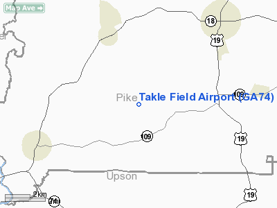
Location: |
Pike County, GA |
|
Magnetic Variation: |
02W (1985) |
Owner
& Manager
|
Ownership: |
Privately owned |
|
Owner: |
Leiv M Takle |
|
Address: |
P.o. Box 276
Concord, GA 30206 |
|
Phone
number: |
404-228-3836 |
|
Manager: |
Leiv M Takle |
|
Address: |
P.o. Box 267
Concord, GA 30206 |
|
Phone number: |
404-228-3836 |
Airport
Operations and Facilities
|
Airport Use: |
Private |
|
Wind
indicator: |
No |
|
Segmented
Circle: |
No |
|
Control
Tower: |
No |
|
Landing
fee charge: |
No |
|
Sectional
chart: |
Atlanta |
|
Region: |
ASO - Southern |
|
Boundary
ARTCC: |
ZTL - Atlanta |
|
Tie-in
FSS: |
MCN - Macon |
|
FSS
on Airport: |
No |
|
FSS
Toll Free: |
1-800-WX-BRIEF |
|
Runway Information
Runway 08/26
|
Dimension: |
2500 x 150 ft / 762.0 x 45.7 m |
|
Surface: |
TURF, |
|
|
Runway 08 |
Runway 26 |
|
Traffic
Pattern: |
Right |
Left |
|
Radio Navigation
Aids
|
ID |
Type |
Name |
Ch |
Freq |
Var |
Dist |
|
JHH |
NDB |
Griffin |
|
412.00 |
04W |
12.7 nm |
|
OP |
NDB |
Yates |
|
339.00 |
03W |
13.5 nm |
|
FF |
NDB |
Pecat |
|
316.00 |
02W |
16.0 nm |
|
EQQ |
NDB |
Coweta County |
|
234.00 |
03W |
19.9 nm |
|
PIM |
NDB |
Pine Mountain |
|
272.00 |
03W |
26.1 nm |
|
BR |
NDB |
Redan |
|
266.00 |
02W |
36.6 nm |
|
FT |
NDB |
Flanc |
|
344.00 |
02W |
44.8 nm |
|
IZS |
NDB |
Montezuma |
|
426.00 |
04W |
45.4 nm |
|
VOF |
NDB |
Alcovy |
|
370.00 |
03W |
47.4 nm |
|
GPQ |
NDB |
Carrollton |
|
278.00 |
02W |
47.9 nm |
|
BEP |
NDB |
Bay Creek |
|
350.00 |
03W |
48.0 nm |
|
ATL |
VORTAC |
Atlanta |
116X |
116.90 |
00W |
35.3 nm |
|
CSG |
VORTAC |
Columbus |
118X |
117.10 |
01E |
39.9 nm |
|
LGC |
VORTAC |
Lagrange |
103X |
115.60 |
01E |
40.0 nm |
|
MCN |
VORTAC |
Macon |
089X |
114.20 |
01E |
44.0 nm |
|
ATL |
VOT |
Atlanta Muni |
|
111.00 |
|
37.0 nm |
Remarks
- PVT
USE; VFR WX CONDS; OPNL AGREEMENT MAINTAINED W/MR M M LEVEILAND, RT
1, BROOKS, GA 30205, OWNER TRIPLE SNAP RANCH. TAKLE FLD RWY 8 THR IS
LCTD 5000' EAST OF TRIPLE SNAP RANCH ARPT RWY 35 THR.
Takle Field Airport
Address:
Pike County, GA
Tel:
404-228-3836
Images
and information placed above are from
http://www.airport-data.com/airport/GA74/
We
thank them for the data!
| General
Info |
| Country |
United
States |
| State |
GEORGIA
|
| FAA ID |
GA74
|
| Latitude |
33-02-30.455N
|
| Longitude |
084-24-44.719W
|
| Elevation |
850 feet
|
| Near City |
CONCORD
|
We don't guarantee the information is fresh and accurate. The data may
be wrong or outdated.
For more up-to-date information please refer to other sources.
|
|


